[Philadelphia & Pennsylvania] Morris, W.E. Map of Bucks County Pennsylvania...
Similar Sale History
View More Items in Maps & AtlasesRelated Maps & Atlases
More Items in Maps & Atlases
View MoreRecommended Transportation & Travel Collectibles
View More
![[Philadelphia & Pennsylvania] Morris, W.E. Map of Bucks County Pennsylvania...](https://p1.liveauctioneers.com/65/295053/156641114_1_x.jpg?quality=1&version=1688656782&width=486)
![[Philadelphia & Pennsylvania] Morris, W.E. Map of Bucks County Pennsylvania...](https://p1.liveauctioneers.com/65/295053/156641114_1_x.jpg?quality=80&version=1688656782)
Item Details
Description
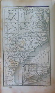
[Philadelphia & Pennsylvania] Morris, W.E. Map of Bucks County Pennsylvania...
Philadelphia: R(obert).P(earsall). Smith, 1850. Large hand-colored engraved wall map, 56 1/4 x 40 3/4 in. (1,429 x 1,035 mm); mounted to linen; original wooden rollers at top and bottom; toned; moderate wear and creasing; chip in top edge, loose but present.
A handsome and scarce wall map of Bucks County, Pennsylvania, with three inset plans and views of Doylestown, Bristol, and Newtown, a description and brief history of the area, and a statistical table of the region's population and acreage.
Buyer's Premium
- 31% up to $600,000.00
- 26% up to $4,000,000.00
- 20% above $4,000,000.00
[Philadelphia & Pennsylvania] Morris, W.E. Map of Bucks County Pennsylvania...
Estimate $1,500 - $2,500
9 bidders are watching this item.
Shipping & Pickup Options
Item located in Philadelphia, PA, usSee Policy for Shipping
Local Pickup Available
Payment
Accepts seamless payments through LiveAuctioneers

Auction Curated By

Head of Department Books, Maps & Manuscripts Photographs & Photobooks
Related Searches
TOP


![1875 Walling and Gray Pennsylvania County Maps -- Atlas of Pennsylvania Counties of Chester,: Title: 1875 Walling and Gray Pennsylvania County Maps -- Atlas of Pennsylvania Counties of Chester, Dauphin, Berks, Lebanon, York and Lancaster [with] Cumberland Fraklin and Adams Cartographer: Wallin](https://p1.liveauctioneers.com/5584/319185/171438575_1_x.jpg?height=310&quality=70&version=1707858212)


![Pittsburg [Sic] and Vicinity.: Publication Date: 1911 Title: Pittsburg [Sic] and Vicinity. Cartographer: RAND, MCNALLY & CO. Publisher: RAND, MCNALLY & CO. Height: 18.25 Width: 12.3 Map showing western Pennsylvania. Shows railroads](https://p1.liveauctioneers.com/5584/331064/178466317_1_x.jpg?height=310&quality=70&version=1716924723)


![[MAP]. TODESCHI, Pietro. [Nova et Acurata Totius Americae Tabula auct. G.I. Blaeu] America quarta: [MAP]. TODESCHI, Pietro. [Nova et Acurata Totius Americae Tabula auct. G.I. Blaeu] America quarta pars orbis quam plerunq, nuvum orbem appellitant primo detecta est anno 1492 a Christophoro Columbo...](https://p1.liveauctioneers.com/197/329395/177650542_1_x.jpg?height=310&quality=70&version=1715364962)


![[MAPS]. HOMANN, Johann Baptist, HOMANN HEIRS, and Georg Matthäus SEUTTER. [Composite Atlas].: [MAPS]. HOMANN, Johann Baptist (1663-1724), HOMANN HEIRS, and Georg Matthäus SEUTTER (1678-1757). [Composite Atlas]. [Nuremberg, Augsburg, and others: Homann Heirs and others, maps dated between](https://p1.liveauctioneers.com/197/329395/177650530_1_x.jpg?height=310&quality=70&version=1715364962)

![[MAP]. ORTELIUS, Abraham. Americae Sive Novi Orbis, Nova Descriptio. 1573.: [MAP]. ORTELIUS, Abraham (1527-1598). Americae Sive Novi Orbis, Nova Descriptio. Antwerp, 1573. Engraved map with hand-coloring. Framed and double glazed, visible area 375 x 521 mm (unexamined out of](https://p1.liveauctioneers.com/197/329395/177650534_1_x.jpg?height=310&quality=70&version=1715364962)
![Set of Twelve Satirical Anthropomorphic Maps of Europe: [SATIRICAL MAPS] A set of twelve satirical anthropomorphic maps of Europe. London: circa 1868. A set of 12 (believed complete) lithographed maps by Vincent Brooks, Day & Son, London, each offering](https://p1.liveauctioneers.com/292/330597/178279264_1_x.jpg?height=310&quality=70&version=1716409282)


![[MAP]. ORTELIUS, Abraham. Turcici Imperii Descriptio.1592.: [MAP]. ORTELIUS, Abraham (1527-1598). Turcici Imperii Descriptio. Antwerp, 1592. Engraved map with hand-coloring. Matted, framed, and double glazed, sight 406 x 521 mm (unexamined out of frame). Decor](https://p1.liveauctioneers.com/197/329395/177650538_1_x.jpg?height=310&quality=70&version=1715364962)


![[FLAGS]. 31-star American parade flag. Ca 1850-1859.: [FLAGS]. 31-star American parade flag. Ca 1850-1859. 22 x 36 1/2 in. cotton flag with 31 printed stars, configured in a double medallion surrounding a much larger central star, that is haloed in both](https://p1.liveauctioneers.com/197/329785/177758218_1_x.jpg?height=310&quality=70&version=1715625218)


