


 Weekly: JewelryBonhamsSponsored.Your ad here?
Weekly: Jewelry
Bonhams
Sponsored.Your ad here?


 DesignChristie'sSponsored.Your ad here?
Design
Christie's
Sponsored.Your ad here?


DesignChristie'sSponsored.Your ad here?
Design
Christie's
Sponsored.Your ad here?

1730. India’s Mughal Empire by Frederick de Wit
Similar Sale History
View More Items in Maps & Atlases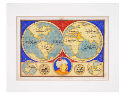


Related Maps & Atlases


![Maps of Asia & India, c1800's (2) [180164]: (2) Maps of Asia, from atlas, c. 1800's. The First is a map of the continent of Asia, highlighting the Russian Empire and the Chinese empire. Map legend includes "Geographical miles", "British Miles",](https://p1.liveauctioneers.com/2699/331495/178785787_1_x.jpg?height=310&quality=70&version=1717094933)
![Antique H/C Map EUROPE SOUS CHARLEMAGNE EN 814: EMPIRES D'OCCIDENT ET D'ORIENT: Antique 19th Century French Map EUROPE SOUS CHARLEMAGNE EN 814: EMPIRES D'OCCIDENT ET D'ORIENT [EUROPE UNDER CHARLEMAGNE IN 814: EMPIRES OF THE WEST AND EAST] by Charles V. Monin (French, 1830 - 1880)](https://p1.liveauctioneers.com/6084/330420/178181958_1_x.jpg?height=310&quality=70&version=1716391551)


More Items in Maps & Atlases
View More
![[MAP]. TODESCHI, Pietro. [Nova et Acurata Totius Americae Tabula auct. G.I. Blaeu] America quarta: [MAP]. TODESCHI, Pietro. [Nova et Acurata Totius Americae Tabula auct. G.I. Blaeu] America quarta pars orbis quam plerunq, nuvum orbem appellitant primo detecta est anno 1492 a Christophoro Columbo...](https://p1.liveauctioneers.com/197/329395/177650542_1_x.jpg?height=310&quality=70&version=1715364962)
![[MAPS]. HOMANN, Johann Baptist, HOMANN HEIRS, and Georg Matthäus SEUTTER. [Composite Atlas].: [MAPS]. HOMANN, Johann Baptist (1663-1724), HOMANN HEIRS, and Georg Matthäus SEUTTER (1678-1757). [Composite Atlas]. [Nuremberg, Augsburg, and others: Homann Heirs and others, maps dated between](https://p1.liveauctioneers.com/197/329395/177650530_1_x.jpg?height=310&quality=70&version=1715364962)


![[MAP]. ORTELIUS, Abraham. Americae Sive Novi Orbis, Nova Descriptio. 1573.: [MAP]. ORTELIUS, Abraham (1527-1598). Americae Sive Novi Orbis, Nova Descriptio. Antwerp, 1573. Engraved map with hand-coloring. Framed and double glazed, visible area 375 x 521 mm (unexamined out of](https://p1.liveauctioneers.com/197/329395/177650534_1_x.jpg?height=310&quality=70&version=1715364962)

![Set of Twelve Satirical Anthropomorphic Maps of Europe: [SATIRICAL MAPS] A set of twelve satirical anthropomorphic maps of Europe. London: circa 1868. A set of 12 (believed complete) lithographed maps by Vincent Brooks, Day & Son, London, each offering](https://p1.liveauctioneers.com/292/330597/178279264_1_x.jpg?height=310&quality=70&version=1716409282)


![[MAP]. ORTELIUS, Abraham. Turcici Imperii Descriptio.1592.: [MAP]. ORTELIUS, Abraham (1527-1598). Turcici Imperii Descriptio. Antwerp, 1592. Engraved map with hand-coloring. Matted, framed, and double glazed, sight 406 x 521 mm (unexamined out of frame). Decor](https://p1.liveauctioneers.com/197/329395/177650538_1_x.jpg?height=310&quality=70&version=1715364962)
![[MAP]. ORTELIUS, Abraham. Romani Imperii Imago. 1592.: [MAP]. ORTELIUS, Abraham (1527-1598). Romani Imperii Imago. Antwerp, 1592. Engraved map with hand-coloring. Matted, framed, and double glazed, visible area 381 x 521 mm (unexamined out of frame). 6 de](https://p1.liveauctioneers.com/197/329395/177650537_1_x.jpg?height=310&quality=70&version=1715364962)
![[MAP]. SPEED, John. A New Mappe of the Romane Empire. 1676.: [MAP]. SPEED, John (ca 1551-1629). A New Mappe of the Romane Empire. London: Basset & Chiswell, 1676. Engraved map with hand-coloring. Framed and double glazed, sight 419 x 559 mm. Decorative cartouch](https://p1.liveauctioneers.com/197/329395/177650541_1_x.jpg?height=310&quality=70&version=1715364962)
Recommended Transportation & Travel Collectibles
View More

![[FLAGS]. 31-star American parade flag. Ca 1850-1859.: [FLAGS]. 31-star American parade flag. Ca 1850-1859. 22 x 36 1/2 in. cotton flag with 31 printed stars, configured in a double medallion surrounding a much larger central star, that is haloed in both](https://p1.liveauctioneers.com/197/329785/177758218_1_x.jpg?height=310&quality=70&version=1715625218)


![[FLAGS]. 13-star American flag, possibly a US Navy boat flag. Ca late-19th century.: [FLAGS]. 13-star American flag, possibly a US Navy boat flag. Ca late-19th century. 35 x 71 1/2 in. hand-sewn and machine-sewn wool flag with 13 double-appliquéd cotton stars configured in 3/2/3/2/3](https://p1.liveauctioneers.com/197/329785/177758215_1_x.jpg?height=310&quality=70&version=1715625218)


Item Details
Description
India’s Mughal Empire. 1730. By Frederick de Wit. Amsterdam. Published by Covens & Mortier. Shows the Mughal Empire in full from Persia in the west to Burma in the east. What’s very interesting is the attention paid to the administrative divisions shown in the empire. It’s a seldom-seen and studied subject. The Ganges River and Indus River are prominently depicted. With elephants near the Ganges and a camel shown in Kashmir. Decorative with cherub’s who is holding the title cartouche and one resting on the lower cartouche. A European ship is sailing the Bay of Bengal. Two fictional lakes appear in the east. One in Burma and one in Tibet. 20 1/3 x 16 1/3”. Hand-colored, copperplate engraved. Excellent condition. Authenticity Guaranteed.
Reserve: $475.00
Shipping:
Your purchase is protected:
Photos, descriptions, and estimates were prepared with the utmost care by a fully certified expert and appraiser. All items in this sale are guaranteed authentic.
In the rare event that the item did not conform to the lot description in the sale, Jasper52 specialists are here to help. Buyers may return the item for a full refund provided you notify Jasper52 within 5 days of receiving the item.
Condition
Excellent condition
Buyer's Premium
- 15%
1730. India’s Mughal Empire by Frederick de Wit
Estimate $550 - $700
3 bidders are watching this item.
Get approved to bid.
Shipping & Pickup Options
Item located in New York, US$12 shipping in the US
Payment
Accepts seamless payments through LiveAuctioneers
See More Items From This Jasper52 Seller

Auction Curated By

Maps Expert
TOP