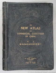
Distance Table Book of Maps, 1975.
Similar Sale History
View More Items in Maps & AtlasesRelated Maps & Atlases
More Items in Maps & Atlases
View MoreRecommended Transportation & Travel Collectibles
View More


Item Details
Description
DISTANCE TABLE 8, BOOK OF MAPS (Cancels Distance Table 7 Book of Maps), Part 2 of 2 Parts (Part 1 Consists of rules and Constructive Mileage Tables). San Francisco: Public Utilities Commission of the State of California, 1975. Elephant folio (23in x 17in). Blue cloth and plain boards with paper label. 32 maps, most fold-out. Condition: Good-Very Good; table of contents toned/discolored, but maps clean and bright (slight/tiny margin spotting here and there).
Buyer's Premium
- 28%
Distance Table Book of Maps, 1975.
Estimate $300 - $500
2 bidders are watching this item.
Get approved to bid.
Shipping & Pickup Options
Item located in South San Francisco, CA, usSee Policy for Shipping
Local Pickup Available
Payment

Related Searches
TOP


![5 Maps incl: Servizio Generale Dei Piroscafi. 1844: [Mediterranean/United States] 5 Maps. ++ Navigazione A Vapore Dell’ I. R. P. Lloyd Austriaco. Servizio Generale Dei Piroscafi. Consists of a map, tables of distances and tariffs, etc. Map’s title:](https://p1.liveauctioneers.com/179/117971/60557766_1_x.jpg?height=310&quality=70&version=1520636872)


![[CATALOGUES] A large group of early auction and dealer catalogues relating to rare books, maps &: [CATALOGUES] A large group of early auction and dealer catalogues relating to rare books, maps & atlases, and related collections, 1950s-70s. A fine large collection of auction catalogues from Parke B](https://p1.liveauctioneers.com/292/250642/130213445_1_x.jpg?height=310&quality=70&version=1654271664)


![[MAP]. TODESCHI, Pietro. [Nova et Acurata Totius Americae Tabula auct. G.I. Blaeu] America quarta: [MAP]. TODESCHI, Pietro. [Nova et Acurata Totius Americae Tabula auct. G.I. Blaeu] America quarta pars orbis quam plerunq, nuvum orbem appellitant primo detecta est anno 1492 a Christophoro Columbo...](https://p1.liveauctioneers.com/197/329395/177650542_1_x.jpg?height=310&quality=70&version=1715364962)


![[MAPS]. HOMANN, Johann Baptist, HOMANN HEIRS, and Georg Matthäus SEUTTER. [Composite Atlas].: [MAPS]. HOMANN, Johann Baptist (1663-1724), HOMANN HEIRS, and Georg Matthäus SEUTTER (1678-1757). [Composite Atlas]. [Nuremberg, Augsburg, and others: Homann Heirs and others, maps dated between](https://p1.liveauctioneers.com/197/329395/177650530_1_x.jpg?height=310&quality=70&version=1715364962)
![[MAP]. ORTELIUS, Abraham. Americae Sive Novi Orbis, Nova Descriptio. 1573.: [MAP]. ORTELIUS, Abraham (1527-1598). Americae Sive Novi Orbis, Nova Descriptio. Antwerp, 1573. Engraved map with hand-coloring. Framed and double glazed, visible area 375 x 521 mm (unexamined out of](https://p1.liveauctioneers.com/197/329395/177650534_1_x.jpg?height=310&quality=70&version=1715364962)


![[MAP]. ORTELIUS, Abraham. Turcici Imperii Descriptio.1592.: [MAP]. ORTELIUS, Abraham (1527-1598). Turcici Imperii Descriptio. Antwerp, 1592. Engraved map with hand-coloring. Matted, framed, and double glazed, sight 406 x 521 mm (unexamined out of frame). Decor](https://p1.liveauctioneers.com/197/329395/177650538_1_x.jpg?height=310&quality=70&version=1715364962)

![[MAP]. ORTELIUS, Abraham. Aevi Veteris, Typus Geographicus. 1601.: [MAP]. ORTELIUS, Abraham (1527-1598). Aevi Veteris, Typus Geographicus. Antwerp, 1601. Engraved map with hand-coloring. Matted, framed, and double glazed, visible area 343 x 470 mm (unexamined out of](https://p1.liveauctioneers.com/197/329395/177650532_1_x.jpg?height=310&quality=70&version=1715364962)


![[FLAGS]. 31-star American parade flag. Ca 1850-1859.: [FLAGS]. 31-star American parade flag. Ca 1850-1859. 22 x 36 1/2 in. cotton flag with 31 printed stars, configured in a double medallion surrounding a much larger central star, that is haloed in both](https://p1.liveauctioneers.com/197/329785/177758218_1_x.jpg?height=310&quality=70&version=1715625218)


