MAP, Africa, Wit
Similar Sale History
View More Items in Maps & AtlasesRelated Maps & Atlases
More Items in Maps & Atlases
View MoreRecommended Transportation & Travel Collectibles
View More


Item Details
Description
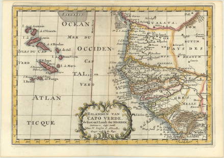
De Wit's Uncommon Carte-a-Figures Map of Africa. Africa. Frederick de Wit, Nova Africa Descriptio, 1660 (circa). Hand Color. This is De Wit's uncommon map of Africa, first published in 1660 in a set of maps of the four continents, each with decorative native figures at the sides and town views above. These were some of the earliest maps by De Wit, and also the last folio-sized maps with decorative borders to be issued in Amsterdam. This map shows views of Cairo (Alcair), Alexandria, Algiers (Alger), Tunis, Tangiers (Tanger), and Ceuta across the top, which are close copies from Jodocus Hondius' map of Africa from 1623. The figures at both sides of the map are nearly identical to those from Van den Keere's Africa map of 1614, with the exception of the top two (Congensis and Mulier Abissinea). The geography on the map is based on Jodocus Hondius' Africae nova Tabula from 1623, which was copied from Willem Blaeu's Africae nova Descriptio from 1617, although De Wit omits the engravings of animals in the interior. The Nile is shown according to Ptolemy with its sources arising in the lakes Zaire and Zaflan, the fictitious Lake Sachaf of Laurent Fries appears, as well as the R. de Spirito Santo. De Wit's map of Africa was issued separately, as well as in composite Dutch atlases. This is the fourth state, with the addition of a woman and infant in the right-hand shield of the publisher cartouche at bottom, and the number "4" engraved at top right.
Condition
A sharp impression on a bright sheet with a few light spots, marginal soiling, and a professionally repaired centerfold separation at top. A "3" has been added in manuscript to obscure the "4" at top right. Grade: B+
Dimensions
17.3 x 21.9 in
Buyer's Premium
- 20% up to $5,000.00
- 15% above $5,000.00
MAP, Africa, Wit
Estimate $2,400 - $3,000
2 bidders are watching this item.
Get approved to bid.
Shipping & Pickup Options
Item located in Richmond, VA, usOffers In-House Shipping
Local Pickup Available
Payment
Accepts seamless payments through LiveAuctioneers

TOP


![[MAP]. ORTELIUS, Abraham. Africae Tabula Nova. 1592.: [MAP]. ORTELIUS, Abraham (1527-1598). Africae Tabula Nova. Antwerp, 1592. Engraved map with hand-coloring. Matted, framed, and double glazed, visible area 406 x 533 mm (unexamined out of frame). Strap](https://p1.liveauctioneers.com/197/329395/177650533_1_x.jpg?height=310&quality=70&version=1715364962)


![d'Anville (Jean Baptiste Bourguignon) [Untitled Composite Atlas with 102 map sheets], [probably: d'Anville (Jean Baptiste Bourguignon) [Untitled Composite Atlas with 102 map sheets], comprising 20 double-page maps, 9 two-sheet double-page maps, 3 two-sheet maps on folding double-pages [Asia, Afri](https://p1.liveauctioneers.com/5458/329231/177514974_1_x.jpg?height=310&quality=70&version=1715269091)


![[MAP]. TODESCHI, Pietro. [Nova et Acurata Totius Americae Tabula auct. G.I. Blaeu] America quarta: [MAP]. TODESCHI, Pietro. [Nova et Acurata Totius Americae Tabula auct. G.I. Blaeu] America quarta pars orbis quam plerunq, nuvum orbem appellitant primo detecta est anno 1492 a Christophoro Columbo...](https://p1.liveauctioneers.com/197/329395/177650542_1_x.jpg?height=310&quality=70&version=1715364962)


![[MAPS]. HOMANN, Johann Baptist, HOMANN HEIRS, and Georg Matthäus SEUTTER. [Composite Atlas].: [MAPS]. HOMANN, Johann Baptist (1663-1724), HOMANN HEIRS, and Georg Matthäus SEUTTER (1678-1757). [Composite Atlas]. [Nuremberg, Augsburg, and others: Homann Heirs and others, maps dated between](https://p1.liveauctioneers.com/197/329395/177650530_1_x.jpg?height=310&quality=70&version=1715364962)


![[MAP]. ORTELIUS, Abraham. Turcici Imperii Descriptio.1592.: [MAP]. ORTELIUS, Abraham (1527-1598). Turcici Imperii Descriptio. Antwerp, 1592. Engraved map with hand-coloring. Matted, framed, and double glazed, sight 406 x 521 mm (unexamined out of frame). Decor](https://p1.liveauctioneers.com/197/329395/177650538_1_x.jpg?height=310&quality=70&version=1715364962)
![[MAP]. ORTELIUS, Abraham. Americae Sive Novi Orbis, Nova Descriptio. 1573.: [MAP]. ORTELIUS, Abraham (1527-1598). Americae Sive Novi Orbis, Nova Descriptio. Antwerp, 1573. Engraved map with hand-coloring. Framed and double glazed, visible area 375 x 521 mm (unexamined out of](https://p1.liveauctioneers.com/197/329395/177650534_1_x.jpg?height=310&quality=70&version=1715364962)


![[FLAGS]. 31-star American parade flag. Ca 1850-1859.: [FLAGS]. 31-star American parade flag. Ca 1850-1859. 22 x 36 1/2 in. cotton flag with 31 printed stars, configured in a double medallion surrounding a much larger central star, that is haloed in both](https://p1.liveauctioneers.com/197/329785/177758218_1_x.jpg?height=310&quality=70&version=1715625218)


