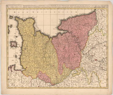
MAP, France, Bernard
Similar Sale History
View More Items in Maps & AtlasesRelated Maps & Atlases
More Items in Maps & Atlases
View MoreRecommended Transportation & Travel Collectibles
View More


Item Details
Description
France. Emile and Cie Bernard, Nouvelle Carte de la France Indiquant les Routes, les Chins. de Fer les Stations Thermales et Balneaires d'Apres les Documents les Plus Recents, 1900 (circa). Printed Color. This unusual promotional piece features a map of France surrounded by large illustrations of double-barrel shotguns produced by Emile and Cie Bernard of Liege, Belgium. The detailed map is delineated by department and presents the road network, canals, railroads, resorts, and more with a legend beneath the title. The company exhibited at the Exposition Universelle in 1900 and apparently produced this advertising piece for patrons. Red overprinting directs interested buyers to contact Monsieur P. Lardin in Meuse, France.
Condition
Issued folding with a few short splits at the fold junctions, a fold separation that just enters map image at right, minor toning along several folds, and a couple punch holes in the left blank margin. Grade: B+
Dimensions
31.8 x 24 in
Buyer's Premium
- 20% up to $5,000.00
- 15% above $5,000.00
MAP, France, Bernard
Estimate $240 - $300
Get approved to bid.
Shipping & Pickup Options
Item located in Richmond, VA, usOffers In-House Shipping
Local Pickup Available
Payment
Accepts seamless payments through LiveAuctioneers

TOP


![[Wall map] France: Carte de la France, 1790.Incisione in coloritura coeva, 1200x1160 mm.](https://p1.liveauctioneers.com/3336/90951/46934974_1_x.jpg?height=310&quality=70&version=1473763184)

![Gallia Color Map [France]: Galliae Regni Potentiss Color Map with written description in Latin on verso. Map of France with boarders to Germany, Spain and Italy. Appears to be a page from an atlas. Undated. Measures 14 in. x 20](https://p1.liveauctioneers.com/5755/154409/77936853_1_x.jpg?height=310&quality=70&version=1573094011)


![French Map of America Southeast [179304]: Northeastern American map published 1788 from a French cartographer. Map measures 9"x 13". Published during America's War of Independence from Great Britain (1176-1783), this map features the mid-Atla](https://p1.liveauctioneers.com/2699/331495/178785746_1_x.jpg?height=310&quality=70&version=1717094933)
![Early French Map of Great Lakes [179300]: Early French (circa 1780s) map of the Great Lakes region and parts of Canada. Map, a double truck page from a book, measures 9"x 13" and shows the various Indian tribes in the area, including the Algo](https://p1.liveauctioneers.com/2699/331495/178785744_1_x.jpg?height=310&quality=70&version=1717094933)
![French Map of America Southwest & Mexico [179298]: French map the American Southwest and Mexico. This is a double truck from an 18th century book and measures 10x 14". Map from 1787 during the reign of Louie XVI the king France who beheaded in1793.Riv](https://p1.liveauctioneers.com/2699/331495/178785763_1_x.jpg?height=310&quality=70&version=1717094933)
![Early French Map of East Coast & Canada [179301]: This is a circa 1790 French map of the Eastern Seaboard of America and parts of Canada. Landmarks and waterways are clearly marked as are the territories inhabited by Indian tribes, including the Iroq](https://p1.liveauctioneers.com/2699/331495/178785745_1_x.jpg?height=310&quality=70&version=1717094933)

![L'Afrique Françoise ou du Senegal'. French West Africa. DE L’ISLE 1727 map: Title: L'Afrique Françoise ou du Senegal'. French West Africa. DE L’ISLE 1727 map Description: Carte de l'Afrique Françoise ou du Senegal [Map of French West Africa, or Senegal] by Gui](https://p1.liveauctioneers.com/5584/330582/178266244_1_x.jpg?height=310&quality=70&version=1716924723)
![Antique H/C Map EUROPE SOUS CHARLEMAGNE EN 814: EMPIRES D'OCCIDENT ET D'ORIENT: Antique 19th Century French Map EUROPE SOUS CHARLEMAGNE EN 814: EMPIRES D'OCCIDENT ET D'ORIENT [EUROPE UNDER CHARLEMAGNE IN 814: EMPIRES OF THE WEST AND EAST] by Charles V. Monin (French, 1830 - 1880)](https://p1.liveauctioneers.com/6084/330420/178181958_1_x.jpg?height=310&quality=70&version=1716391551)


![Maps of Spain, France, & Portugal, c1800s (3) [180172]: (3) Maps of Spain, Portugal, and France. 1. "Map of Spain, Portugal and France" with inset of Island of Corsica and Switzerland. Detailed and colorful map with floral border. S. Augustus Mitchell Jr.](https://p1.liveauctioneers.com/2699/331495/178785790_1_x.jpg?height=310&quality=70&version=1717094933)


![[MAPS]. HOMANN, Johann Baptist, HOMANN HEIRS, and Georg Matthäus SEUTTER. [Composite Atlas].: [MAPS]. HOMANN, Johann Baptist (1663-1724), HOMANN HEIRS, and Georg Matthäus SEUTTER (1678-1757). [Composite Atlas]. [Nuremberg, Augsburg, and others: Homann Heirs and others, maps dated between](https://p1.liveauctioneers.com/197/329395/177650530_1_x.jpg?height=310&quality=70&version=1715364962)
![[MAP]. TODESCHI, Pietro. [Nova et Acurata Totius Americae Tabula auct. G.I. Blaeu] America quarta: [MAP]. TODESCHI, Pietro. [Nova et Acurata Totius Americae Tabula auct. G.I. Blaeu] America quarta pars orbis quam plerunq, nuvum orbem appellitant primo detecta est anno 1492 a Christophoro Columbo...](https://p1.liveauctioneers.com/197/329395/177650542_1_x.jpg?height=310&quality=70&version=1715364962)

![[MAP]. ORTELIUS, Abraham. Americae Sive Novi Orbis, Nova Descriptio. 1573.: [MAP]. ORTELIUS, Abraham (1527-1598). Americae Sive Novi Orbis, Nova Descriptio. Antwerp, 1573. Engraved map with hand-coloring. Framed and double glazed, visible area 375 x 521 mm (unexamined out of](https://p1.liveauctioneers.com/197/329395/177650534_1_x.jpg?height=310&quality=70&version=1715364962)


![[MAP]. ORTELIUS, Abraham. Turcici Imperii Descriptio.1592.: [MAP]. ORTELIUS, Abraham (1527-1598). Turcici Imperii Descriptio. Antwerp, 1592. Engraved map with hand-coloring. Matted, framed, and double glazed, sight 406 x 521 mm (unexamined out of frame). Decor](https://p1.liveauctioneers.com/197/329395/177650538_1_x.jpg?height=310&quality=70&version=1715364962)
![Set of Twelve Satirical Anthropomorphic Maps of Europe: [SATIRICAL MAPS] A set of twelve satirical anthropomorphic maps of Europe. London: circa 1868. A set of 12 (believed complete) lithographed maps by Vincent Brooks, Day & Son, London, each offering](https://p1.liveauctioneers.com/292/330597/178279264_1_x.jpg?height=310&quality=70&version=1716409282)


![[MAP]. ORTELIUS, Abraham. Romani Imperii Imago. 1592.: [MAP]. ORTELIUS, Abraham (1527-1598). Romani Imperii Imago. Antwerp, 1592. Engraved map with hand-coloring. Matted, framed, and double glazed, visible area 381 x 521 mm (unexamined out of frame). 6 de](https://p1.liveauctioneers.com/197/329395/177650537_1_x.jpg?height=310&quality=70&version=1715364962)
![[MAP]. SPEED, John. A New Mappe of the Romane Empire. 1676.: [MAP]. SPEED, John (ca 1551-1629). A New Mappe of the Romane Empire. London: Basset & Chiswell, 1676. Engraved map with hand-coloring. Framed and double glazed, sight 419 x 559 mm. Decorative cartouch](https://p1.liveauctioneers.com/197/329395/177650541_1_x.jpg?height=310&quality=70&version=1715364962)
![[MAP]. ORTELIUS, Abraham. Aevi Veteris, Typus Geographicus. 1601.: [MAP]. ORTELIUS, Abraham (1527-1598). Aevi Veteris, Typus Geographicus. Antwerp, 1601. Engraved map with hand-coloring. Matted, framed, and double glazed, visible area 343 x 470 mm (unexamined out of](https://p1.liveauctioneers.com/197/329395/177650532_1_x.jpg?height=310&quality=70&version=1715364962)


