


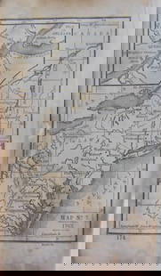
1880 Gray Map of Maryland, Delaware and Washington DC -- Maryland, Delaware and the District of
Similar Sale History
View More Items in Maps & Atlases


![1795 Map, Maryland & Delaware [18th c. Cartography]: Engraved map of Maryland and Delaware printed in 1799, based on a 1795 edition produced by Samuel Lewis. Drawn by A. Anderson, engraved by J. Scoles. Includes an inset map of the Continuation of the P](https://p1.liveauctioneers.com/7226/275519/144720286_1_x.jpg?height=310&quality=70&version=1673742614)


![1894 Cowles Civil War Map of Northern Virginia, Maryland, Delaware and Parts of West Virginia and: Title: 1894 Cowles Civil War Map of Northern Virginia, Maryland, Delaware and Parts of West Virginia and Pennsylvania -- General Topographical Map, Sheet I [Plate CXXXVI] Cartographer: C Cowles (compi](https://p1.liveauctioneers.com/5584/300803/160207035_1_x.jpg?height=310&quality=70&version=1693946338)
Related Maps & Atlases


![Large Map of Alaska: Large Map of Alaska With map of Washington and Oregon [separately] on versos Cartographer: George Franklin Cram Dated: Circa 1900 Type: Color Lithograph Dimensions: 14](https://p1.liveauctioneers.com/5614/330257/178045317_1_x.jpg?height=310&quality=70&version=1716032806)


More Items in Maps & Atlases
View More

![[MAP]. TODESCHI, Pietro. [Nova et Acurata Totius Americae Tabula auct. G.I. Blaeu] America quarta: [MAP]. TODESCHI, Pietro. [Nova et Acurata Totius Americae Tabula auct. G.I. Blaeu] America quarta pars orbis quam plerunq, nuvum orbem appellitant primo detecta est anno 1492 a Christophoro Columbo...](https://p1.liveauctioneers.com/197/329395/177650542_1_x.jpg?height=310&quality=70&version=1715364962)


![[MAPS]. HOMANN, Johann Baptist, HOMANN HEIRS, and Georg Matthäus SEUTTER. [Composite Atlas].: [MAPS]. HOMANN, Johann Baptist (1663-1724), HOMANN HEIRS, and Georg Matthäus SEUTTER (1678-1757). [Composite Atlas]. [Nuremberg, Augsburg, and others: Homann Heirs and others, maps dated between](https://p1.liveauctioneers.com/197/329395/177650530_1_x.jpg?height=310&quality=70&version=1715364962)


![[MAP]. ORTELIUS, Abraham. Turcici Imperii Descriptio.1592.: [MAP]. ORTELIUS, Abraham (1527-1598). Turcici Imperii Descriptio. Antwerp, 1592. Engraved map with hand-coloring. Matted, framed, and double glazed, sight 406 x 521 mm (unexamined out of frame). Decor](https://p1.liveauctioneers.com/197/329395/177650538_1_x.jpg?height=310&quality=70&version=1715364962)
![[MAP]. ORTELIUS, Abraham. Americae Sive Novi Orbis, Nova Descriptio. 1573.: [MAP]. ORTELIUS, Abraham (1527-1598). Americae Sive Novi Orbis, Nova Descriptio. Antwerp, 1573. Engraved map with hand-coloring. Framed and double glazed, visible area 375 x 521 mm (unexamined out of](https://p1.liveauctioneers.com/197/329395/177650534_1_x.jpg?height=310&quality=70&version=1715364962)

![[MAP]. ORTELIUS, Abraham. Aevi Veteris, Typus Geographicus. 1601.: [MAP]. ORTELIUS, Abraham (1527-1598). Aevi Veteris, Typus Geographicus. Antwerp, 1601. Engraved map with hand-coloring. Matted, framed, and double glazed, visible area 343 x 470 mm (unexamined out of](https://p1.liveauctioneers.com/197/329395/177650532_1_x.jpg?height=310&quality=70&version=1715364962)
Recommended Transportation & Travel Collectibles
View More


![[FLAGS]. 31-star American parade flag. Ca 1850-1859.: [FLAGS]. 31-star American parade flag. Ca 1850-1859. 22 x 36 1/2 in. cotton flag with 31 printed stars, configured in a double medallion surrounding a much larger central star, that is haloed in both](https://p1.liveauctioneers.com/197/329785/177758218_1_x.jpg?height=310&quality=70&version=1715625218)


Item Details
Description
This is a lovely large, double-page map of Maryland, Delaware and Washington D.C. The capital city is in a large inset. The other insets are plans of Annapolis, Annapolis Harbor, Dover, and Wilmington. Much detail is offered as to topography, rivers, towns, cities, named railroads, canals, etc. Washington D.C. details include the Capitol, Washington Monument, Smithsonian, other important buildings, named roads, etc. Published by O. W. Gray & Sons.
Reserve: $100.00
Shipping:
Your purchase is protected:
Photos, descriptions, and estimates were prepared with the utmost care by a fully certified expert and appraiser. All items in this sale are guaranteed authentic.
In the rare event that the item did not conform to the lot description in the sale, Jasper52 specialists are here to help. Buyers may return the item for a full refund provided you notify Jasper52 within 5 days of receiving the item.
Condition
Very good-excellent. Hand-color. Issued centerfold.
Buyer's Premium
- 15%
1880 Gray Map of Maryland, Delaware and Washington DC -- Maryland, Delaware and the District of
Estimate $120 - $150
2 bidders are watching this item.
Get approved to bid.
Shipping & Pickup Options
Item located in Ohio, US$17 shipping in the US
Payment
Accepts seamless payments through LiveAuctioneers
See More Items From This Jasper52 Seller

TOP