MAP, South Atlantic, Jansson
Similar Sale History
View More Items in Maps & Atlases
Related Maps & Atlases
More Items in Maps & Atlases
View MoreRecommended Transportation & Travel Collectibles
View More


Item Details
Description
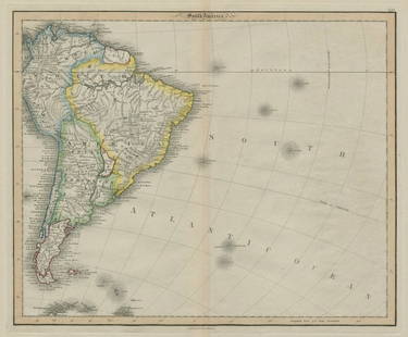
South Atlantic. Jan Jansson, Mar di Aethiopia Vulgo Oceanus Aethiopicus, from Atlas Novus, 1650 (published). Hand Color. A handsome chart decorated with figurative title cartouche, distance scale, compass rose and multiple rhumb lines. It covers most of South America and the southwestern portion of Africa. Tierra del Fuego is separated from the continent and a huge Terra Australis Incognita appears in the south. Locates several islands in the Atlantic including Dos Picos, Sebald de waerts Eylanden (Falklands), and S. Helena Noua. German text on verso.
LITERATURE: Norwich #240; Van der Krogt (Vol. I) #0102:1.
LITERATURE: Norwich #240; Van der Krogt (Vol. I) #0102:1.
Condition
A sharp impression with full contemporary color, archivally repaired centerfold separations at top and bottom, a small stain in central Brazil, and scattered foxing. Grade: B
Dimensions
17.1 x 21.9 in
Buyer's Premium
- 20% up to $5,000.00
- 15% above $5,000.00
MAP, South Atlantic, Jansson
Estimate $475 - $600
1 bidder is watching this item.
Get approved to bid.
Shipping & Pickup Options
Item located in Richmond, VA, usOffers In-House Shipping
Local Pickup Available
Payment
Accepts seamless payments through LiveAuctioneers

TOP


![South-west Europe. Swiss Savoy. British Hanover. THOMSON 1817 old antique map: TITLE/CONTENT OF MAP: [South-west sheet of] A map of Europe, with the political divisions after the Peace of Paris and Congress of Vienna The map shows south west Europe after the Congress of Vienna.](https://p1.liveauctioneers.com/5584/328641/177014448_1_x.jpg?height=310&quality=70&version=1715113718)


![South-west Europe. Iberia France Italy Austria Mediterranean. LIZARS 1842 map: TITLE/CONTENT OF MAP: [Europe south west sheet] DATE PRINTED: 1842 IMAGE SIZE: Approx 43.0 x 50.0cm, 17 x 19.75 inches (Large); Please note that this is a folding map. TYPE: Antique 19th century atlas](https://p1.liveauctioneers.com/5584/328641/177014214_1_x.jpg?height=310&quality=70&version=1715113718)


![[Maps] Gio. Ant. Magnini, Italia, 1620: [Maps] Gio. Ant. Magnini, Italia, 1620, Giovanni Antonio Magnini. Italia, data in luce da Fabio suo figliuolo al Serenissimo Ferdinado Gonzaga Duca di Matoua edi Monserrato etc. Bologna, for Sebastian](https://p1.liveauctioneers.com/188/326797/176317457_1_x.jpg?height=310&quality=70&version=1713847031)
![[Maps] Martin Zeiler, Itinerarium Italiae, 1640: [Maps] Martin Zeiler, Itinerarium Italiae, 1640, Martini Zeilleri. Itinerarium Italiae Nov-Antiquae: oder, Raiss-Beschreibung durch Italien, Matthaus Merian, Frankfurt, 40 plates, most double-page, in](https://p1.liveauctioneers.com/188/326797/176317459_1_x.jpg?height=310&quality=70&version=1713847031)


![[MAP]. TODESCHI, Pietro. [Nova et Acurata Totius Americae Tabula auct. G.I. Blaeu] America quarta: [MAP]. TODESCHI, Pietro. [Nova et Acurata Totius Americae Tabula auct. G.I. Blaeu] America quarta pars orbis quam plerunq, nuvum orbem appellitant primo detecta est anno 1492 a Christophoro Columbo...](https://p1.liveauctioneers.com/197/329395/177650542_1_x.jpg?height=310&quality=70&version=1715364962)


