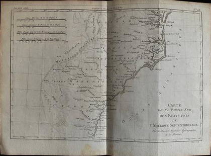
MAP, Southern Alaska, Bonne
Similar Sale History
View More Items in Maps & AtlasesRelated Maps & Atlases
More Items in Maps & Atlases
View MoreRecommended Transportation & Travel Collectibles
View More


Item Details
Description
Southern Alaska. Rigobert Bonne, Carte de la Riviere de Cook dans la Partie N.O. de l'Amerique, from Atlas Encyclopedique, 1787 (circa). Black & White. This handsome map shows Capt. Cook's discoveries in Prince William Sound and Cook Inlet and includes the track and anchor points of the Resolution. The map is inset with Plan du Havre de Samganoodha, dans l'Isle de Oonalaska. A large compass rose dominates the center. Drawn by Bonne and engraved by Andre.
Condition
Issued on watermarked paper with minor toning along the centerfold and a few spots of foxing. There are remnants of hinge tape on verso. Grade: B+
Dimensions
9.3 x 13.6 in
Buyer's Premium
- 20% up to $5,000.00
- 15% above $5,000.00
Shipping & Pickup Options
Item located in Richmond, VA, usOffers In-House Shipping
Local Pickup Available
Payment
Accepts seamless payments through LiveAuctioneers

TOP


![Côte NO de l'Amérique & côte NE de l’Asie. Alaska & Kamchatka. BONNE 1790 map: TITLE/CONTENT OF MAP: [Cook 3e Voyage] Carte de la côte Nord-Ouest de l'Amérique et de la côte Nord-Est de l’Asie // Plan de l'Entrée de Nootka [Cook's 3rd Voyage - Map of th](https://p1.liveauctioneers.com/5584/310511/166159558_1_x.jpg?height=310&quality=70&version=1701205563)
![Côte NO de l'Amérique & côte NE de l’Asie. Alaska & Kamchatka. BONNE 1788 map: TITLE/CONTENT OF MAP: [Cook 3e Voyage] Carte de la côte Nord-Ouest de l'Amérique et de la côte Nord-Est de l’Asie // Plan de l'Entrée de Nootka [Cook's 3rd Voyage - Map of th](https://p1.liveauctioneers.com/5584/315733/169293401_1_x.jpg?height=310&quality=70&version=1705443824)


![1858 Mitchell Map of Southern Europe and France [verso] Asia -- No. 24 Map of France, Spain,: Title: 1858 Mitchell Map of Southern Europe and France [verso] Asia -- No. 24 Map of France, Spain, Portugal & Italy [verso] No. 26 Map of Asia Cartographer: S Mitchell Year / Place: 1858, Philadelphi](https://p1.liveauctioneers.com/5584/328338/176911601_1_x.jpg?height=310&quality=70&version=1715113718)


![Les Royaumes de Suede, de Danemark et de Norwege. Scandinavia. BONNE 1787 map: TITLE/CONTENT OF MAP: Les Royaumes de Suede, de Danemark et de Norwege [The Kingdoms of Sweden, Denmark and Norway] DATE PRINTED: 1787 IMAGE SIZE: Approx 36.0 x 25.5cm, 14.25 x 10 inches (Large); Plea](https://p1.liveauctioneers.com/5584/328641/177014398_1_x.jpg?height=310&quality=70&version=1715113718)


![Isles de Corse et de Sardaigne. Corsica and Sardinia. BONNE 1787 old map: TITLE/CONTENT OF MAP: Isles de Corse et de Sardaigne [The islands of Corsica and Sardinia] DATE PRINTED: 1787 IMAGE SIZE: Approx 36.0 x 24.5cm, 14 x 9.75 inches (Large); Please note that this is a fol](https://p1.liveauctioneers.com/5584/328641/177014474_1_x.jpg?height=310&quality=70&version=1715113718)
![1869 Mitchell Map of Much of Western Europe -- XXXII Prussia the German States Holland & Belgium: Title: 1869 Mitchell Map of Much of Western Europe -- XXXII Prussia the German States Holland & Belgium [verso] XXXIII France, Spain, Portugal and Belgium Cartographer: S Mithchell Year / Place: 1869,](https://p1.liveauctioneers.com/5584/328338/176911579_1_x.jpg?height=310&quality=70&version=1715113718)


![[Maps] Martin Zeiler, Itinerarium Italiae, 1640: [Maps] Martin Zeiler, Itinerarium Italiae, 1640, Martini Zeilleri. Itinerarium Italiae Nov-Antiquae: oder, Raiss-Beschreibung durch Italien, Matthaus Merian, Frankfurt, 40 plates, most double-page, in](https://p1.liveauctioneers.com/188/326797/176317459_1_x.jpg?height=310&quality=70&version=1713847031)
![[Maps] Gio. Ant. Magnini, Italia, 1620: [Maps] Gio. Ant. Magnini, Italia, 1620, Giovanni Antonio Magnini. Italia, data in luce da Fabio suo figliuolo al Serenissimo Ferdinado Gonzaga Duca di Matoua edi Monserrato etc. Bologna, for Sebastian](https://p1.liveauctioneers.com/188/326797/176317457_1_x.jpg?height=310&quality=70&version=1713847031)


