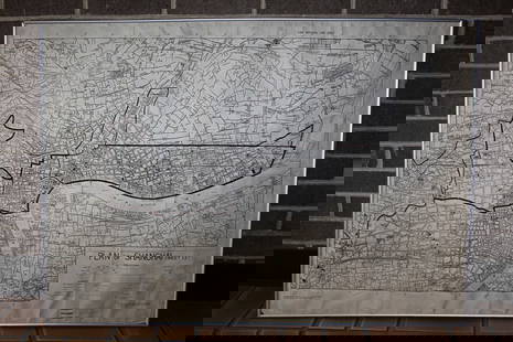
SEVEN ENGRAVED MAPS.
Similar Sale History
View More Items in Maps & Atlases
Related Maps & Atlases
More Items in Maps & Atlases
View MoreRecommended Transportation & Travel Collectibles
View More


Item Details
Description
European, 18th-19th century. Printed with some hand coloring. Four on laid paper including three German and French military maps, "Plan des Camps de Pisek, 1741", 15.25"h. 20.25"w., battles of Peterwardein and Belagerten, 1716. 17"h. 14"w. and unmarked. Fourth is hand colored three sheet 1782 map of Russia "Tabula Geographica Imperii Russici". 26.5"h. 56.25"w. Together with three 19th century maps. Two published by William Blackwood & Sons, Battles of Abensberg and Wagram, 7.25"h. 9"w. and "...Livingstone's Route across Africa" published 1857 by J. Arrowsmith. 13.5"h. 26.5"w. Varying toning, surface wear, creases and edge damage. Unframed.
Buyer's Premium
- 25% up to $250,000.00
- 17.5% above $250,000.00
Shipping & Pickup Options
Item located in Columbus, OH, usSee Policy for Shipping
Local Pickup Available
Payment

TOP


![[MAP]. ORTELIUS, Abraham. Romani Imperii Imago. 1592.: [MAP]. ORTELIUS, Abraham (1527-1598). Romani Imperii Imago. Antwerp, 1592. Engraved map with hand-coloring. Matted, framed, and double glazed, visible area 381 x 521 mm (unexamined out of frame). 6 de](https://p1.liveauctioneers.com/197/329395/177650537_1_x.jpg?height=310&quality=70&version=1715364962)


![[MAPS]. ORTELIUS, Abraham. A group of 3 engraved maps with hand-coloring.: [MAPS]. ORTELIUS, Abraham (1527-1598). A group of 3 engraved maps with hand-coloring, comprising: Gallia Vetus. Antwerp, 1592. Latin text on verso. Van den Broecke Ort194 (1592L5). -- Wirtenberg Ducat](https://p1.liveauctioneers.com/197/329395/177650539_1_x.jpg?height=310&quality=70&version=1715364962)
![[MAPS]. A group of 3 engraved maps, most with hand-coloring.: [MAPS]. A group of 3 maps, comprising: HOMANN, Johann Baptist (1663-1724). Regni Mexicani seu Novae Hispaniae, Ludovicianae, N. Angliae, Carolinae, Virginiae et Pensylvaniae. Nuremberg: Homann, [ca 17](https://p1.liveauctioneers.com/197/328642/177014805_1_x.jpg?height=310&quality=70&version=1714760103)


![L' Asie. Asia Tartary China Mughal Empire. BUFFIER c1818 old antique map chart: CAPTION PRINTED BELOW PICTURE: L' Asie [Asia] DATE PRINTED: c1818 IMAGE SIZE: Approx 14.0 x 18.0cm, 5.5 x 7 inches (Medium); Please note that this is a folding map. TYPE: Antique engraved map CONDITIO](https://p1.liveauctioneers.com/5584/329387/177649271_1_x.jpg?height=310&quality=70&version=1715717898)


![[MAP]. TODESCHI, Pietro. [Nova et Acurata Totius Americae Tabula auct. G.I. Blaeu] America quarta: [MAP]. TODESCHI, Pietro. [Nova et Acurata Totius Americae Tabula auct. G.I. Blaeu] America quarta pars orbis quam plerunq, nuvum orbem appellitant primo detecta est anno 1492 a Christophoro Columbo...](https://p1.liveauctioneers.com/197/329395/177650542_1_x.jpg?height=310&quality=70&version=1715364962)


![[MAPS]. HOMANN, Johann Baptist, HOMANN HEIRS, and Georg Matthäus SEUTTER. [Composite Atlas].: [MAPS]. HOMANN, Johann Baptist (1663-1724), HOMANN HEIRS, and Georg Matthäus SEUTTER (1678-1757). [Composite Atlas]. [Nuremberg, Augsburg, and others: Homann Heirs and others, maps dated between](https://p1.liveauctioneers.com/197/329395/177650530_1_x.jpg?height=310&quality=70&version=1715364962)


