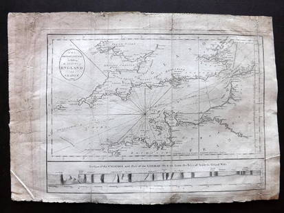
LUFTWAFFE FLIGHT MAP OF GERMANY, FRANCE AND ENGLAND
Similar Sale History
View More Items in Maps & AtlasesRelated Maps & Atlases
More Items in Maps & Atlases
View MoreRecommended Transportation & Travel Collectibles
View More


Item Details
Description
Double-sided ‘Luft-Navigationskarte’ (‘Air Navigation Map’), 26.5 x 24 in., printed on weatherproofed canvas and produced by the General Staff of the Luftwaffe, circa 1941. Both sides are titled at the top edge and additionally marked with Luftwaffe eagles. The front presents a 1:2,000,000-scale view of the entirety of Germany, while the verso depicts the English Channel, the southern portion of the British Isles and the northwestern sector of France, at the same scale. Such a map would have been standard equipment for Luftwaffe crews on bombing raids against England, with important industrial targets such as Manchester, Birmingham, Liverpool, Sheffield and London all well marked. Moderately toned all over, showing light staining and folds, else very good.
Buyer's Premium
- 30%
LUFTWAFFE FLIGHT MAP OF GERMANY, FRANCE AND ENGLAND
Estimate $200 - $300
20 bidders are watching this item.
Shipping & Pickup Options
Item located in Chesapeake City, MD, usOffers In-House Shipping
Local Pickup Available
Payment

TOP


![1869 Mitchell Map of Much of Western Europe -- XXXII Prussia the German States Holland & Belgium: Title: 1869 Mitchell Map of Much of Western Europe -- XXXII Prussia the German States Holland & Belgium [verso] XXXIII France, Spain, Portugal and Belgium Cartographer: S Mithchell Year / Place: 1869,](https://p1.liveauctioneers.com/5584/328338/176911579_1_x.jpg?height=310&quality=70&version=1715113718)
![Europe after the Congress of Vienna. 4 sheets. 128x106cm. THOMSON 1817 old map: TITLE/CONTENT OF MAP: A map of Europe, with the political divisions after the Peace of Paris and Congress of Vienna [4 sheets] This very large map, printed on 4 sheets, shows a re-aligned Europe after](https://p1.liveauctioneers.com/5584/328641/177014440_1_x.jpg?height=310&quality=70&version=1715113718)


![South-west & Central Europe. Switzerland includes Haute-Savoie. THOMSON 1817 map: CAPTION PRINTED BELOW PICTURE: [Europe after the Congress of Vienna - South-west sheet] An oddly-misshapen Switzerland erroneously includes what is now the French departement of Haute Savoie and part](https://p1.liveauctioneers.com/5584/328641/177014438_1_x.jpg?height=310&quality=70&version=1715113718)
![South-west & Central Europe. Switzerland includes Haute-Savoie. THOMSON 1830 map: TITLE/CONTENT OF MAP: [Europe after the Congress of Vienna - South-west sheet] An oddly-misshapen Switzerland erroneously includes what is now the French departement of Haute Savoie and part of Savoie](https://p1.liveauctioneers.com/5584/328641/177014316_1_x.jpg?height=310&quality=70&version=1715113718)
![South-west Europe. Swiss Savoy. British Hanover. THOMSON 1817 old antique map: TITLE/CONTENT OF MAP: [South-west sheet of] A map of Europe, with the political divisions after the Peace of Paris and Congress of Vienna The map shows south west Europe after the Congress of Vienna.](https://p1.liveauctioneers.com/5584/328641/177014448_1_x.jpg?height=310&quality=70&version=1715113718)


![[Maps] Gio. Ant. Magnini, Italia, 1620: [Maps] Gio. Ant. Magnini, Italia, 1620, Giovanni Antonio Magnini. Italia, data in luce da Fabio suo figliuolo al Serenissimo Ferdinado Gonzaga Duca di Matoua edi Monserrato etc. Bologna, for Sebastian](https://p1.liveauctioneers.com/188/326797/176317457_1_x.jpg?height=310&quality=70&version=1713847031)
![[Maps] Martin Zeiler, Itinerarium Italiae, 1640: [Maps] Martin Zeiler, Itinerarium Italiae, 1640, Martini Zeilleri. Itinerarium Italiae Nov-Antiquae: oder, Raiss-Beschreibung durch Italien, Matthaus Merian, Frankfurt, 40 plates, most double-page, in](https://p1.liveauctioneers.com/188/326797/176317459_1_x.jpg?height=310&quality=70&version=1713847031)


![[MAP]. TODESCHI, Pietro. [Nova et Acurata Totius Americae Tabula auct. G.I. Blaeu] America quarta: [MAP]. TODESCHI, Pietro. [Nova et Acurata Totius Americae Tabula auct. G.I. Blaeu] America quarta pars orbis quam plerunq, nuvum orbem appellitant primo detecta est anno 1492 a Christophoro Columbo...](https://p1.liveauctioneers.com/197/329395/177650542_1_x.jpg?height=310&quality=70&version=1715364962)


