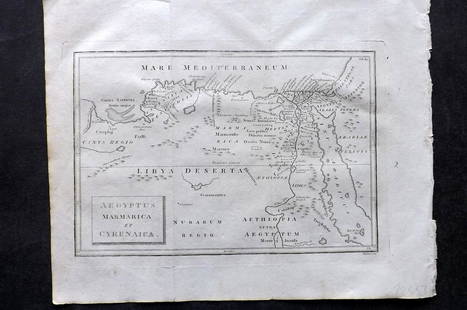
Cellarius & Patrick 1816 Map. Italy, Alps etc
Similar Sale History
View More Items in Maps & AtlasesRelated Maps & Atlases
More Items in Maps & Atlases
View MoreRecommended Transportation & Travel Collectibles
View More


Item Details
Description
"Vindelicia Rhaetia Noricum" Copper Engraved Map Published 1816, London for "Geographia Antiqua" by Samuel Patrick. Maps based on those by Andreas Cellarius. Folds as issued. Paper Size: 10 x 8 inch (26 x 20cm) Good Condition
Buyer's Premium
- 22%
Cellarius & Patrick 1816 Map. Italy, Alps etc
Estimate $30 - $40
Get approved to bid.
Shipping & Pickup Options
Item located in Chesterfield, Derbyshire, ukOffers In-House Shipping
Payment

TOP


![Nevada City, CA Map, etc. c1930s-50s (3) [180880]: This Nevada City, CA, collection of three includes a 22" x 17.5" rare caricature map of Nevada City, c1950s. The lot also includes letterhead (3) from Schreiber's CafÈ in Nevada City, Ernest Schreibe](https://p1.liveauctioneers.com/2699/331495/178785751_1_x.jpg?height=310&quality=70&version=1717094933)


![1581 Ortelius Map of Tuscany [with] Corsica [with] Ancona -- Senensis Ditionis, Accurata Descrip [on: Title: 1581 Ortelius Map of Tuscany [with] Corsica [with] Ancona -- Senensis Ditionis, Accurata Descrip [on sheet with] Corsica [and] Marcha Anconae, olim Picenum Cartographer: A Ortelius Year / Place](https://p1.liveauctioneers.com/5584/331064/178466435_1_x.jpg?height=310&quality=70&version=1716924723)


![Atlas Pages Stark Cty, OH & Townships . c1870-1900's. [180168]: (13) Pages from "Combination Atlas Map of Stark County Ohio", Published by L. H. Everts & Co. Philadelphia, 1875. The Pages include biographies of residents of the township, illustrations of the town](https://p1.liveauctioneers.com/2699/331495/178785794_1_x.jpg?height=310&quality=70&version=1717094933)

![Atlas Maps Report of Fortieth Parallel c1876 (14) [181041]: A collection of 14 rolled vertical atlas maps to accompany "The Report of the Fortieth Parallel," by Clarence King, c1876. Rolled for some time. Not bound. Some degradation on edges. Julius Bien lith.](https://p1.liveauctioneers.com/2699/331495/178785770_1_x.jpg?height=310&quality=70&version=1717094933)
![[MAPS]. HOMANN, Johann Baptist, HOMANN HEIRS, and Georg Matthäus SEUTTER. [Composite Atlas].: [MAPS]. HOMANN, Johann Baptist (1663-1724), HOMANN HEIRS, and Georg Matthäus SEUTTER (1678-1757). [Composite Atlas]. [Nuremberg, Augsburg, and others: Homann Heirs and others, maps dated between](https://p1.liveauctioneers.com/197/329395/177650530_1_x.jpg?height=310&quality=70&version=1715364962)
![[MAP]. TODESCHI, Pietro. [Nova et Acurata Totius Americae Tabula auct. G.I. Blaeu] America quarta: [MAP]. TODESCHI, Pietro. [Nova et Acurata Totius Americae Tabula auct. G.I. Blaeu] America quarta pars orbis quam plerunq, nuvum orbem appellitant primo detecta est anno 1492 a Christophoro Columbo...](https://p1.liveauctioneers.com/197/329395/177650542_1_x.jpg?height=310&quality=70&version=1715364962)

![[MAP]. ORTELIUS, Abraham. Americae Sive Novi Orbis, Nova Descriptio. 1573.: [MAP]. ORTELIUS, Abraham (1527-1598). Americae Sive Novi Orbis, Nova Descriptio. Antwerp, 1573. Engraved map with hand-coloring. Framed and double glazed, visible area 375 x 521 mm (unexamined out of](https://p1.liveauctioneers.com/197/329395/177650534_1_x.jpg?height=310&quality=70&version=1715364962)


![Set of Twelve Satirical Anthropomorphic Maps of Europe: [SATIRICAL MAPS] A set of twelve satirical anthropomorphic maps of Europe. London: circa 1868. A set of 12 (believed complete) lithographed maps by Vincent Brooks, Day & Son, London, each offering](https://p1.liveauctioneers.com/292/330597/178279264_1_x.jpg?height=310&quality=70&version=1716409282)


![[MAP]. ORTELIUS, Abraham. Turcici Imperii Descriptio.1592.: [MAP]. ORTELIUS, Abraham (1527-1598). Turcici Imperii Descriptio. Antwerp, 1592. Engraved map with hand-coloring. Matted, framed, and double glazed, sight 406 x 521 mm (unexamined out of frame). Decor](https://p1.liveauctioneers.com/197/329395/177650538_1_x.jpg?height=310&quality=70&version=1715364962)
![[MAP]. ORTELIUS, Abraham. Romani Imperii Imago. 1592.: [MAP]. ORTELIUS, Abraham (1527-1598). Romani Imperii Imago. Antwerp, 1592. Engraved map with hand-coloring. Matted, framed, and double glazed, visible area 381 x 521 mm (unexamined out of frame). 6 de](https://p1.liveauctioneers.com/197/329395/177650537_1_x.jpg?height=310&quality=70&version=1715364962)
![[MAP]. SPEED, John. A New Mappe of the Romane Empire. 1676.: [MAP]. SPEED, John (ca 1551-1629). A New Mappe of the Romane Empire. London: Basset & Chiswell, 1676. Engraved map with hand-coloring. Framed and double glazed, sight 419 x 559 mm. Decorative cartouch](https://p1.liveauctioneers.com/197/329395/177650541_1_x.jpg?height=310&quality=70&version=1715364962)
![[MAP]. ORTELIUS, Abraham. Aevi Veteris, Typus Geographicus. 1601.: [MAP]. ORTELIUS, Abraham (1527-1598). Aevi Veteris, Typus Geographicus. Antwerp, 1601. Engraved map with hand-coloring. Matted, framed, and double glazed, visible area 343 x 470 mm (unexamined out of](https://p1.liveauctioneers.com/197/329395/177650532_1_x.jpg?height=310&quality=70&version=1715364962)


