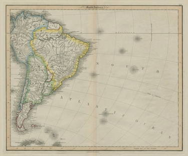
Antique 19th C. Ohio Map, J. Meyer (German) 1845
Similar Sale History
View More Items in Maps & Atlases

Related Maps & Atlases
More Items in Maps & Atlases
View MoreRecommended Transportation & Travel Collectibles
View More


Item Details
Description
An original steel engraved atlas map "Neuste Karte von Ohio mit seinen Canaelen, Strassen & Entfernungen der Hauptpunkte. Nach den bessten Quellen verbessert. 1845" Joseph Meyer (German, 1796-1856) from 'Meyer's Hand Atlas No. 84'Â published Hildburghausen: Bibliographischen Instituts. Framed and matted in a sleek Hogarth style frame. Condition; good with mild age wear, toning, and wrinkling to paper. Sight size 15" x 12.5", total frame size 21" x 17.5" in.
Â
Â
Buyer's Premium
- 23%
Antique 19th C. Ohio Map, J. Meyer (German) 1845
Estimate $100 - $200
4 bidders are watching this item.
Shipping & Pickup Options
Item located in Cleveland, OH, usShip with LiveAuctioneers
Local Pickup Available
Arrange Your Own Shipping
Payment
Accepts seamless payments through LiveAuctioneers

TOP


![Turquie d'Europe. Turkey in Europe Balkans Greece Wallachia MALTE-BRUN c1871 map: TITLE/CONTENT OF MAP: Turquie d'Europe [Turkey from Europe] DATE PRINTED: c1871 IMAGE SIZE: Approx 32.5 x 24.0cm, 12.75 x 9.5 inches (Large) TYPE: Antique 19th century engraved atlas map with original](https://p1.liveauctioneers.com/5584/328641/177014318_1_x.jpg?height=310&quality=70&version=1715113718)
![Suède et Norvège. Sweden and Norway. Scandinavia. MALTE-BRUN c1871 old map: TITLE/CONTENT OF MAP: Suède et Norvège [Sweden and Norway] DATE PRINTED: c1871 IMAGE SIZE: Approx 33.0 x 24.5cm, 13 x 9.5 inches (Large) TYPE: Antique 19th century engraved atlas map with or](https://p1.liveauctioneers.com/5584/328641/177014305_1_x.jpg?height=310&quality=70&version=1715113718)


![Belgique et de Hollande. Belgium & Netherlands. Benelux. MALTE-BRUN c1871 map: TITLE/CONTENT OF MAP: Carte des Royaumes de Belgique et de Hollande [Map of the Kingdoms of Belgium and Holland] DATE PRINTED: c1871 IMAGE SIZE: Approx 33.0 x 24.0cm, 13 x 9.5 inches (Large) TYPE: Ant](https://p1.liveauctioneers.com/5584/328641/177014293_1_x.jpg?height=310&quality=70&version=1715113718)
![Empire Romain sous Constantin et sous Trajan. Roman Empire. MALTE-BRUN c1871 map: TITLE/CONTENT OF MAP: Empire Romain sous Constantin et sous Trajan [Roman Empire under Constantine and under Trajan] DATE PRINTED: c1871 IMAGE SIZE: Approx 25.0 x 33.5cm, 10 x 13.25 inches (Large) TYP](https://p1.liveauctioneers.com/5584/328641/177014387_1_x.jpg?height=310&quality=70&version=1715113718)


![[Maps] Gio. Ant. Magnini, Italia, 1620: [Maps] Gio. Ant. Magnini, Italia, 1620, Giovanni Antonio Magnini. Italia, data in luce da Fabio suo figliuolo al Serenissimo Ferdinado Gonzaga Duca di Matoua edi Monserrato etc. Bologna, for Sebastian](https://p1.liveauctioneers.com/188/326797/176317457_1_x.jpg?height=310&quality=70&version=1713847031)
![[Maps] Martin Zeiler, Itinerarium Italiae, 1640: [Maps] Martin Zeiler, Itinerarium Italiae, 1640, Martini Zeilleri. Itinerarium Italiae Nov-Antiquae: oder, Raiss-Beschreibung durch Italien, Matthaus Merian, Frankfurt, 40 plates, most double-page, in](https://p1.liveauctioneers.com/188/326797/176317459_1_x.jpg?height=310&quality=70&version=1713847031)


![[MAP]. TODESCHI, Pietro. [Nova et Acurata Totius Americae Tabula auct. G.I. Blaeu] America quarta: [MAP]. TODESCHI, Pietro. [Nova et Acurata Totius Americae Tabula auct. G.I. Blaeu] America quarta pars orbis quam plerunq, nuvum orbem appellitant primo detecta est anno 1492 a Christophoro Columbo...](https://p1.liveauctioneers.com/197/329395/177650542_1_x.jpg?height=310&quality=70&version=1715364962)


