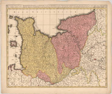
Map of the Bas-Rhin (France), 1854
Similar Sale History
View More Items in Maps & AtlasesRelated Maps & Atlases
More Items in Maps & Atlases
View MoreRecommended Transportation & Travel Collectibles
View More


Item Details
Description
Map of the Bas-Rhin, or Lower Rhine region of France, 1854, engraving from the Atlas National Illustre, translated inscriptions read, "Engraved by Laguillermie and Rainaud, Rue St. Jacques No. 82", "Statistics and geography by V. Levasseur, Geographical Engineer, Rue de Malte No. 24"
image: 10" x 16", frame: 21" x 26"
We happily provide seamless shipping services on everything we sell. Please email us at shipping@vogtauction.com or call 210-971-5750 for more information.
image: 10" x 16", frame: 21" x 26"
We happily provide seamless shipping services on everything we sell. Please email us at shipping@vogtauction.com or call 210-971-5750 for more information.
Buyer's Premium
- 23%
Map of the Bas-Rhin (France), 1854
Estimate $80 - $150
2 bidders are watching this item.
Shipping & Pickup Options
Item located in San Antonio, TX, usOffers In-House Shipping
Local Pickup Available
Payment

TOP


![[Wall map] France: Carte de la France, 1790.Incisione in coloritura coeva, 1200x1160 mm.](https://p1.liveauctioneers.com/3336/90951/46934974_1_x.jpg?height=310&quality=70&version=1473763184)

![Gallia Color Map [France]: Galliae Regni Potentiss Color Map with written description in Latin on verso. Map of France with boarders to Germany, Spain and Italy. Appears to be a page from an atlas. Undated. Measures 14 in. x 20](https://p1.liveauctioneers.com/5755/154409/77936853_1_x.jpg?height=310&quality=70&version=1573094011)


![HAND COLORED MAP OF PERU & COUNTRY OF THE AMAZONS, 1747, BY EMANUEL BOWEN, FRAMED: A New And Accurate Map Of Peru And The Country Of The Amazones. Drawn From The Most Authentick French Maps &C. And Regulated By Astronomical Observations, London]: William Innys [et al.], 1747. A deta](https://p1.liveauctioneers.com/957/328836/177180798_1_x.jpg?height=310&quality=70&version=1715021458)


![[MAPS]. A group of 3 engraved maps, most with hand-coloring.: [MAPS]. A group of 3 maps, comprising: HOMANN, Johann Baptist (1663-1724). Regni Mexicani seu Novae Hispaniae, Ludovicianae, N. Angliae, Carolinae, Virginiae et Pensylvaniae. Nuremberg: Homann, [ca 17](https://p1.liveauctioneers.com/197/328642/177014805_1_x.jpg?height=310&quality=70&version=1714760103)

![[Maps] Gio. Ant. Magnini, Italia, 1620: [Maps] Gio. Ant. Magnini, Italia, 1620, Giovanni Antonio Magnini. Italia, data in luce da Fabio suo figliuolo al Serenissimo Ferdinado Gonzaga Duca di Matoua edi Monserrato etc. Bologna, for Sebastian](https://p1.liveauctioneers.com/188/326797/176317457_1_x.jpg?height=310&quality=70&version=1713847031)
![[Maps] Martin Zeiler, Itinerarium Italiae, 1640: [Maps] Martin Zeiler, Itinerarium Italiae, 1640, Martini Zeilleri. Itinerarium Italiae Nov-Antiquae: oder, Raiss-Beschreibung durch Italien, Matthaus Merian, Frankfurt, 40 plates, most double-page, in](https://p1.liveauctioneers.com/188/326797/176317459_1_x.jpg?height=310&quality=70&version=1713847031)


![[MAP]. TODESCHI, Pietro. [Nova et Acurata Totius Americae Tabula auct. G.I. Blaeu] America quarta: [MAP]. TODESCHI, Pietro. [Nova et Acurata Totius Americae Tabula auct. G.I. Blaeu] America quarta pars orbis quam plerunq, nuvum orbem appellitant primo detecta est anno 1492 a Christophoro Columbo...](https://p1.liveauctioneers.com/197/329395/177650542_1_x.jpg?height=310&quality=70&version=1715364962)


