


40 +/- 1940's-1970's Nat'l Geographic Maps
Similar Sale History
View More Items in Maps & Atlases


![LONDON UNDERGROUND tube map diagram plan. First STINGEMORE edition 1925: TITLE/CONTENT OF MAP: Underground Railways of London [694 11.5.25] This is the first edition of an Underground geographic map designed by F H Stingemore. It is one of the first designs not to show any](https://p1.liveauctioneers.com/5584/263211/137236971_1_x.jpg?height=310&quality=70&version=1664917902)


Related Maps & Atlases


![HAND COLORED MAP OF PERU & COUNTRY OF THE AMAZONS, 1747, BY EMANUEL BOWEN, FRAMED: A New And Accurate Map Of Peru And The Country Of The Amazones. Drawn From The Most Authentick French Maps &C. And Regulated By Astronomical Observations, London]: William Innys [et al.], 1747. A deta](https://p1.liveauctioneers.com/957/328836/177180798_1_x.jpg?height=310&quality=70&version=1715021458)


![[Maps] Martin Zeiler, Itinerarium Italiae, 1640: [Maps] Martin Zeiler, Itinerarium Italiae, 1640, Martini Zeilleri. Itinerarium Italiae Nov-Antiquae: oder, Raiss-Beschreibung durch Italien, Matthaus Merian, Frankfurt, 40 plates, most double-page, in](https://p1.liveauctioneers.com/188/326797/176317459_1_x.jpg?height=310&quality=70&version=1713847031)
More Items in Maps & Atlases
View More![[Maps] Gio. Ant. Magnini, Italia, 1620: [Maps] Gio. Ant. Magnini, Italia, 1620, Giovanni Antonio Magnini. Italia, data in luce da Fabio suo figliuolo al Serenissimo Ferdinado Gonzaga Duca di Matoua edi Monserrato etc. Bologna, for Sebastian](https://p1.liveauctioneers.com/188/326797/176317457_1_x.jpg?height=310&quality=70&version=1713847031)


![[MAP]. TODESCHI, Pietro. [Nova et Acurata Totius Americae Tabula auct. G.I. Blaeu] America quarta: [MAP]. TODESCHI, Pietro. [Nova et Acurata Totius Americae Tabula auct. G.I. Blaeu] America quarta pars orbis quam plerunq, nuvum orbem appellitant primo detecta est anno 1492 a Christophoro Columbo...](https://p1.liveauctioneers.com/197/329395/177650542_1_x.jpg?height=310&quality=70&version=1715364962)


Recommended Transportation & Travel Collectibles
View More


Item Details
Description
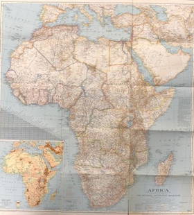
40 +/- National Geographic maps, from 1949-1979, includes Europe and The Near East with Russian and Polish boundaries according to treaties and claims as of April 1, 1949, post-World War II, Classical Lands of the Mediterranean, Charts of The Great Lakes by The Army Corps of Engineers, 1950's maps including historical map of the United States, North and South American countries, and more, see photos for details, condition. ***WE DO NOT ACCEPT PREPAID SHIPPING LABELS. NO EXCEPTIONS.Scheerer McCulloch Auctioneer will ship select items only, and will add shipping charges 2-4 business days after an auction for qualifying lots. Some items, such as exceptionally fragile items, items won by International bidders, or large items will be shipped by a third party for profit shipping company, Pak Mail, by default. Please contact Pak Mail PRIOR to bidding for a shipping quote on these items (260)-637-4809 or us419@pakmail.com. For info regarding in-house shipping please contact us directly at info@smauctioneers.com.
Buyer's Premium
- 18%
40 +/- 1940's-1970's Nat'l Geographic Maps
Estimate $50 - $10,000
Shipping & Pickup Options
Item located in Fort Wayne, IN, usOffers In-House Shipping
Local Pickup Available
Payment
Accepts seamless payments through LiveAuctioneers

Related Searches
TOP