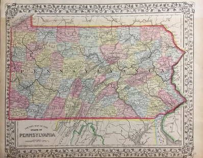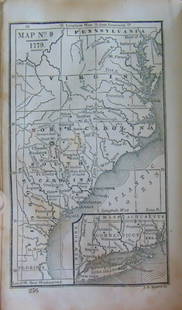
Pair of 19th century maps of Pennsylvania
Similar Sale History
View More Items in Maps & AtlasesRelated Maps & Atlases
More Items in Maps & Atlases
View MoreRecommended Transportation & Travel Collectibles
View More


Item Details
Description
Pair of 19th century maps of Pennsylvania: North America Sheet VII, Pennsylvania, New Jersey... And Part of Virginia, c.1833, hand colored, 16 x 14 inches //AND// Map of Pennsylvania Prepared Expressly for Smull's Hand Book, printed by Benjamin Singerly, 1872, 15 x 22.5 inches.
Condition
Older map with some tearing to left margin and creases from storage; newer map Good or better with original folds. Merchandise will be packed and transported by the purchaser at their own risk and expense. A current list of shippers is listed on our website www.conceptgallery.com under “Auctions” / “Shipping” tab.
Buyer's Premium
- 25%
Pair of 19th century maps of Pennsylvania
Estimate $20 - $40
5 bidders are watching this item.
Shipping & Pickup Options
Item located in Pittsburgh, PA, usSee Policy for Shipping
Local Pickup Available
Payment
Accepts seamless payments through LiveAuctioneers

Related Searches
TOP


![Pair of maps of Russian Empire, 1750: Heading: Author: Robert de Vaugondy, Gilles and Didier Title: Partie Occidentale de l'Empire de Russie, ou se trouve distinguee la Russie Europeenne... [together with] Partie Orientale de L'Empire de](https://p1.liveauctioneers.com/642/151690/76551282_1_x.jpg?height=310&quality=70&version=1570486555)

![[Maps] Pair of Maps of N & S America: Pair of Maps: AN ACCURATE MAP OF NORTH AMERICA…BY EMANUEL BOWEN. 1747. Measuring from neatline to neatline 201 x 149mm. Vertical creases as folded, clean, Very Good. ***** AN ACCURATE MAP OF SOU](https://p1.liveauctioneers.com/3532/107013/54846861_1_x.jpg?height=310&quality=70&version=1501119763)


![Pair of Robert Morden Antique Maps Herefordshire Barkshire: Morden, Robert, Pair of Hand Colored Antique Maps: Hereford Shite [Herefordshire] and Bark Shire [Barkshire], printed for Abel Swale [Swall] and John Churchill, 14 x 16.5 inches, uniformly matted and](https://p1.liveauctioneers.com/184/328649/177016430_1_x.jpg?height=310&quality=70&version=1714770323)


![Untitled. Midwest. [Map Issued With the Official Inter-State Railway Guide]: Title: Untitled. Midwest. [Map Issued With the Official Inter-State Railway Guide] Cartographer: ANONYMOUS Publisher: THE GUIDE PUBLISHING CO. Dimensions: Height: 16 Width: 20.75 Description: Regional](https://p1.liveauctioneers.com/5584/329422/177662238_1_x.jpg?height=310&quality=70&version=1715717898)


![1892 Cowles Civil War Map of Battles in Gettysburg, Virginia, W Virginia and Maryland -- Sketch of: Title: 1892 Cowles Civil War Map of Battles in Gettysburg, Virginia, W Virginia and Maryland -- Sketch of the battle of McDowell, VA. [and] Route Map of Gettysburg Campaign Lt-Gen T.J. Jackson [and] S](https://p1.liveauctioneers.com/5584/329422/177662185_1_x.jpg?height=310&quality=70&version=1715717898)
![Rand, McNally & Co.'S New Commercial Railroad Map of the United States [Chicago to Denver]: Title: Rand, McNally & Co.'S New Commercial Railroad Map of the United States [Chicago to Denver] Cartographer: RAND, MCNALLY & CO. Publisher: RAND-MCNALLY & CO. Dimensions: Height: 26 Width: 18.5 Des](https://p1.liveauctioneers.com/5584/329422/177662153_1_x.jpg?height=310&quality=70&version=1715717898)


![[MAP]. TODESCHI, Pietro. [Nova et Acurata Totius Americae Tabula auct. G.I. Blaeu] America quarta: [MAP]. TODESCHI, Pietro. [Nova et Acurata Totius Americae Tabula auct. G.I. Blaeu] America quarta pars orbis quam plerunq, nuvum orbem appellitant primo detecta est anno 1492 a Christophoro Columbo...](https://p1.liveauctioneers.com/197/329395/177650542_1_x.jpg?height=310&quality=70&version=1715364962)


![[MAPS]. HOMANN, Johann Baptist, HOMANN HEIRS, and Georg Matthäus SEUTTER. [Composite Atlas].: [MAPS]. HOMANN, Johann Baptist (1663-1724), HOMANN HEIRS, and Georg Matthäus SEUTTER (1678-1757). [Composite Atlas]. [Nuremberg, Augsburg, and others: Homann Heirs and others, maps dated between](https://p1.liveauctioneers.com/197/329395/177650530_1_x.jpg?height=310&quality=70&version=1715364962)


