


Done
New York, NY, United States
Auction Details
Mapping the Globe: Antique World Maps Auction
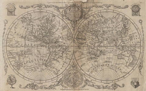
This auction offers antique maps of the Ancient and Modern Worlds, and of the Western Hemisphere and Eastern Hemisphere, including maps of the Americas, and maps straddling more than one continent. World maps on different projections including Mercator projection, Gnomic Projection, and the world in Twin Hemispheres. Maps of European Empires covering more than one continent including the British Empire, Portuguese and Spanish colonial possessions etc
Lot Number: Lowest
24
![ARMILLARY SPHERE. compared to a Globe. Astrolabe. MALLET 1683 old antique map: TITLE OF MAP (NOT PRINTED ON THE PAGE):[Conformité des cercles de la Sphere Artificielle avec ceux qui sont representés sue les Globes ou sur les Cartes Generales] (De la Sphere) DATE](https://p1.liveauctioneers.com/5584/296524/157572964_1_x.jpg?height=310&quality=70&version=1690316768)
0001: ARMILLARY SPHERE. compared to a Globe. Astrolabe. MALLET 1683 old antique mapEst. $70-$80Lot Passed

0002: EUROPEAN COLONIES 1713. Peace of Utrecht. Americas. France v Britain 1902 mapEst. $40-$50Lot Passed

0003: The World on Mercator's Projection by John Bartholomew 1859 old antique mapEst. $100-$120Lot Passed

0004: Comparative lengths of principal WORLD RIVERS. SDUK 1844 old antique map chartEst. $150-$200Lot Passed

0005: Atlantis in its Decadence. World 800,000-200,000 BC. SCOTT-ELLIOT 1925 old mapEst. $150-$200Lot Passed

0006: WORLD RIVERS. Comparative lengths of principal rivers. Countries.SDUK 1844 mapEst. $150-$200Lot Passed

0007: WESTERN HEMISPHERE Americas Mexican Texas New Zealand Pacific SDUK 1844 mapEst. $110-$150Lot Passed

0008: NORTH POLE ARCTIC to 45˚ N Latitude.Alaska as Russian Territory.SDUK 1844 mapEst. $150-$200Lot Passed

0009: WORLD Isobaric lines & Prevailing Winds of the Globe. January. JOHNSTON 1901 mapEst. $40-$50Lot Passed

0010: Mercantile Marine Flags America Asia Pilot International code signals 1952Est. $60-$70Lot Passed

0011: World in Hemispheres - Western & Eastern. STANFORD c1925 old vintage map chartEst. $70-$80Lot Passed

0012: WORLD post WW2 British French Dutch Belgian colonies. BARTHOLOMEW 1947 old mapEst. $60-$70Lot Passed

0013: WORLD COMMUNICATIONS. air/shipping routes railways. BARTHOLOMEW 1944 old mapEst. $50-$60Lot Passed

0014: A chart of magnetic curves of equal variation. World. GEORGE AIKMAN 1856 mapEst. $60-$70Lot Passed

0015: WORLD ON MERCATOR'S PROJECTION showing the BRITISH EMPIRE by GW BACON 1891 mapEst. $100-$120Lot Passed

0016: SOUTHERN LATITUDES POLE ANTARCTIC Patagonia Tasmania SDUK 1844 old antique mapEst. $90-$110Lot Passed

0017: BRITISH EMPIRE. World Mercator. Currents. Steamship routes. JOHNSTON 1899 mapEst. $90-$110Lot Passed

0018: Southern hemisphere Antarctic Australia South America/Africa. THOMSON 1817 mapEst. $250-$300Lot Passed

0019: ARMILLARY SPHERE. 'Des Colvres'. Astrolabe. MALLET 1683 old antique printEst. $60-$70Lot Passed

0020: PTOLEMY'S WORLD MAP. Compared with actual positions. Kiepert. Britannica 1898Est. $40-$50Lot Passed

0021: WORLD POPULATION. Sinusoidal equal area projection. BARTHOLOMEW 1944 old mapEst. $30-$40Lot Passed

0022: A map of the world on Mercators Projection. Davis Land. GENTS MAG 1755 oldEst. $250-$300Lot Passed

0023: WORLD. Mercator's projection. Ocean currents & shipping routes. BLACKIE 1882 mapEst. $60-$70Lot Passed

0024: WORLD.Isobaric lines & Prevailing Winds of the Globe.January.JOHNSTON 1906 mapEst. $40-$50Lot Passed
View:
24
Auction Details

Bid Increments
PriceBid Increment
$0$1
$10$5
$100$10
$200$20
$500$50
$1,000$100
$2,000$200
$5,000$500
$10,000$1,000
$20,000$2,000
TOP