


Done
New York, NY, United States
Auction Details
16th-20th Century Antiquarian Maps
Explore both land and sea with this array of maps, which preserves the geography of nearly every region imaginable. Unlike modern maps, these original engravings trace borders as they evolved throughout history. Discover centuries-old views of every corner of America or a map of Portugal and parts of Spain from 1645! Not only will these maps serve as decorative pieces, but they also will reveal innumerable ways to view our world.
Auction Curator:
Steve Kovacs
Maps ExpertLot Number: Lowest
24

0001: 1894 Johnson Map of New England States -- Johnson's Section Map and Index of the New England StatesEst. $120-$150Lot Passed

0002: 1764 Bellin Map of the Lesser Antilles -- Les Petites Antilles ou Les Isles du VentEst. $120-$150Lot Passed

0003: 1714 Chatelain Map of Sri Lanka -- Nouvelle Carte de l'Ile de Ceylon, avec des Remarques HistoriquesEst. $200-$250Lot Passed


0009: 1872 Asher and Adams Map of Maine and Parts of Quebec, Vermont and New Hampshire -- Asher & AdamsEst. $50-$60Lot Passed


Sold
0013: 1680 Jansson Historical Map of Southern Asia -- Erythraei sive Rubri Maris Periplus. Olim ab ArrianoEst. $250-$300
See Sold Price

0014: 19th Cent FLORIDA MAP, EVERGLADES INDIAN RESERVATION FT. BROOKE MILITARY RESERVEEst. $50-$60Lot Passed


Sold
0017: 1782 Cary View of Fort St. George, Madras, India -- Fort St. George on the Coromandel Coast, EastEst. $50-$60
See Sold Price
![1876 Mitchell Map of Virginia, West Wirginia [verso] New Jersey, Maryland, Delaware -- County Map of: Title: 1876 Mitchell Map of Virginia, West Wirginia [verso] New Jersey, Maryland, Delaware -- County Map of Virginia and West Virginia [verso] County Map of New Jersey [and] County Map of Maryland](https://p1.liveauctioneers.com/5584/277912/146135500_1_x.jpg?height=310&quality=70&version=1675809127)
0018: 1876 Mitchell Map of Virginia, West Wirginia [verso] New Jersey, Maryland, Delaware -- County Map ofEst. $50-$60Lot Passed


0021: 1920s Blum US Railroad Map -- Blum's Commercial Map of the United statesEst. $70-$80Lot Passed

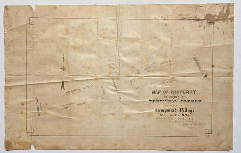
0023: MAP of PROPERTY TREDWELL ELDERD at HEMPSTEAD VILLAGE, QUEENS CO. New York CityEst. $40-$50Lot Passed


View:
24
Auction Details

Bid Increments
PriceBid Increment
$0$1
$10$5
$100$10
$200$20
$500$50
$1,000$100
$2,000$200
$5,000$500
$10,000$1,000
$20,000$2,000
TOP