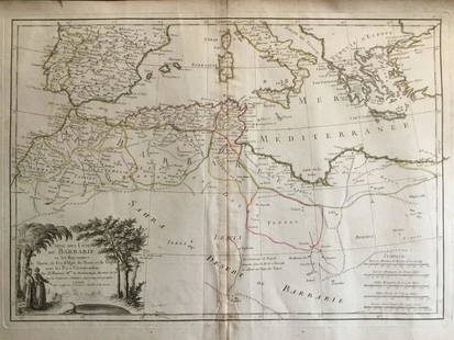
16th-20th Century Antiquarian Maps 2020-08-11 Auction - 180 Price Results - Jasper52 in NY
LiveAuctioneers Logo

1850 Tallis Map of North America -- North America1792 Elwe Map of Northern Russia in Europe -- CarteBRITISH NORTH AMERICA Northwest passage explorers'
Done
New York, NY, United States
Auction Details

16th-20th Century Antiquarian Maps

Jasper52

Jasper52

badge TOP RATED
Explore both land and sea with this array of maps, which preserves the geography of nearly every region imaginable. Unlike modern maps, these original engravings trace borders as they evolved throughout history. Discover centuries-old views of every corner of America or a map of Sri Lanka from 1750! Not only will these maps serve as decorative pieces, but they also will reveal innumerable ways to view our world.
Auction Curator:
Steve Kovacs
Steve Kovacs
Maps Expert
Lot Number: Lowest
24
Sold
1884 Map of West Texas: Author: CramTitle: 1884 Map of West TexasMedium: Ink on PaperDimensions: 14.5"X21.5" Map of the West portion of Texas dated 1884. Engraved and published by George Cram in Chicago. Part of his World
0009: 1884 Map of West TexasEst. $30-$40
See Sold Price
Sold
1884 Map of Washington DC: Author: WatsonTitle: 1884 Map of Washington DCMedium: Ink on PaperDimensions: 14.5"X11" Map of Washington DC. dated 1884. Engraved and published by Watson in Chicago. Upper right references to
0012: 1884 Map of Washington DCEst. $30-$40
See Sold Price
N&S Carolina 1901: Title: N&S Carolina 1901Date Printed: 1901Material/Medium: paperSize: 14.5x22 inchesAdditional Info: The National Standard Family and Business Atlas of the World. Fort Dearborn Publishing Co. Chicago
0015: N&S Carolina 1901Est. $40-$50Lot Passed
Detroit 1889: Title: Detroit 1889Date Printed: 1889Material/Medium: paperSize: Approx. 14.5x10.5 inchesAdditional Info: Cram's Unrivaled Atlas of the World. W.H. Stewart Publisher, Rochester NY Reserve: $20.00
0020: Detroit 1889Est. $30-$40Lot Passed
1883 Map of Quebec City: Author: CramTitle: 1883 Map of Quebec CityMedium: Ink on PaperDimensions: 14.5"X11" Map of Quebec City dated 1883. Engraved and published by George Cram in Chicago. Very detailed. References for
0021: 1883 Map of Quebec CityEst. $30-$40Lot Passed
1776 Map of Ancient Britain: Author: LodgeTitle: 1776 Map of Ancient BritainMedium: Ink on PaperDimensions: 12"X11" Map of Ancient Britain dated 1766. Engraved by J. Lodge and published by London. Captures Britain under Roman
0023: 1776 Map of Ancient BritainEst. $50-$60Lot Passed
1842 Map of Greece: Author: ScottTitle: 1842 Map of GreeceMedium: Ink on PaperDimensions: 11.5"X9" Map of Greece dated 1842. Engraved by R. Scott. Part of the New General Atlas of the World. Copper plate engraving.
0024: 1842 Map of GreeceEst. $30-$40Lot Passed
1887 Map of the Dakotas: Author: CramTitle: 1887 Map of the DakotasMedium: Ink on PaperDimensions: 13.5"X21.5" Map of the Dakotas before partition, dated 1887. Engraved and published by George Cram in Chicago. Printed on
0025: 1887 Map of the DakotasEst. $40-$50Lot Passed
1892 Civil War Map: Author: BienTitle: 1892 Civil War MapMedium: Ink on PaperDimensions: 29.5"X18.5" Civil War map dated 1892. Published under the direction of the Hon. Stephen B. Elkins Secretary of War. These map
0026: 1892 Civil War MapEst. $100-$120Lot Passed
Persia 1888: Title: Persia 1888Date Printed: 1888Material/Medium: paperSize: 14.5x 11.5 inchesAdditional Info: John C. Lonngren & Son Standard Atlas of the World Reserve: $20.00 Shipping:Domestic: Flat-rate of
0028: Persia 1888Est. $30-$40Lot Passed
Nevada & Utah 1880: Title: Nevada & Utah 1880Date Printed: 1880Material/Medium: paperSize: folio, 23x 15 inchesAdditional Info: Hand colored county & township map of Utah & Nevada by Mitchell. Map measures 23" x 15",
0030: Nevada & Utah 1880Est. $40-$50Lot Passed
View:
24
TOP