


Done
New York, NY, United States
Auction Details
Antiquarian Maps of Europe
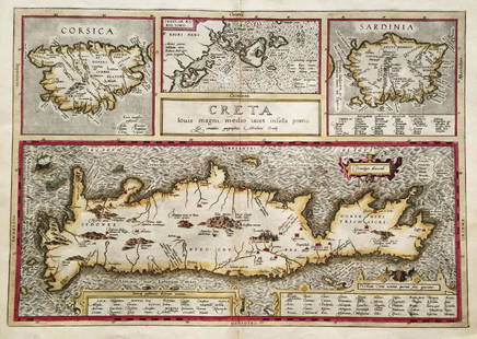
Explore both land and sea with this array of maps of Europe and the United Kingdom. With this focused yet diverse auction, discover a rare colored view of Corsica and Sardinia from the early 1600s, or revel in unique view of France's Seine River. Not only will these maps serve as decorative pieces, but they also will reveal innumerable ways to view our world.
Auction Curator:
Steve Kovacs
Maps ExpertLot Number: Lowest
24


![1760 Jeffers Map of the Seine River and its Delta with: Title/Content of Map: 1760 Jeffers Map of the Seine River and its Delta with the Town of le Havre Shown -- The Road and Bay of Havre de Grace [inset] The River Seine…Date: 1760 c.,](https://p1.liveauctioneers.com/5584/122553/62377093_1_x.jpg?height=310&quality=70&version=1527639612)


![Veuede Barcelone. Capitale de Catalogne'. Barcelona,: CAPTION PRINTED BELOW PICTURE: 'Veue, ou profil, de Barcelone. Capitale de Catalogne [View of Barcelona, capital of Catalonia]'Date: 1705 IMAGE SIZE: Approx 12.0 x 32.5cm, 4.75 x 12.75 inches](https://p1.liveauctioneers.com/5584/122553/62377097_1_x.jpg?height=310&quality=70&version=1527639612)


!["Turquie d'Europe". Greece Balkans Anatolia. SANTINI /: TITLE/CONTENT OF MAP: 'Turquie d'Europe par le S.Janvier Geographe. À Venise par François Santini rue Ste Justine prés la dite Eglise. Chez. Mr. Remondini [Turkey in Europe]'A decorative 18th](https://p1.liveauctioneers.com/5584/122553/62377100_1_x.jpg?height=310&quality=70&version=1527639612)

![1772 Sayer Map of Russia -- The European Part of the: Title/Content of Map: 1772 Sayer Map of Russia -- The European Part of the Russian Empire... [joined with] The Asiatic Part of the Russian Empire… [Also Titled as] The Whole Russian EmpireDate:](https://p1.liveauctioneers.com/5584/122553/62377103_1_x.jpg?height=310&quality=70&version=1527639612)


View:
24
Auction Details

Bid Increments
PriceBid Increment
$0$1
$10$5
$100$10
$200$20
$500$50
$1,000$100
$2,000$200
$5,000$500
$10,000$1,000
$20,000$2,000
TOP