Sold20181757 Venegas Map of Baja California -- NaauwkeurigeTitle/Content of Map: 1757 Venegas Map of Baja California -- Naauwkeurige Kaart van California, Uytgegeven door de Maatschappy der Jesuiten, en Opgedragen aan den Koning van Spanjen -- California (penSee Sold Price
Sold2018Diderot/Vaugondy: Antique Map California & West AmericaTitle/Content of Map: Carte De La Californie Et Des Pays Nord Ouest separes de L'Asie par le Detroit d'Anian… Cartographer: Diderot/de Vaugondy Place & Date: Paris / 1772 Size: 14 3/8" x 11 7/8" ConSee Sold Price
Sold2022Important map of Baja California and today’s Arizona c1765. By TirionTitle: Important map of Baja California and today’s Arizona c1765. By Tirion Date/Period: c1765 Materials: Copper plate engraved Size: 14 x 13” AMONG THE BEST AND OLDEST DETAILED MAPS OBTASee Sold Price
Sold2017du Val: Antique Map of California as an Island, 1670Title: Nouveau Mexique. Wonderful 1670 miniature of California as an Island Map maker: Pierre Du Val, Le Monde ou la Geographie Universelle Place and Year: Paris, 1670 Dimensions: 3.9 x 4.7 in; 9.8 xSee Sold Price
Sold2017Bien: Antique Map of California as Island, 1889Wheeler, George M[ontague]. . Washington: Julius Bien, Photo-lithograph, 1889. Quarto, one leaf. Fine. This is the map showing California as an island, and the northern part of present day Mexico andSee Sold Price
Sold2018Rand McNally: Antique Map of California, 1894Title/Content of Map: 1894 Rand McNally Map of California [verso] Nevada and Arizona -- Map of California [verso] Nevada; Arizona Date Printed: 1894, Chicago Cartographer: Rand McNally Size: 18.5 x 13See Sold Price
Sold2024Francis McNally - Antique Map of California & MinnesotaThis is a fine example of McNally's System of Geography by: Francis McNally, published by A.S. Barmes & Co. in 1875. This atlas was made for schools, academies, and seminaries to teach students aboutSee Sold Price
Sold2017Cram: Antique Map of California, 1891Map: California Date: 1891 From Cram's "Unrivaled Family Atlas of the World Indexed" Size: 14 x 22 inches George F. Cram (1842-1928) served in the U.S. Army during the American Civil War. After the waSee Sold Price
Sold2022Scarce Johnson map of the Great Western states, 1864Antique map of California, Nevada, Utah, Colorado, New Mexico, and Arizona. Published during a great time of expansion and change in the U.S. West, as well as during the Civil War. Here Utah displaysSee Sold Price
Sold2017Nicolas De Fer: Carte Generale du Globe Terrestre, 1705Map: Carte Generale du Globe Terrestre et Aquatiques ou Mappemonde en Deux Plans-Hemisphere [Scarce 1705 antique map with California as an island] Maker: Nicolas De Fer Size: 8.125 x 11.125 (10.25 x 1See Sold Price
Sold2021Antique California Maps c1872-1896 (Lot of 3) [31975]1) 1896 City of San Francisco, 2000 feet to the inch, printed on newsprint, separated in two pieces at the center fold. Very detailed, some penciled notes in the top right. Map includes concentric cirSee Sold Price
Sold2017Jefferys: Antique Map of the World, 1757Map: 1757 Jefferys Map of the World -- The World Cartographer: T. Jefferys Year / Place: 1757 London Dimensions: 6 x 10.6 in. Condition: Very good - Excellent condition, issued fold noted. Slight fingSee Sold Price
Sold2017Fremont: Antique Map of Oregon & Upper California, 1848Map: 1848 Fremont Map of Oregon and Upper California -- Map of Oregon and Upper California, From the Surveys of John Charles Fremont Cartographer: J Fremont Year / Place: 1848, Washington Map DimensioSee Sold Price
Sold2017Bellin: Antique Map of Carolina & Georgia, 1757Map: Carte de la Caroline et Georgie Cartographer: Bellin Place & Date: Paris / 1757 Size: 11 1/8" x 7 3/8" Condition: b&w Bellin's highly detailed map of Georgia and the Carolinas with an elegant titSee Sold Price
Sold2018Bellin: Antique Map of Early Boston, 1757Title/Content of Map: Plan de la Ville de Boston et ses Environs Cartographer: Bellin Place & Date: Paris / 1757/1760 Size: 10 5/8" x 6 3/8" Condition: b&w; light overall age toning; a few spots in thSee Sold Price
Sold2019California Southwest Antique MapEarly map: California, also Utah, Nevada, Colorado, New Mexico and Arizona. Map by A.J. Johnson, New York, c. 1870. 18" x 26 1/2".See Sold Price
Sold2017Bellin: Antique Map of Chesapeake Bay, 1757Map: Carte de la Baye de Chesapeack et Pays Voisins Cartographer: Bellin Place & Date: Paris / 1757/1760 Size: 11 1/8" x 7 3/8" Condition: b&w; overall age toning; some minor spotting; a tiny repairedSee Sold Price
Sold2018Bellin: Antique Map of West Africa, 1757Title/Content of Map: 1757 Bellin Map of West Africa -- Carte du Golfe de Guinee Et les Costes comprises entre le Cap Formosa et le Cap de Lopes Consalvo Date Printed: 1757, Paris Cartographer: J BellSee Sold Price
Sold2017Bellin: Antique Map of New England, 1757Map: Carte de la Nouvelle Angleterre, Nouvelle Yorck, et Pensilvanie Cartographer: Bellin Place & Date: Paris / 1757/1760 Size: 11 5/8" x 8" Condition: light outline color; overall age toning; some miSee Sold Price
Sold2023Antique & Vintage California Maps, Adams & AsherNice pair of California maps with the Adams & Asher California and Nevada believed to be from the 1870s, the other unknown and is vintage. Measures 15" x 22" and 18" x 25".See Sold Price
Sold2017Bellin: Antique Map of Florida and Louisiana, 1757Map: Carte de la Floride, de la Louisiane, et Pays Voisins Cartographer: Bellin Place & Date: Paris / 1757 Size: 12" x 8 1/2" Condition: b&w; overall age toning; a few minor spots Bellin's beautifullySee Sold Price
Sold2017Wilkes: Antique Map of Gold Rush Era California, 1849Title: 1849 Wilkes Map of Gold Rush Era California -- Map of Upper California by the U.S Ex. Ex. Best Authorities Cartographer: C. Wilkes Year / Place: 1849 Philadelphia Map Dimensions: 8.5 x 11.3 in.See Sold Price
Sold2023Antique Map Print - America - Mexico - Brazil - California - Vaugondy - 1806Title: Antique Map Print - America - Mexico - Brazil - California - Vaugondy - 1806 Description: Original 1806 copper-engraved map by Robert de Vaugondy on the Mercator projection. Derived from "NouveSee Sold Price
7 days LeftTrillium Antique Prints & Rare BooksWilkes - Pair of Maps of California and the Pacific Ocean$100
13 hrs LeftTremont AuctionsAntique "Chili" map by Blaeu. 2 sided framing. Overall: 18.25 x 21.75in.$50
May 16Potter & Potter AuctionsPictorial Map of Hollywood and Vicinity / Hollywood Film Ca...$125(1 bid)
May 14Akiba Galleries(2 Pc) Allain Manesson Mallet Description De L'Univers 2 Vol. German Translation$200(1 bid)
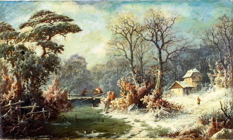
21 hrs LeftCurated Gallery AuctionsAntique Impressionist Western California Taos School Native American Horse Landscape Oil Painting$20(2 bids)
21 hrs LeftCurated Gallery AuctionsMarius Schmidt (1868 - 1938) Antique American Impressionist Signed California Landscape Flowers$10(1 bid)
21 hrs LeftCurated Gallery AuctionsAntique American School Western Horse Landscape California Frontier Framed Original Oil Painting$180(2 bids)
7 days LeftHess Fine AuctionsKirstie Alley Estate Large Antique Heavy Carved Alabaster Bust Beaux Arts Bronzed Patina COA$100(5 bids)


![Bien: Antique Map of California as Island, 1889: Wheeler, George M[ontague]. . Washington: Julius Bien, Photo-lithograph, 1889. Quarto, one leaf. Fine. This is the map showing California as an island, and the northern part of present day Mexico and](https://p1.liveauctioneers.com/5584/107399/55057770_1_x.jpg?height=310&quality=70&version=1501794677)
![Rand McNally: Antique Map of California, 1894: Title/Content of Map: 1894 Rand McNally Map of California [verso] Nevada and Arizona -- Map of California [verso] Nevada; Arizona Date Printed: 1894, Chicago Cartographer: Rand McNally Size: 18.5 x 13](https://p1.liveauctioneers.com/5584/114081/58622920_1_x.jpg?height=310&quality=70&version=1514373969)


![Nicolas De Fer: Carte Generale du Globe Terrestre, 1705: Map: Carte Generale du Globe Terrestre et Aquatiques ou Mappemonde en Deux Plans-Hemisphere [Scarce 1705 antique map with California as an island] Maker: Nicolas De Fer Size: 8.125 x 11.125 (10.25 x 1](https://p1.liveauctioneers.com/5584/106187/54391534_1_x.jpg?height=310&quality=70&version=1499460562)
![Antique California Maps c1872-1896 (Lot of 3) [31975]: 1) 1896 City of San Francisco, 2000 feet to the inch, printed on newsprint, separated in two pieces at the center fold. Very detailed, some penciled notes in the top right. Map includes concentric cir](https://p1.liveauctioneers.com/2699/202326/102449099_1_x.jpg?height=310&quality=70&version=1619652794)