Sold20181829 Malte-Brun Map of Germany -- ConfederationReserve Reduced! Title/Content of Map: 1829 Malte-Brun Map of Germany -- Confederation Germanique en 1829 Date: 1829, Paris Cartographer: M Malte-Brun Size: 11.7 x 8.8 in. An attractive map of GermanSee Sold Price
Sold2019GERMANY. Germanic tribes. 'La vraye Germanie' & Poland.TITLE OF THE MAP: 'Partie Meridionale de l'Ancienne Germanie ou la vraye Germanie' The top image on the right hand side shows the entire map. To view a close up of the map showing the level of printedSee Sold Price
Sold2018Mallet: Antique Map of Germanic Tribes, 1683Title/Content of Map: 'Partie Meridionale de l'Ancienne Germanie ou la vraye Germanie' GERMANY. Germanic tribes. 'La vraye Germanie' & Poland. Date Printed: 1683 Image Size: Approx Overall page size 1See Sold Price
Sold2018Mallet: GERMANY. Germanic tribes. 'La vraye Germanie' &TITLE OF THE MAP: 'Partie Meridionale de l'Ancienne Germanie ou la vraye Germanie' DATE PRINTED: 1683 IMAGE SIZE: Approx Overall page size 13 x 21cm approximately (5 x 8 inches); image size 10.5 x 14.See Sold Price
Sold2023MAP, Germany, Braun & HogenbergMainz & Wurzburg, Germany & Sion, Switzerland. Braun & Hogenberg, Moguntia, Germaniae Metropolis, ad Rheni... [on sheet with] Herbipolis, Comuniter Wirtzburg... [and] Sedunum, Primaria & MetropoliticaSee Sold Price
Sold2023MAP, Germany, MunsterSouthern Germany. Sebastian Munster, Das Algow, from Cosmographey oder Beschreibung Aller Laender, 1578 (published). Hand Color. This charming woodblock map of southwestern Bavaria oriented with northSee Sold Price
Sold2022MAP, Germany, JanssonSoutheastern Germany. Jan Jansson, Franconiae Nova Descriptio, from Atlas Novus..., 1646 (circa). Hand Color. This elegantly engraved map focuses on the Franconia region of Germany, located in BavariaSee Sold Price
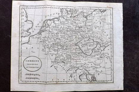
Sold2018FRAMED MAP, GERMANY NORTH OF THE MAYNEFramed map, "Germany, North of the Mayne", drawn and engraved for Thomson's New General Atlas, 1816, London engraved, hand colored highlights, sight approx: 20"h, 24.5"w, overall: 30"h, 34.5"w, 10.5lbSee Sold Price
Sold202118th C Large Handcolored Mercator Map GermanyLarge beautifully handcolored map of Braunswyck and Meydburg after Gerard Mercator circa 1640, this being an 18th century restike.. Printed at Amsterdam. Measures 23 x 19". Fine, reinforced central veSee Sold Price
Sold2017Jamaica British West Indies Antique Map, 1835Map: Jamaica British West Indies Antique Map Size: 15.5"W × 0.1"D × 13.0"H Year: 1835 Please note that this lot has a confidential reserve. When you leave a bid in advance of the auction, submit youSee Sold Price
Sold2022Barclay, James C1800 Hand Col Map. GermanyHand Colored Copper Engraved Map Published C1800 Halifax & Newcastle, England for "Barclay's Universal English Dictionary…" by James Barclay. Maps Engraved by Clerk, Milton and others. Paper Size: 1See Sold Price
Sold2019Barclay, James 1809 Hand Col Map. Germany & BohemiaHand Coloured Copper Engraved Map Published 1809, Leeds for "Barclay's Complete and Universal Dictionary of the English Language..." by the Rev. James Barclay. Folds as issued. Paper Size: 11 x 10 incSee Sold Price
Sold2017The Ionian Greek Islands Map, 1835The Ionian Islands. James Cochrane & Co., Walker, J. & C. James Cochrane & Co. 1835-11-01. "For Montgomery Martin's History of the British colonies Vol.V..." Corfu, Leucadia, Ithaca, Cephalonia, CerigSee Sold Price
Sold2017Norman German Islands Map, 1835Norman Islands. James Cochrane & Co., Walker, J. & C. James Cochrane & Co. 1835-11-01. "For Montgomery Martin's History of the British colonies Vol.V..." The Channel Islands. Inset shows Heligoland, aSee Sold Price
Sold2021Wilkes, John 1805 Hand Col Map. GermanyFinely Hand Colored Copper Engraved Map Published 1796-1828 London for "Encyclopaedia Londinensis, or universal dictionary of arts, sciences and literature" by John Wilkes et al. Paper Size: 10.5 x 8.See Sold Price
Sold2022Barclay, James 1812 Hand Col Map. GermanyHand Colored Copper Engraved Map Published 1812-13 by Brightly & Childs, Bungay for "A Complete and Universal Dictionary of the English Language..." by the Rev. James Barclay. Paper Size: 10.5 x 8 incSee Sold Price
Sold2022Times Atlas 1895 Lot of 7 Maps. GermanyLithograph Map Published 1895, London for "The Times Atlas" Two with Centre fold as published. Paper Size: Up to 21 x 16 inch (53 x 41cm) A couple with centre fold splits. A few other minor faults inSee Sold Price
Sold2021Tallis, John (Pub) 1852 Map. GermanySteel Engraved Map with Original Outline Hand Color Published 1852-56 by John Tallis, London for "The Universal Pronouncing Dictionary" by Thomas Wright. Drawn & Engraved by John Rapkin. Centre fold aSee Sold Price
Sold2021Tallis, John (Pub) 1852 Map. GermanySteel Engraved Map with Original Outline Hand Color Published 1852-56 by John Tallis, London for "The Universal Pronouncing Dictionary" by Thomas Wright. Drawn & Engraved by John Rapkin. Centre fold aSee Sold Price
Sold2021Thomson, John (Pub) 1825 Map. GermanyCopper Engraved Map Published 1825 by John Thomson, Edinburgh for "The Edinburgh School Atlas" by N. R. Hewitt. Maps Engraved by Hewitt. Engraved Vignette in corner. Original Outline Hand Colour. RareSee Sold Price
Sold2023Thomson, John (Pub) 1825 Map. GermanyCopper Engraved Map Published 1825 by John Thomson, Edinburgh for "The Edinburgh School Atlas" by N. R. Hewitt. Maps Engraved by Hewitt. Original Outline Hand Colour. Rare. Paper Size: 10.5 x 8 inch (See Sold Price
Sold2021Guthrie, William 1806 Map. GermanyCopper Engraved Map Published 1806, London for "A New Geographical, Historical and Commercial Grammar..." by William Guthrie. The maps are by John Senex, Thomas Kitchin and others. Folds as issued. PaSee Sold Price
Sold2019Antique Map: Germany (Deutschland)Description: Antique Map: Germany (Deutschland), Holstein, Hanover, Mecklenburg, the Prussian States, Saxony. Antique steel engraved map with original outline hand coloring. Date of printing: 1844. CaSee Sold Price
Sold2021Guthrie, William 1798 Map. GermanyCopper Engraved Map Published 1798, London for "A New Geographical, Historical and Commercial Grammar..." by William Guthrie. The maps are by John Senex, Thomas Kitchin and others. Folds as issued. PaSee Sold Price
7 days LeftLion Heart AutographsMagnificent SP of Carl Schurz, Most Famous German-American of the 19th Century$150
Featured6 days LeftJasper521758 Akerman Map of Germanic States -- Area Belli Germanici Praesentis…$80


![MAP, Germany, Braun & Hogenberg: Mainz & Wurzburg, Germany & Sion, Switzerland. Braun & Hogenberg, Moguntia, Germaniae Metropolis, ad Rheni... [on sheet with] Herbipolis, Comuniter Wirtzburg... [and] Sedunum, Primaria & Metropolitica](https://p1.liveauctioneers.com/6576/279721/147265449_1_x.jpg?height=310&quality=70&version=1677104593)