Sold2021New Voyage and Description Isthmus 1699A New Voyage and Description of the Isthmus of America by Lionel Wafer. 1699 First Edition. Printed for James Knapton, London. MAP ONLY, lacking all other plates. 224 pp. plus 14 pp. plus 2 pp. publisSee Sold Price
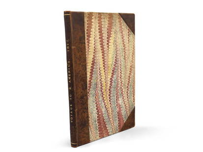
Sold2023Montule: Voyage to North America"A Voyage to North America, and the West Indies in 1817", E. Montule. First edition. London. Printed for Sir Richard Phillips and Co. 1821. 9-1/2in tall x 6in wide. | Philadelphia Metro area delivery,See Sold Price
Sold20191763 Annual Register America Indians Philippines“The Annual Register or a View of the History, Politics, and Literature for the Year 1763. The Seventh Edition.”, printed at London for J. Dodsley, 1796. Content includes the American Indian WarsSee Sold Price
Sold2023Lot of Books about Jewish Experience in AmericaLot of Books about Jewish Experience in America, includes 13 titles, some in Yiddish, all printed and published in America, the earliest an 1827 edition of An Epitome of General Ecclesiastical HistorySee Sold Price
Sold2020Central America Leather Bound Books w MapsIncidence of Travel in Central America, Chiapas and Yucatán by John L Stevens illustrated by numerous engravings in 2 volumes new edition. London Hama John Murray Albemarle Street 1842See Sold Price
Sold20211776 American Revolutionary War By Arthur LeeRevolutionary War, An Appeal to the Justice and Interests of the people of Great Britain in the present dispute with America. 1776, The Fourth Edition, corrected. Printed for J. Almon, London. IncludeSee Sold Price
Sold20201919 Atlas America LatinaTitle/Content of Map: 1919 Atlas America Latina Date Printed: 1919 Material/Medium: Bound Atlas Size: folio, approx. 11x 16 inches Additional Info: 1st Edition. Illustrated with color maps & b/w chartSee Sold Price
Sold2023ANSON. A Voyage round the World, 1748George ANSON. A Voyage round the World ... Second Edition. London:1748. Octavo. 3 folding maps (Toned, no plates, tears to maps, plates). Contemporary calf (extremities worn). Printed in the same yearSee Sold Price
Sold2020Ogilby, John 1939 Lot of 375 Facsimile Road Maps, UK375 Sheets of Maps, printed both sides. Some duplication. Lithographs Published for 1939, London for "Britannia, Volume the First..." Facsimile Edition of the 1675 Edition by John Ogilyby & AlexanderSee Sold Price
Sold2023Larry Rivers (American, 1923-2003) "Map with Fraser" Screenprint on Offset Lithograph CollageLarry Rivers (American, 1923-2003) 'Map with Fraser' Screenprint on Offset Lithograph Collage 1966, unsigned, from an edition of twenty, silkscreen portrait on an offset printed map of London having sSee Sold Price
Sold20221910 "Revolution" by Jack London, 1st EditionNorth America, United States, New York, ca. 1910 CE. BAL 11916; Sisson & Martens, p. 45. One of only 2,130 copies printed! A rare first edition of "Revolution and Other Essays," written by Jack LondonSee Sold Price
Sold20231906 "Moon-Face" by Jack London, 1st EditionNorth America, United States, New York, ca. 1906. BAL 11895; Sisson & Martens, p. 27. 8400 copies printed in the first edition. A first edition of "Moon-Face and Other Stories" written by Jack LondonSee Sold Price
Sold2022Salmon & Jeffreys 1749 Map. South AmericaCopper Engraved Map Published 1749, London for "A New Geographical and Historical Grammar" First or Early Edition by Thomas Salmon. Engraved by Thomas Jeffreys. Folds as issued. Paper Size: 10 x 8 incSee Sold Price
Sold2023Early 4-color map of Rhode Island from very scarce McNally atlasBeautiful, precisely printed early 4-color map of Rhode Island from the 1881 McNally Indexed Atlas of the World, the earliest attainable edition of this atlas. McNally maps from the 1880s were far supSee Sold Price
Sold2019British map prints from the 1880s -SOUTH AMERICA -SOUTHTitle/Content of Map: British map prints from the 1880s -SOUTH AMERICA -SOUTH AMERICA. Date Printed: 1880s Material/Medium: Engraving Size: 22 X 27.5 Provenance: WILLIAM MACKENZIE,LONDON,EDINBURGH & GSee Sold Price
Sold2018Western or Atlantic Ocean Color Map 1740A New Map or Chart of the Western or Atlantic Ocean, with part of Europe, Africa & America. 1740. Printed for E. Cave, London. 15" x 12". We ship all items in this auction in-house with the most fairSee Sold Price
Sold2024CARIBBEAN. West Indies & Central America. Britannica 9th edition 1898 old mapTITLE/CONTENT OF MAP: 'West Indies' DATE PRINTED: 1898 IMAGE SIZE: Approx 18.0 x 24.5cm, 7.25 x 9.75 inches (Medium) TYPE: Antique coloured map CONDITION: Good; suitable for framing. However, please nSee Sold Price
Sold2020Central and South America 1903 Lot of 5 MapsLithograph Maps Published 1903 by Adam & Charles Black, Edinburgh & London for "Encyclopaedia Brittannica" Tenth Edition. Centre fold as published. Paper Size: 16 x 11.5 inch (41 x 29cm) Good ConditioSee Sold Price
Sold2022IRVING, A HISTORY OF THE LIFE AND VOYAGES OF CHRISTOPHER COLUMBUS, 1828WASHINGTON IRVING, A HISTORY OF THE LIFE AND VOYAGES OF CHRISTOPHER COLUMBUS (London: Printed by M. Clowes, 1828), 8vo, 23.3 x 14.5 cm (9 3/16 x 5 11/16 in.), vols. 4 of 4. First edition with a map ofSee Sold Price
Sold2022[Burke]. Account of the European Settlements...[Americas] [Burke, Edmund, attributed]. An Account of the European Settlements in America. R. and J. Dodsley, London, 1758. Second edition. 8vo. [10], 324, [10]; [14], 308 pp, 2 folding maps. ContempoSee Sold Price
Sold20221787 London Guide with Folding MapAmbulator; or the Stranger's Companion in a Tour Round London…, Third Edition, printed at London for J. Bew, 1787. Collates Title xxx, 256, [4]. 12.5 x 12" folding map of London with hand coloriSee Sold Price
Sold2022Encyclo. Britannica C1880 Mix Lot of 6 Antique MapsIncl York, South America, North America, Africa, Norway, and Asia. Lithograph Maps Published 1875-98, Edinburgh & London for "Encyclopaedia Britannica" Ninth Edition. Center fold as issued. Paper SizeSee Sold Price
Sold2017Map of United States of America, Peace of 1783Fielding, John A Map of the United States of America, as Settled by the Peace of 1783 Place Published: London Publisher: European Magazine, Paternoster Row. Date Published: 1783 Edition: 1st Edition BSee Sold Price
Sold2021London.- Railways.- Map of London. The DistrictLondon.- Railways.- Map of London. The District Railway, fifth edition, colour-printed lithograph, 658 x 1062 mm., linen-backed and dissected, some staining and pencil writing / drawing to verso, foldSee Sold Price
6 days LeftJasper521581 BIBLE in LATIN PRINTED in ENGLAND antique 16th century BIBLIA LATINA RARE$1,200
8 hrs LeftJasper52United States of America. California Gold region. THOMAS, COWPERTHWAIT 1852 map$360
8 hrs LeftJasper52LONDON UNDERGROUND tube map plan diagram. 2nd HARRY BECK edition. August 1933$1,400
Featured8 hrs LeftJasper52LSE POVERTY OS PROOF MAP St Johns Wood Maida Vale Lisson Grove Regents Park 1928$850
8 hrs LeftJasper52LONDON UNDERGROUND tube map plan diagram. Lines at 60 degrees HARRY BECK #2 1941$500
8 hrs LeftJasper52LSE POVERTY OS PROOF MAP Swiss Cottage. West/South Hampstead. Belsize Park 1928$800


![[Burke]. Account of the European Settlements...: [Americas] [Burke, Edmund, attributed]. An Account of the European Settlements in America. R. and J. Dodsley, London, 1758. Second edition. 8vo. [10], 324, [10]; [14], 308 pp, 2 folding maps. Contempo](https://p1.liveauctioneers.com/179/268856/140615703_1_x.jpg?height=310&quality=70&version=1668545725)
![1787 London Guide with Folding Map: Ambulator; or the Stranger's Companion in a Tour Round London…, Third Edition, printed at London for J. Bew, 1787. Collates Title xxx, 256, [4]. 12.5 x 12" folding map of London with hand colori](https://p1.liveauctioneers.com/5584/235420/121910842_1_x.jpg?height=310&quality=70&version=1643755752)


