Sold2017Fantastic Dutch 17th C. map of Japan & adjacent islandsA nice Dutch map of Japan and adjacent islands by Joan Jansson, c. 1660. Title: New and Accurate Japan, Land of Ezo and Adjacent Islands, fully hand-colored with 2 Compass Roses, 4 Galleons and a SeaSee Sold Price
Sold2017ASIAN PHOTO ALBUM WITH BLACK LACQUEREDCOVERS, FRONT COVER INCLUDES MAP OF JAPAN & SURROUNDING ISLANDS. NICE SELECTION OF EARLY 1950'S PHOTOS COMPILED BY JEAN BOUCHER ARE CAREFULLY MOUNTED WITHIN THE ALBUM, EACH PAGE CONTAINS ITS ORIGINALSee Sold Price
Sold20181943 US Air Force Silk Escape Map of Northern HonsuTitle/Content of Map: 1943 US Army Air Force Silk Escape Map of Northern Honsu (main island) and Hokkado Islands, Japan -- [Escape Silk Map] Hakodate [verso] Nemuro Date Printed: 1943, Washington DC CSee Sold Price
2017Johnston: Antique Map of China & Japan, 1879Title/Content of Map: 'China and Japan [inset: Islands of Japan]' Date Printed: 1879 Image Size: Approx 47.5 x 61.0cm, 18.75 x 24 inches (Large); Please note that this is a folding map. Type: Large, fSee Sold Price
Sold2017Abstract Japanese Woodcut by Joichi HoshiWoodcut on paper by Joichi Hoshi (Japanese, 1913-1979); with abstract green splotches, resembling islands; hand-signed, dated 1961 and numbered 33/100 in pencil, with seal mark; 18 1/2" xSee Sold Price
Sold2017Bellin: Antique Map of Kouriles Islands (Japan), 1750Map: Kouriles Islands (North of Japan) Date Printed: 1750-60's Cartographer: Jacques Nicolas Bellin Material/Medium: Paper Size: 14 1/2" x 10 3/4" Condition: Good. Some foxing on edges, and one brownSee Sold Price
Sold2023Perry, Matthew C. 1856 Large Map. The Coffin Islands, JapanLarge Folio Lithograph Map Published 1856, Washington for "Narrative of the Expedition of an American Squadron to the China Seas and Japan, performed in the years 1852, 1853, and 1854" by Commodore MaSee Sold Price
Sold2018Baldwin & Cradock/SDUK: Empire of Japan, 1835Empire of Japan The highly detailed Japan map from the SDUK atlas with insets of Nagasaki Harbour and the "Eastern Point of Yeso (Hokkaido island)." Beneath the title are notes identifying Yedo (todaySee Sold Price
Sold2017Janssonius: Antique Map East Asia. Japan & Korea, 1630Title/Content of Map: East Asia. Japan and Korea (as an island), Amsterdam Date Printed: 1630's Cartographer: Janssonius Joannes Material/Medium: Paper Size: 22" x 19" French text on verso. PublishedSee Sold Price
Sold2017Antique Hand Colored Map of JapanA striking map of the island of Japan. Shows provinces, islands, towns, mountains, rivers, islands etc.Sight size: 8.25 x 12 inches.See Sold Price
Sold2024Prevost - Map of China, Korea, Japan, Phlippines and Surrounding IslandsThis fine engraving is from Antoine-Francois Prevost d'Exiles's Histoire G?n?rale des Voyages, ou nouvelle collection de toutes les relations de voyages par mer et par terre, qui ont ?t? publi?es jusqSee Sold Price
Sold2023Perry, Commodore 1856 Large Map. China, Japan & Philippines"Chart of the coast of China and of the Japan Islands including the Marianes and a part of the Philippines" Large Folio Lithograph Map Published 1856, Washington for "Narrative of the Expedition of anSee Sold Price
Sold20231945 Geographical Map Of Japan & KoreaMarked copyright 1945 for The National Geographic Magazine. Depicts the geographical maps of the peninsula of Korea and Islands of Japan. Approximately 26 x 37 inches. Minor discoloration of folds ofSee Sold Price
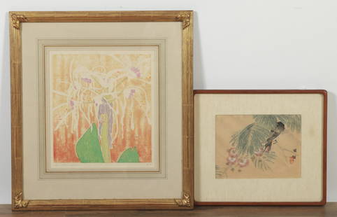
Sold2021Japanese Watercolor & Woodcut PrintJapanese Watercolor & Modern Woodcut Print, "Birds & Flowers", larger signed indistinctly Dimensions: Frame 20" H x 18 1/2" W Property from the Estate of Carter Bales (1938 - 2019), Centre Island, NYSee Sold Price
Sold2017Japanese Tryptich WoodcutApprox. 9 1/2" H x 21 1/2" W 3 panels, 22" H x 39" W framed. From a Long Island, NY estate.See Sold Price
Sold2018Rand-McNally New Library Atlas Map of JapanTitle/Content of Map: Rand-McNally New Library Atlas Map of Japan Date Printed: 1912 Cartographer: RAND-MCNALLY & COMPANY Size: 19X25.8 Page 416-417. Five island insets. Margin frayed, stained. MildewSee Sold Price
Sold2023OTTO ECKMANN (GERMAN, 1865-1902).'Nachtreiher' (Night Herons). 1896. Color woodcut on Japan paper. Monogrammed in the block. From a Long Island, NY collection. Image: 5.375" x 9.75" w. Sheet: 6.75" h x 11.50 w.See Sold Price
Sold2019Isles du Japon & presquIsle de Corée. Japan Korea ChinaTITLE/CONTENT OF MAP: 'Carte des Isles du Japon, & la Presqu Isle de Corée, avec les Côtes de la Chine, depuis Pékin jusquà Canton [Map of the Islands of Japan, and the peninsula of Korea, with thSee Sold Price
Sold2019Isles du Japon & presquIsle de Corée'. Japan KoreaTITLE/CONTENT OF MAP: 'Carte des Isles du Japon et la Presqu Isle de Corée, avec les Costes de la Chine, depuis Pékin jusquà Canton [Map of the Islands of Japan, and the peninsula of Korea, with thSee Sold Price
Sold2016Hand-Colored Engraved 48-Fold Mapof the Islands of Japan The Map of Great Japan, Japanese with English legends, 1893, "Compliments of [The Pacific], the oldest religious newspaper on the western coast, San Francisco, California", 65See Sold Price
Sold2019Japan C1880 Pair of Maps by Nolan & Blackie"The Islands of Japan with Corea..." Steel Engraved Map Published C1880, London for "The Illustrated History of the British Empire in India and the East" by Edward H. Nolan. Centre fold as published.See Sold Price
Sold2023Kawase Hasui (1883-1957) Matsushima Zaimokujima (Zaimoku Island at Matsushima)Kawase Hasui (1883-1957) Matsushima Zaimokujima (Zaimoku Island at Matsushima), woodcut, signed in Japanese Hasui and sealed in red Kawa, titled in Japanese and dated (1933) in the margins, publishedSee Sold Price
Sold20221886AD Antique Chinese Japanese Samurai History 12 Book Set With Japan Korea and Ryukyu Island map1886AD Antique Chinese Japanese Samurai History 12 Book Set With Japan Korea and Ryukyu Island map: Oda Nobunaga Toyotomi Hideyoshi. Original, printed in 1883. Please notes these are antique books, anSee Sold Price
Sold20221883AD Antique Japanese Chinese woodblock printed book SetTitle: 1883AD Antique Japanese Chinese woodblock printed book Set Date/Period: 1883 1883AD Antique Chinese Japanese Samurai History 12 Book Complete Set With Japan Korea and Ryukyu Island map: Oda NobSee Sold Price
1 day LeftTrillium Antique Prints & Rare BooksSanson - Map of the Philippines and Ladrones Islands$75
1 day LeftTrillium Antique Prints & Rare BooksSanson - Map of the Sunda Islands, Sumatra, Java, & Borneo$75
Jun 08Leon GalleryJodocus Hondius 1606 (Jodocus Hondius and Cornelis Claesz) - India Orientalis₱40,000
1 day LeftBasel Auction HouseFramed Toshusai Sharaku Vol 1 Japanese Polychrome woodcut print on paper$50
1 day LeftBasel Auction HouseFramed Toshusai Sharaku Vol 1 Japanese Polychrome woodcut print on paper$50
1 day LeftBasel Auction HouseFramed Toshusai Sharaku Vol 1 Japanese Polychrome woodcut print on paper$50
1 day LeftBasel Auction HouseFramed Toshusai Sharaku Vol 1 Japanese Polychrome woodcut print on paper$50
1 day LeftBasel Auction HouseFramed Toshusai Sharaku Vol 1 Japanese Polychrome woodcut print on paper$50
1 day LeftBasel Auction HouseFramed Toshusai Sharaku Vol 1 Japanese Polychrome woodcut print on paper$50
Jun 01Hargesheimer Kunstauktionen DuesseldorfCARRY HAUSER UND GOERG PHILIPP WOERLEN 'TITELBLATT DER MAPPE€120


![1943 US Air Force Silk Escape Map of Northern Honsu: Title/Content of Map: 1943 US Army Air Force Silk Escape Map of Northern Honsu (main island) and Hokkado Islands, Japan -- [Escape Silk Map] Hakodate [verso] Nemuro Date Printed: 1943, Washington DC C](https://p1.liveauctioneers.com/5584/117342/60336934_1_x.jpg?height=310&quality=70&version=1520389291)
![Johnston: Antique Map of China & Japan, 1879: Title/Content of Map: 'China and Japan [inset: Islands of Japan]' Date Printed: 1879 Image Size: Approx 47.5 x 61.0cm, 18.75 x 24 inches (Large); Please note that this is a folding map. Type: Large, f](https://p1.liveauctioneers.com/5584/108292/55552456_1_x.jpg?height=310&quality=70&version=1503667951)


![Hand-Colored Engraved 48-Fold Map: of the Islands of Japan The Map of Great Japan, Japanese with English legends, 1893, "Compliments of [The Pacific], the oldest religious newspaper on the western coast, San Francisco, California", 65](https://p1.liveauctioneers.com/33/93281/47618628_1_x.jpg?height=310&quality=70&version=1472844838)


