Sold2019Isaak Tirion (1705-1765, Dutch), "Grondvlakte van NieuwIsaak Tirion (1705-1765, Dutch), "Grondvlakte van Nieuw Orleans, de Hoofdstad van Louisiana (Ground Plan of New Orleans, of the Capital of Louisiana)...", Â 1769, hand-colored engraved map, H.- 15 iSee Sold Price
Sold2016Map, Isaak Tirion, Nieuwe Kaart Van EuropaIsaak Tirion (Dutch, 1705-1765), "Nieuwe Kaart Van Europa," hand-colored copper engraving, overall (with frame): 19"h x 21"wSee Sold Price
Sold2017MAP, C. 1750, INDIA & SOUTHEAST ASIA, ISAAK TIRIONFramed map of India an nearby countries, "Nieuwe Kaart van India over de Ganges of van Malakka, Siam, Cambodia, Chiampa, Kochinchina, Laos, Pegu, Ava" c. 1750 by Issak Tirion (Dutch, 1705-1765), handSee Sold Price
Sold2019Two Maps by Isaak Tirion (1705-1765, Amsterdam),Two Maps by Isaak Tirion (1705-1765, Amsterdam), "Nieuwe Kaart Va restelykste Deel Der Weereld..Scheepstogten der Nederlanderen Naar Westindie," 1754, H. - 14 in., W. - 15 in., and H.- 17 in., W.- 20See Sold Price
Sold2019Isaak Tirion (1705-1765, Amsterdam), "Nieuwe Kaart vanIsaak Tirion (1705-1765, Amsterdam), "Nieuwe Kaart van America," 1766, hand colored, H. - 12 in., W. - 13 in.See Sold Price
Sold2019Isaak Tirion (1705-1765), "Kaart van hel WestelykIsaak Tirion (1705-1765), "Kaart van hel Westelyk Gedeelte van Nieuw Mexico en van California," 1765, hand colored, H.- 15 in., W.- 19 in.See Sold Price
Sold2019Attributed to Isaak Tirion (1705-1765), "Kaart Van HetAttributed to Isaak Tirion (1705-1765), "Kaart Van Het Eiland Terre-Nueve, Van Nieuw Schotland/Kanada," c. 1740, engraving on laid paper, H. - 9 in., W. - 13.5 in.See Sold Price
Sold2019Isaak Tirion (1705-1765, Amsterdam), "Nieuwe Kaart vanIsaak Tirion (1705-1765, Amsterdam), "Nieuwe Kaart van Arabia,"18th c., hand colored, H. - 15 in., W. - 18 in.See Sold Price
Sold2019Isaak Tirion (1705-1765, Amsterdam), "Nieuwe Kaart vantIsaak Tirion (1705-1765, Amsterdam), "Nieuwe Kaart vant Eilan Ceilon," hand colored, H. - 16 in., W. - 21 in.See Sold Price
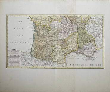
Sold2019Isaak Tirion (1705-1765, Amsterdam), "Nieuwe Kaart vanIsaak Tirion (1705-1765, Amsterdam), "Nieuwe Kaart van het Zuidelykste Gedeltevan Frankryk," 1757, hand colored, H. - 16 7/8 in., W. - 20 7/8 in.See Sold Price
Sold2019Isaak Tirion (1705-1765, Amsterdam), "Nieuwe Kaart vanIsaak Tirion (1705-1765, Amsterdam), "Nieuwe Kaart van Frankryk," hand colored, H. - 17 in., W. -20 1/2 in.See Sold Price
Sold20191766 Beautiful Handcolored Map Cayenne1766 hand colored engraved map and plan “Land-Kaart van het Eiland en de Volkplanting van Cayenne aus de Kust van Zuid-Amerika”, by Isaak Tirion,. Fine, close right margin. Measures 18 x 16”, foSee Sold Price
Sold20191760 Hand Colored Map of Panama TirionFine engraved handcolored map of Panama entitled “Kaart van de Landengte van Panama”, by Isaak Tirion at Amsterdam circa 1760. Measures 17 x 16”. Reserve: $20.00 Shipping: Domestic: Flat-rate ofSee Sold Price
2018Tirion: Antique Map of North Pole & Northern RegionsTitle/Content of Map: North Pole & Northern Regions by Tirion Date Printed: 1735-1740 Cartographer: Isaak Tirion Material/Medium: Paper Size: 13" x 13" Hand colored. Copperplate engraved. Published inSee Sold Price
Sold20221765 Atlas Map of North + South AMERICA, ExpillyHistoric Maps 1765 Atlas Map of North and South AMERICA by Expilly 1765 Copper Engraved Atlas Map of North and South AMERICA titled, "AMERIQUE Septentrionale et Meridionale," from Le Geographe ManuelSee Sold Price
Sold2020Netherlands 1747 Map of Holland, Utrecht"A New & Exact Map of the Provinces of Holland, Utrecht, Gelderland, Zeeland, Dutch Flanders and Dutch Brabant" Copper Engraved Map Published 1732-85, London for "The London Magazine" Folds as issued.See Sold Price
2020Isaak Tirion Print of European MapPrint on paper, framed. Featuring "map of nations". 29 x 37 cm (11.25 x 14.25 in), Frame: 34 x 42 cm (13.25 x 16.5 in). PROVENANCE: This lot carries limited provenance from a Private German collectionSee Sold Price
Sold2019Desnos 1765 Map of the English Channel. UK France"Flle L'Indicateur Fidele du Voyageur Francois du Voyage Francois..." Copper Engraved Map Published 1765, Paris for "Coup d'oeil general sur la France" by Louis Charles Desnos & Louis Brion de la TourSee Sold Price
Sold2019Desnos 1765 Map. Paris to Basle. France Switzerland"Feuille Qui donne les Routes de Champagne, Lorraine, Franche Comte: Partie de la Bourgogne et de l'Alsace" Copper Engraved Map Published 1765, Paris for "Coup d'oeil general sur la France" by Louis CSee Sold Price
Sold2019Desnos 1765 Map. Vienna to Strasbourg, France AustriaAlso showing Germany. "Grande Route de Strasbourg a Wienne en Autriche" Copper Engraved Map Published 1765, Paris for "Coup d'oeil general sur la France" by Louis Charles Desnos & Louis Brion de la ToSee Sold Price
Sold2019Desnos 1765 Map. Paris to Frankfurt. France Germany"Fle L'Indicateur Fidele, Donne la Troisieme Route de Paris a Strasbourg..." Copper Engraved Map Published 1765, Paris for "Coup d'oeil general sur la France" by Louis Charles Desnos & Louis Brion deSee Sold Price
Sold2019Desnos 1765 Map of South France, Marseilles Toulon"L'Indicateur Fidele du Voyageur Francois" Copper Engraved Map Published 1765, Paris for "Coup d'oeil general sur la France" by Louis Charles Desnos & Louis Brion de la Tour. Paper Size: 14 x 11 inchSee Sold Price
Sold2019Desnos 1765 Antique Map of Central France"Feuille Qui donne les Routes et Chemins, tant Royaux que Particuliers, compris entre les deux grandes Routes de Paris" Copper Engraved Map Published 1765, Paris for "Coup d'oeil general sur la FranceSee Sold Price
Sold2019Desnos 1765 Map of Brittany, France. Bretagne"L'Indicateur Fidele qui donne toutes les routes et Chemins de la Bretagne" Copper Engraved Map Published 1765, Paris for "Coup d'oeil general sur la France" by Louis Charles Desnos & Louis Brion de lSee Sold Price
12 hrs LeftJasper52Different seats from biblical times - Dutch edition of the Illustrated Bible, 1690$70
Jun 13Swann Auction Galleries(OVID.) Isaak Verburg, translator. De Gedaant-Wisselingen van P. Ovidius Naso,$750
5 days LeftWorthington Galleries1705 Map LE COMBAT DE STEENKERKE [Battle of Steenkerque] by Nicolas de Fer$10
Jun 13Swann Auction Galleries(MISCELLANEOUS MAPS.) Group of 8 seventeenth-to-nineteenth-century engraved maps.$500
BonhamsKOLBE (PETER) Caput Bonae Spei hodiernum. das ist: vollständige Beschreibung des Afrikanis...£800
Bonhams[BERNARD (FRANCOIS)] Nederlandsch Afrika: of Historisch en Staatkundig Tafereel van den oorspron...£600
BonhamsWEST AFRICA DE WIT (FREDERICK) Tractus Littorales Guineae a Promontorio Verde usque ad Sinum Cat...£10(1 bid)
Jun 13Swann Auction Galleries(DUTCH EAST INDIA COMPANY -- JAVA SEA.) Isaak de Graaf. Manuscript chart of Java, the Java Sea,$80,000
BonhamsBLAEU (WILLEM AND JAN) Toonneel des Aerdrycks oft Nieuwe Atlas...Vierde Deel, Amsterdam, Jan Bla...£8,000
3 days LeftFreeman's | Hindman[MAPS]. HOMANN, Johann Baptist, HOMANN HEIRS, and Georg Matthäus SEUTTER. [Composite Atlas].$15,000
BonhamsBLAEU (WILLEM AND JAN) Toonneel des Aerdrycz, oft Nieuwe Atlas... Tweede Deels, 2 parts in 1 vol...£8,000
Jun 13Swann Auction Galleries(FRANCE and SWITZERLAND.) Johannes Blaeu. Geographiae Blauianae Volumen Septimum, quo Liber XIV, XV$3,000
BonhamsKOLBE (PETER) Naaukeurige en uitvoerige beschryving van de Kaap de Goede Hoop... Waar by nog kom...£400
Jun 13Swann Auction Galleries(CHIROGRAPHY.) Carl Friedrich Egelmann. Deutsche & Englische Vorschriften fur die Jugend.$450


![1705 Map LE COMBAT DE STEENKERKE [Battle of Steenkerque] by Nicolas de Fer (1 of 1)](https://p1.liveauctioneers.com/6084/330420/178181962_1_x.jpg?height=282&quality=70&version=1716391551)


![[BERNARD (FRANCOIS)] Nederlandsch Afrika: of Historisch en Staatkundig Tafereel van den oorspron... (1 of 3)](https://p1.liveauctioneers.com/1043/316318/178467423_1_x.jpg?height=282&quality=70&version=1717430371)

![AFRICA BLAEU (WILLEM) Africae nova descriptio, [c. 1630 or later] (1 of 2)](https://p1.liveauctioneers.com/1043/316318/178467347_1_x.jpg?height=282&quality=70&version=1717430354)


![[MAPS]. HOMANN, Johann Baptist, HOMANN HEIRS, and Georg Matthäus SEUTTER. [Composite Atlas]. (1 of 5)](https://p1.liveauctioneers.com/197/329395/177650530_1_x.jpg?height=282&quality=70&version=1715364962)


