Sold20181756 Map of Minorca's St. Philip and Mahon Harbor -- ATitle/Content of Map: 1756 Map of Minorca's St. Philip and Mahon Harbor -- A Plan of Fort St. Philip and its Environs with the French Encampments, Batteries, etc. Date: 1756, London Cartographer: GentSee Sold Price
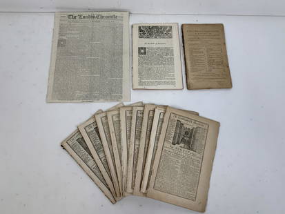
Sold20216 Gentleman's Magazines & The London ChronicleIncludes The Gentleman's Magazine: St. Johns Gate for February 1775, March 1756, July 1756, August 1763, and The London Chronicle or, Universal Evening Post from Tuesday, July 11 to Thursday, July 13,See Sold Price
Sold2021India 1747 Antique Map Plan of Fort St. George & Madras"A Plan of Fort St. George and the City of Madras" Copper Engraved Map Published 1732-85, London for "The London Magazine" Paper Size: 8 x 5 inch (20 x 13cm) Very minor toning. Good ConditionSee Sold Price
Sold2020India 1747 Antique Map Plan of Fort St. George & Madras"A Plan of Fort St. George and the City of Madras" Copper Engraved Map Published 1732-85, London for "The London Magazine" Paper Size: 8 x 5 inch (20 x 13cm) Very minor toning. Good ConditionSee Sold Price
Sold20221756 GENTLEMANS MAGAZINE, w/Caribbee Islands MAPHistoric Maps 1756 French & Indian War Map of the "Caribbee Islands" August 1756-Dated French & Indian War, THE GENTLEMAN'S MAGAZINE with its Map, London, England, Very Fine. Published By Sylvanus UrbSee Sold Price
Sold2024Gentleman's Magazine 1757 Map & View of Fort Fouras, FrancceCopper Plate Published 1750, London for the "Gentleman's Magazine" Folds as issued. Paper Size: 8 x 5 inch (21 x 13cm) Good Condition overallSee Sold Price
Sold20191756 Magazine Colonial America Map of SpainThe January 1756 issue of “Gentleman’s Magazine”, printed at London with content related to America including Pennsylvania disputes, cultivation of American Fir trees, and on American settlementSee Sold Price
Sold2017River St. Laurence, Sillery-Falls of Montmorency MapAn Authentic Plan of the River St. Laurence (Lawrence) from Sillery to the Falls of Montmorency, Gibson, John, Gentleman's Magazine, 1st Edition, 1759, Original black ink engraving with hand-coloring.See Sold Price
Sold2017Bellin/Jefferys: Antique Map of Canada & Islands, 1746Map: A new chart of the coast of New England, Nova Scotia, New France or Canada, with the islands of Newfoundl’d. Cape Breton, St. John’s &c. Publication Date: 1746 Authors: Gentleman’s MagazineSee Sold Price
Sold2022English Plan of the Forts Ontario & OswegoTitle: English Plan of the Forts Ontario & Oswego Date: c1865 Cartographer: GIBSON, J. (after) ? Description: "with parts of the River Onondago and Lake Ontario 1756. From Gentleman's Magazine 1757" SSee Sold Price
Sold2018Gentlemen’s Magazine: Map of Chagres, Panama, 1740An Exact Draught of the Castle of San Lorenzo and the Village & River of Chagre A fascinating chart of the Village and River of Chagre and the castle of San Lorenzo under siege by Admiral Vernon in MaSee Sold Price
Sold2019Frans Ludwig Gussefeld (1744-1808), "Charte von NordFrans Ludwig Gussefeld (1744-1808), "Charte von Nord America Nach Astronomischen Bestimmungen," 1797, hand colored, H.- 20 in., W.- 24 1/2 in.; together with A Gentlemen's Magazine, " Map of the CaribSee Sold Price
Sold202112 18th Century Magazines and NewspapersIncludes The London Chronicle from October 23, 1777, The Columbian Magazine from January 1789, 9 The Gentleman's Magazine: St. John's Gate dated December 1753, August 1755, June 1755 (2), March 1755,See Sold Price
20241782 Magazine Map of St Christophers NevisThe March 1782 issue of "The Europeam Magazine and Literary Review" printed at London for John Fielding. 80 pages and large folding map of St. Christopher's and Nevis, the other two plates not presentSee Sold Price
Sold20171759 Map Seat of War on Rhine1759 Map Seat of War on Rhine 1759 “Map of the Seat of War on the Rhine”, printed for Gentleman’s Magazine, folding map measures 11 x 8”, Fine. Please note that this lot has a confidential resSee Sold Price
Sold2017"Forcing the Passage of the Mississippi River,"Forcing the Passage of the Mississippi River, Bombardment of Forts Jackson and St. Philip, and Destruction of the Rebel Flotilla of Iron-plate vessels, by the National Squadron under Com. Farragut ApSee Sold Price
Sold20231762 Accurate Map British Empire North AmericaAn Accurate Map of the British Empire in North America as Settled by the Preliminarues in 1762, by Gibson for Gentleman's Magazine, 1762. Folding map with inset of the entance to the Mississippi. FineSee Sold Price
Sold2020Aitken Revolutionary War Boston Map 1775Robert Aitken (1735-1808), "A New and Correct Plan of the Town of Boston," London: The Gentleman's Magazine, 1775. This map of Boston depicts the city early in the American Revolution, including the rSee Sold Price
Sold2024Feb. 1777 Issue of The Gentleman's Magazine with Superb Map of PhiladelphiaRevolutionary WarLondon, England, ca. February 1777Feb. 1777 Issue of The Gentleman's Magazine with Superb Map of PhiladelphiaPamphlet/BookletA February 1777 issue of London's "The Gentleman's MaSee Sold Price
Sold2017LOT (6) ASSORTED ENGRAVED MILITARY MAPS INCLUDING FT.LOT (6) ASSORTED ENGRAVED MILITARY MAPS INCLUDING FT. ST. PHILIP AND ENVIRONS, 18TH CENTURY, 14 1/2 X 9"; (3) BATTLE PLANS INCLUDING DEFRIBOURG, 1644; DETURCKEIM, 1674; D'ENSHEIM, 1674; ALL 10 X 15";See Sold Price
Sold20161747 Fine Folding Map of France1747 Map “France with its Acquired Territories in Germany and Netherlands”, by T. Jefferys, engraved for Gentleman’s Magazine, 1747. Folding map in Fine condition, fold along right margin, measuSee Sold Price
Sold20191831 West Point Map by Philip St. George Cockepen and ink topographical map, signed in ink, "Topographical map of West Point - done with pen by Cadet Cocke 1831.", over faint pencil signature "Cocke", on wove paper, image 7-1/4 x 9-1/4 in., overaSee Sold Price
Sold2022Prevost: French Colonial Fort St. Louis, SenegalTitle/Content of Map: Prevost: French Colonial Fort St. Louis, Senegal Date Printed: 1755, Paris Cartographer: Bellin/Prevost d'Exiles Size: 11 7/8" x 8 1/8" The highly detailed plan, with a 34-pointSee Sold Price
Sold20181778 Revolutionary War Magazine & Map of Hudson's RiverThe January 1778 issue of Gentleman’s Magazine featuring a folding map of “Hudson’s River with the Adjacent Country”, showing area from Lake Ontario to Long Island and Philadelphia. ImportantSee Sold Price
4 days LeftHolabird Western Americana CollectionsBonneville's Rocky Mountain Adventure Map 1849 [178900]$350
3 days LeftJasper52WEST AFRICA Explorers' routes Senegal Ashanti. Mountains of Kong. SDUK 1857 map$30
4 days LeftFreeman's | Hindman[MAP]. ORTELIUS, Abraham. Peregrinationis Divi Pauli Typus Corographicus. 1592.$150(1 bid)
Jun 15Crescent City Auction GalleryPair of New Orleans Sanborn Fire Insurance Mock-Up Skeleton Maps of the French Quarter, 1910-1911,$250
Jun 15Matthew Bullock Auctioneers1953 I Love Lucy Philip Morris Cigarettes Holiday Greetings Advertising Cigarette Carton$200
2 days LeftJasper521852 Evans Map of the Badlands -- Map Showing the Position of the Bad Lands or Mauvaises Terres of$60
5 days LeftEarly American History Auctions1853 Map of Portion of British North America and Gulf of St. Lawrence, by Henry Perley$260


![Bonneville's Rocky Mountain Adventure Map 1849 [178900] (1 of 2)](https://p1.liveauctioneers.com/2699/331495/178785771_1_x.jpg?height=282&quality=70&version=1717094933)
![American Biography Book Pair [182220] (1 of 12)](https://p1.liveauctioneers.com/2699/331494/178785556_1_x.jpg?height=282&quality=70&version=1717094654)


![[MAP]. ORTELIUS, Abraham. Peregrinationis Divi Pauli Typus Corographicus. 1592. (1 of 2)](https://p1.liveauctioneers.com/197/329395/177650535_1_x.jpg?height=282&quality=70&version=1715364962)


