Sold2016Framed and matted map of Upper and Lower Canada datedFramed and matted map of Upper and Lower Canada dated 1798, published in 1798 by J. Stockdale. Site-7.25"h.x9.5"w.See Sold Price
Sold2018Framed & Matted Vintage Map Of The BermudasAntique Map Of The Bermudas, this colored map is professionally framed and matter in a black with gold detailed frame with maroon matting, it is measured at 27.5 x 23 inchesSee Sold Price
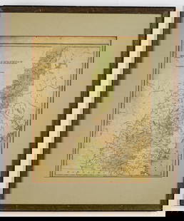
Sold2021VINTAGE GILT FRAMED AND MATTED MAPVINTAGE GILT FRAMED AND MATTED MAP. Height: 27 by Width: 32See Sold Price
Sold2021Antique 18th C Hand Colored Engraving Map AntillesAntique 18th Century Hand Colored Engraving Map of Antilles. Depicting the West Indies. Professionally framed and matted. Map measures 19 inches high x 23 inches wide. Frame measures 25.25 inches highSee Sold Price
Sold2020Framed Map of Ireland etc.Framed and matted map of Ireland by Herman Mull 12" x 11" sight size / 17.5" x 16.5" overall; together with two other mapsSee Sold Price
Sold2024MAP OF LE CERCLE DE LA HAUTE SAXEFramed and matted map Le Cercle de le Cercle de la Haute Saxe dated 1696. 22.25" x 34.5" ss / 29" x 40.5" oaSee Sold Price
Sold2017The USA Map 1829, Engraving by W. Darton, London, UKThe United States of America, 1829 by W. Darton Junior, Holborn Hill. England. Hand colored engraved atlas map. Relief is shown pictorially. Map framed, matted and glazed. Publisher 1829, William DartSee Sold Price
Sold2017Antique Framed 1863 A.J. Johnson Georgia Alabama MapAntique 1863 A.J. Johnson Framed and triple matted map of Georgia and Alabama. Map is in very good condition. Frame measures 32x25.5"See Sold Price
Sold2016Framed and matted Indian Territory map of OKFramed and matted Indian Territory map of Oklahoma. 20" x 17".See Sold Price
Sold2021The United States of America, Including Newly AcquiredThe United States of America, Including Newly Acquired Territory. Boston: The National Publishing Company, 1902. Chromolithographed map, matted and framed 38 1/2 x 57 1/4 inches. Property from a CorpoSee Sold Price
Sold2020Hand Colored Map of St. Georges ChannelFramed and matted hand colored map of St. Georges Channel and the Irish Sea, R.W. Seale 19" x 15" sight size / 25" x 21" overall Condition: some creasing, not examined out of the frameSee Sold Price
Sold2024HAND COLORED MAP OF AMSTERDAMFramed and matted hand colored map of Amsterdam by G. Van Keuian. 20.5" x 23" ss / 28.75" x 34.75" oaSee Sold Price
Sold2024Two Vintage Framed Maps of AmericaTwo vintage 20th century maps, nicely framed and matted, including a map of the United States together with a map of Florida and the Gulf of Mexico. Provenance: Phyllis Lucas Gallery, NYC. [Larger fraSee Sold Price
Sold2023Gold Foil Print of 1651 World Map in FrameGold foiled print reproduction of 1651 "A new and Accurat map of the world" world map. Matted and framed.See Sold Price
Sold2021Rigobert Bonne Maps of Mexico, 18th CenturyA nicely framed and matted pair of maps depicting "Le Nouveau Mexique" and "De L'Ancien Mexique", double matted within frame, each by Rigobert Bonne and engraved by Dien, with original coloring. EachSee Sold Price
Sold2021Large Matted and Framed Map of Norfolk Virginia:Large Matted and Framed Map of Norfolk Virginia: Stylized Blazon Coat of Arms of Howard Duke of Norfolk (Premier Duke of England) Motto is "Virtuecont Alone is Invincible". Labeled JH DINGEE, Banker,See Sold Price
Sold2021Framed and Matted Print of a Map of FranceFramed and Matted Print of a Map of France Measures about 19.5"x16.5"See Sold Price
Sold2020Nantucket Map, c. 1890Two U.S. geological survey topographical chart maps framed and matted together, showing Nantucket Tuckernuck and Muskeget,c.1890, Overall, 35” x 45”See Sold Price
Sold20241875 Map of Harrisburg, PALarge 1875 city map of Harrisburg, PA in 400 feet to 1 inch scale. Map is matted and framed measuring approx 59.25" W x 39.35" H OD. Some loss, creases, and foxing are present on the map.See Sold Price
Sold2019Framed Map of Southern & Northern British IndiaFramed Map of Southern & Northern British India. Professionally matted and framed map depicting southern and northern British India. Frame measures 28.5 inches x 59 inches.See Sold Price
Sold2017GROUP OF 3 MATTED FRAMED 19TH CENT. FRENCH MAPSA grouping of three like matted and framed nineteenth century French maps circa 1890. Ht: 24.25" Wd: 18.25"See Sold Price
Sold2015Chez Pierre Vander, "Nouvelle France," MapChez Pierre Vander, "Nouvelle France," hand colored early map of Canada, matted and framed, 10" h x 15" w (view), 15 1/2" h x 20" w (frame). Provenance: From a Massachusetts estate.See Sold Price
Jun 07Freeman's | Hindman[MAP]. ORTELIUS, Abraham. Peregrinationis Divi Pauli Typus Corographicus. 1592.$150
Jun 07Freeman's | Hindman[MAP]. ORTELIUS, Abraham. Presbiteri Iohannis, sive, Abissinorum Imperii Descriptio. 1592.$200
7 days LeftArarity AuctionsThomson's 1817 Hand Colored Map Comparative Heights of the World's Great Mountains$50
Jun 08Early American History Auctionsc 1730 Hand-Colored Colonial Era Map of the Americas, California shown as an Island, Matted + Framed$500
Jun 07Freeman's | HindmanBELLIN, Jacques-Nicolas. Carte Reduite de L'Ocean Oriental ou Mer Des Indies. Paris, 1757. Second$150
Jun 08Early American History Auctions1836 Hand-Colored Map, Country Twenty Five Miles Round The City Of New-York Published by D.S. Stone$260
7 days LeftArarity AuctionsC. G. Reichard "Charte des Osmanische Reichs in Asien" 1804 Antique Hand Colored Framed Map$50
Jun 08Early American History Auctions1753 Map of the County of Lancaster Divided into its Hundreds, by Royal Mapmaker Emanuel Bowen$280
3 days LeftThomaston Place Auction GalleriesHAND COLORED MAP OF PERU & COUNTRY OF THE AMAZONS, 1747, BY EMANUEL BOWEN, FRAMED$250
Jun 07Freeman's | Hindman[MAPS]. ORTELIUS, Abraham. A group of 3 engraved maps with hand-coloring.$150(1 bid)


![[MAP]. ORTELIUS, Abraham. Aevi Veteris, Typus Geographicus. 1601. (1 of 3)](https://p1.liveauctioneers.com/197/329395/177650532_1_x.jpg?height=282&quality=70&version=1715364962)
![[MAP]. ORTELIUS, Abraham. Turcici Imperii Descriptio.1592. (1 of 2)](https://p1.liveauctioneers.com/197/329395/177650538_1_x.jpg?height=282&quality=70&version=1715364962)
![[MAP]. ORTELIUS, Abraham. Romani Imperii Imago. 1592. (1 of 2)](https://p1.liveauctioneers.com/197/329395/177650537_1_x.jpg?height=282&quality=70&version=1715364962)
![[MAP]. ORTELIUS, Abraham. Peregrinationis Divi Pauli Typus Corographicus. 1592. (1 of 2)](https://p1.liveauctioneers.com/197/329395/177650535_1_x.jpg?height=282&quality=70&version=1715364962)
![[MAP]. ORTELIUS, Abraham. Africae Tabula Nova. 1592. (1 of 2)](https://p1.liveauctioneers.com/197/329395/177650533_1_x.jpg?height=282&quality=70&version=1715364962)
![[MAP]. ORTELIUS, Abraham. Presbiteri Iohannis, sive, Abissinorum Imperii Descriptio. 1592. (1 of 2)](https://p1.liveauctioneers.com/197/329395/177650536_1_x.jpg?height=282&quality=70&version=1715364962)


![[MAPS]. ORTELIUS, Abraham. A group of 3 engraved maps with hand-coloring. (1 of 4)](https://p1.liveauctioneers.com/197/329395/177650539_1_x.jpg?height=282&quality=70&version=1715364962)


