Sold2020Jan Jansson Colored Map of Central & South AmericaJan Jansson (Johannes Janssonius; Dutch, 1588-1664). Framed antique etching print of South and Central America. Titled TERRA FIRMA ET NOVUM REGNUM GRANATENSE ET POPAYAN. Hand colored. Unknown printingSee Sold Price
Sold2018Pair Colored PrintsArabian soldiers. 8" X 6" (10" X 8"). (24 Central Park South, NYC Estate)See Sold Price
Sold2022Antique Map Print - North America - Africa - South America - WorldSet of 4 Map Prints. Hand-colored map print of the edition of 1851 from the work Universal Historical and Geographical Atlas ("Atlas Universel Historique et Geographique"). This iconic map contains diSee Sold Price
Sold2020Jan Jansson Hand Colored Old Map of South AmericaJan Jansson (Johannes Janssonius; Dutch, 1588-1664). Framed antique etching print of South America. Titled AMERICAE PARS MERIDIONALIS. Hand colored. Unknown printing date in two sheets joined in the mSee Sold Price
Sold20172 early maps, Chili & Auriacus Princip, by Ortelius.2 Antique Hand-Colored Map Prints, "Royaume de Chili", a miniature map of Chili, South America ; and "Auriacus Principatus" ( by Ortelius), showing the region around the Roman city of Orange in southeSee Sold Price
Sold2021Aziet Illeg Sig Child South Central AmericaAziet Illeg Sig Child South Central America, possibly Aziet, South or Central American or Mexican Social Realist Modernist School, miniature painting, pastel on colored paper, 5.5 x 4.75 inches, 4.875See Sold Price
Sold2015Map of Brazil. South America. 1835.Print of hand colored steel engraving titled „Bresil“.Author C. V. Monin.Engraved by unknown.From the „Atlas Universel de Geography“ by C. V. Monin. Parsi. 1835.Brazil officially the FederativSee Sold Price
Sold2015Map of South America. 1835.Print of hand colored steel engraving titled „Amerique Meridionale“.Author C. V. Monin.Engraved by unknown.From the „Atlas Universel de Geography“ by C. V. Monin. Parsi. 1835.South America isSee Sold Price
Sold2023Hoffmann, Carl 1868 Hand Col Print. Parrot in Rainforest, South America 12Hand Colored Lithograph Published 1842-80, Stuttgart for "Das Buch der Welt" by Carl Hoffmann. Paper Size: 9.5 x 7 inch (25 x 18cm) Approx. Good Condition overallSee Sold Price
Sold202324 International Photos from Star Tribune Archive24 international related silver gelatin prints and original vintage photographic reproductions from the archives of the Star Tribune from South and Central America as well as Canada depicting: NormanSee Sold Price
Sold2021Thomas Kitchin Map of "South America"Thomas Kitchin (English, 1718-1784). "South America with its Several Divisions". A hand colored and engraved map with vertical central fold. 18" x 22" (sight), 26" x 29" (framed).See Sold Price
Sold2023Carey & Lea - Map of AlabamaThis hand-colored map was part of the atlas titled A Complete Historical, Chronological, and Geographical American Atlas, being A Guide to the History of North and South America, and the West Indies:See Sold Price
Sold2023Carey & Lea - Map of MissouriThis hand-colored map was part of the atlas titled A Complete Historical, Chronological, and Geographical American Atlas, being A Guide to the History of North and South America, and the West Indies:See Sold Price
Sold2023Carey & Lea - Map of IndianaThis hand-colored map was part of the atlas titled A Complete Historical, Chronological, and Geographical American Atlas, being A Guide to the History of North and South America, and the West Indies:See Sold Price
Sold20201861 The Indian Races of North and South America Bookwith colored Illustrations - Nicely boundSee Sold Price
Sold2024Catherwood - General View of Uxmal, Taken from the Archway of Las Monjas, Looking SouthThis rare and resplendent folio lithograph is from Frederick Catherwood Views of Ancient Monuments in Central America, Chiapas and Yucatan 1844. The work was published in London by F. Catherwood in 18See Sold Price
Sold2023Two Prints of BostonComprising "View of the City of Boston the Capital of New England in North America" engraving by Pownal; together with a hand-colored engraving of "The South-East View of the City of Boston in North ASee Sold Price
Sold20226 CENTRAL & SOUTH AMERICA POTTERY VESSELS6 CENTRAL & SOUTH AMERICA POTTERY VESSELSSee Sold Price
Sold2021MAP, Central South America, BlaeuCentral South America, Paraguay. Johannes Blaeu, Paraquaria Vulgo Paraguay. Cum Adjacentibus, 1690 (circa). Hand Color. Centered on the course of the Rio De La Plata, this map explores parts of ParaguSee Sold Price
Sold2021MAP, Central South America, GerritszCentral South America, Paraguay. Hessel Gerritsz & Joannes de Laet, Paraguay, o Prov. de Rio de la Plata: met de Aenpalende Landen van Tucuman, ende Sta. Cruz de la Sierra, from Nieuwe Wereldt ofte BeSee Sold Price
Sold2024Vintage Car License Plate Group Lot Chimborazo Central South America Espana Latin AmericaVintage Automobile License Plate Collection Grouping Lot Lot Central South America Espana Latin America 12" x 6" Aruba Bahamas Chimborazo Costa Rica Dominicana Dominican Republic Honduras La Reina NicSee Sold Price
Sold2023KEYSTONE MAGIC LANTERN SLIDES INCLUDING (18) JAPAN, CHNA & INDIA; PLUS (29) CENTRAL & SOUTH AMERICAMostly Keystone, labels give locations.See Sold Price
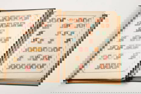
Sold2023EARLY POSTAGE STAMPS of CENTRAL & SOUTH AMERICA(2) Albums include some of the earliest examples from: Argentina, Brazil, Chili, Colombia, Antigua, Ecuador, Haiti, Honduras, Mexico. Nicaragua, Panama, Paraguay, Peru, Salvador,See Sold Price
Sold2018Collection of Books: Central & South AmericaCollection of 18 books pertaining to the countries in Central & South America, including: Olmec: Colossal Masterworks of Ancient Mexico edited by Kathleen Berrin and Virginia M. Fields; The Maya: TreaSee Sold Price
2 days LeftJasper52South America. Commercial/Industrial Development. Agricultural products 1925 map$8
2 days LeftJasper52CENTRAL AMERICA.Honduras Panama Guatemala Belize Costa Rica El Salvador 1910 map$8
2 days LeftJasper52Central America. Mexico Chiapa, Tabasco & Yucatan. Belize &c. SWANSTON 1860 map$60