Sold20221680 deWit Map of Asia -- Accuratissima Totius AsiaeTitle: 1680 deWit Map of Asia -- Accuratissima Totius Asiae Tabula Recens Emendata Cartographer: F de Wit Year / Place: 1680 c. Amsterdam Map Dimension (in.): 19.3 X 22.9 in. This is a lovely large maSee Sold Price
Sold2017De Wit Map of AfricaTotius Africa Accuratissima Tabula. Frederick de Wit (1629/1630-1706). Engraved map with original hand color. Amsterdam, c. 1660. 19 1/4 x 23 inches visible, 24 3/4 x 28 1/2 inches framedSee Sold Price
Sold2020De Wit Map of Africa ca. 1685Frederick de Wit (ca. 1630 – 1706), "Totius Africae Accuratissima Tabula," Amsterdam, ca. 1685. Hand colored map of Africa. African animals are included throughout the continent, and the decoraSee Sold Price
Sold2020WIT, FREDERICK de. Novissima et Accuratissima TotiusWIT, FREDERICK de. Novissima et Accuratissima Totius Americae Descriptio. Double-page engraved map of the Americas showing California as an island. 20x23½ inches sheet size, ample margins; originSee Sold Price
Sold2015Tabula Indiae Orientalis byFrederick de Wit Amsterdam, 1662, de Wit's attractive hand-colored map of Southeast Asia, engraved by Joannas Lhulier, this map served as a prototype for Speed's map of the East Indies, cartouche withSee Sold Price
Sold2017de Wit: Map of Southeast Asia, 1670Map: Tabula Indiae Orientalis Cartographer: Frederick De Wit Place & Date: Amsterdam / 1670 Size: 22 1/4" x 18 1/4" Condition: light overall age-toning A highly decorative and beautifully colored lateSee Sold Price
Sold2016An important map of Asia, c1680 by Frederick De WitAn important map of Asia, c1680 by Frederick De Wit depicting the area of Asia, including China, Japan, Tibet, India, Russia, Persia, Arab and more (center folding area repair), 19.5"x23"See Sold Price
Sold2022MAP- Frederick De. Wit:MAP- Frederick De. Wit: MAP- Frederick De. Wit: NOVISSIMA PRAE CETERISALIIS ACCURATISSIMA REGNORUM ANGLIAE SCOTIAE HIBERNIAE. Ca. 1690, hand coloured and laid down (560x490mm)See Sold Price
Sold2022De Wit - Nova Orbis Tabula In Lucem Edita, MapFrederick De Wit (circa 1629-1706), Nova Orbis Tabula In Lucem Edita, A.F. De Wit, published by Covens and Mortier, Amsterdam, circa 1720, in two sheets, engraving on laid paper, double hemisphere vieSee Sold Price
Sold2022De Wit, Map of North and South America, c. 1720Property of a Private Collector, Hilton Head Island, SC Description: Frederick De Wit (circa 1629-1706), Nova Orbis Tabula In Lucem Edita, A.F. De Wit, Amsterdam: Covens and Mortier, c. 1720, publSee Sold Price
Sold2019AN ANTIQUE MAP, "Accuratissima Angliæ Regni et WalliæAN ANTIQUE MAP, "Accuratissima Angliæ Regni et Walliæ Principatus," AMSTERDAM, CIRCA 1680, hand colored engraving on paper, published by Frederick de Wit (1630-1706), showing most of the British IslSee Sold Price
Sold2016County of Flanders. Frederick De Wit.Comitatus Flandriae Tabula In Lucem Maker: De Wit, Frederick. Origin: Amsterdam, 1680. Medium: Original copper engraving with early hand-coloring. Sheet size: 20 1/4 x 24 3/4 in. No Reserve: This lotSee Sold Price
Sold2023De Wit Map of Zeeland, HollandDE WIT, Frederick (c. 1630-1706). Comitatus Zelandiae tabula... Engraved map with original hand color. Amsterdam, c. 1680. 21 1/2" x 24 3/8" sheet, approx. Antique Map of Zeeland, Netherlands showingSee Sold Price
Sold20191662 deWit Map of Southeast Asia -- Tabula IndiaeReserve Reduced! Title/Content of Map: 1662 deWit Map of Southeast Asia -- Tabula Indiae Orientalis Date: 1662, Amsterdam Cartographer: F de Witt Size: 18 X 22.2 in. This is a outstanding larger map oSee Sold Price
Sold2019Delamarche, Felix 1829 Lot of 3 Maps. Asia Minor etc"Tableau de la Retraite des dix Mille" "Alexandri Magni Imperium" and "Asiae Minoris Tabula" Copper Engraved Maps Published 1829, Paris for "Atlas de La Geographie..." by Felix Delamarche. ContemporarSee Sold Price
Sold2019Delamarche, Felix 1829 Pair of Maps Turkey & Asia Minor"Asiae Minoris Tabula" and "Turquie d'Europe" Copper Engraved Maps Published 1829, Paris for "Atlas de La Geographie..." by Felix Delamarche. Contemporary outline hand colour. Centre fold as publishedSee Sold Price
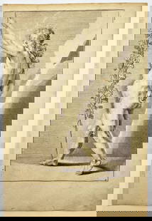
Sold2023Antique Engraving - Frederick de Wit - Female Form - Drawing of Woman FigureTitle/Artist: Antique Engraving - Frederick de Wit - Female Form - Drawing of Woman Figure Medium: Antique engraving originates from "Lumen Picturae: A Classical Drawing Manual" by Frederick de Wit. TSee Sold Price
Sold201717th C Frederick De Wit Handcolored Engraving ChristLarge engraving, hand colored of Frederick De Wit (1629/30-1706), engraver most noted for his maps. This engraving of the Passion of Christ. Signed in type at bottom of engraving and listed place of pSee Sold Price
Sold2024EARLY 18TH C. DUTCH CHART OF PACIFIC OCEAN BY FREDERIK DE WIT (1629-1706) WITH CALIFORNIA AS AN"Magnuum Mare del Zur, cum Insula California, De Groote Zuyd-Zee en't Eylandt California; Gedruck't Amsterdam by Frederick De Wit ince Calver Street". Handcolored copper engraving. Engraver: Romeyn deSee Sold Price
Sold2018Allard Engraved Map of Iberian PeninsulaCorona Portugalliae cum ei affinibus Regnis Hispanicis...Carel Allard (1648-c. 1709). Engraved map with fine original hand color in full. Amsterdam: Frederick De Wit, c. 1705. In 4 parts, 21 1/8 x 24See Sold Price
Sold2015Magnum Mare del Zur cum InsulaCalifornia by Frederick de Wit (1630-1706), Amsterdam, 1675, copper-engraved mariner's chart, hand-colored in outline, showing California as an island, Tooley #40, with a colorful pictorial cartoucheSee Sold Price
Sold2022MAP, Middle East, WitMiddle East. Frederick de Wit, Nova Persiae Armeniae Natoliae et Arabiae, 1680 (circa). Hand Color. This splendid map of the Middle East covers the region from Turkey and Egypt to Afghanistan with theSee Sold Price
Sold2022MAP, South America, WitNorthwestern South America & Central America. Frederick de Wit, Novae Hispaniae, Chili, Peruviae, et Guatimalae Littorae, from Orbis Maritimus ofte Zee Atlas, 1680 (circa). Hand Color. This handsome sSee Sold Price
BonhamsAFRICA DE WIT (FREDERICK) Totius Africae Accuratissima Tabula,Amsterdam, Frederick de Wit, [c.16...£10
BonhamsEAST AFRICA DE WIT (FREDERICK) Occidentalior Tractus Indiarum Orientalium a Promontorio Bonae Sp...£300
BonhamsWEST AFRICA DE WIT (FREDERICK) Tractus Littorales Guineae a Promontorio Verde usque ad Sinum Cat...£10
5 days LeftAustin Auction Gallery(2) JOHN DE WIT (20TH C.) ORIENT & FLUME ART GLASS SPIRAL PAPERWEIGHT VASES$150
6 days LeftFreeman's | Hindman[MAP]. TODESCHI, Pietro. [Nova et Acurata Totius Americae Tabula auct. G.I. Blaeu] America quarta$5,000
2 days LeftSchilb Antiquarian Rare Books1698 Blaise PASCAL Provincial Letters Witchcraft Sorcery JESUIT Philosophy RARE$125(3 bids)
Jun 11BonhamsSTATUETTE D'AKSHOBHYA EN LAITON AVEC INCRUSTATION DE CUIVRE TIBET CENTRAL, VERS XIIIE SIÈ...€48,000
BonhamsTHAILAND AND EAST ASIA TACHARD (GUY) Reis Na Siam, Amsterdam, A.D. Oossaan, 1687; and 11 others ...£500
BonhamsIACOVLEFF (ALEXANDRE) Dessins et peintures d'Asie. Exécutés au cours de l'Expedition C...£800
4 days LeftJasper521755 MAP of RUSSIAN EMPRIRE & INNER ASIA CHINESE TARTARY antique 20 x 27 in.$100(1 bid)
4 days LeftJasper521752 Robert de Vaugondy Map of Middle East and Ancient Empires -- Antiquor Imperiorum Tabula, in qua$140
Jun 30Global Auctions CompanyFrederick M Perl Germany California 1890 - 1963 Oil Painting Abstract 1956$250


![[MAP] FREDERICK DE WIT (DUTCH, 1630-1706): Totius Flumenis Rheni Novissima](https://p1.liveauctioneers.com/3820/102962/52635922_1_x.jpg?height=310&quality=70&version=1492789342)


![[MAP]. TODESCHI, Pietro. [Nova et Acurata Totius Americae Tabula auct. G.I. Blaeu] America quarta (1 of 1)](https://p1.liveauctioneers.com/197/329395/177650542_1_x.jpg?height=282&quality=70&version=1715364962)


