Sold201718th Century French Map of North AmericaL’Amerique Septentrionale. Daniel de la Feuille (1640-1709). Engraved map with hand color in full. Amsterdam, 1702 or 1706. 6 x 8 inches visible, 13 x 14 1/2 inches framed. Nicely colored early 18thSee Sold Price
Sold2020Group of French Maps Guillaume de l'Isle SansonGroup of four 17th and 18th century French maps. Guillaume Delisle (1675-1726) hand colored engraved map of Picardie, 1748. Two maps by Nicolas Sanson (1600-1677), "Le Roayaume de France" and "GouvernSee Sold Price
Sold2022Rare 18th C Copper engraved Topographical Map of Taiwan, "L'Ile de Formosa, ou sont Exactement MarquGeographic location: Asia Title: "L'Ile de Formosa, ou sont Exactement Marquez les Bancs de Sables (..)" Cartographer / Publisher: Pieter van der Aa Date: 1719 Technique: Copper engraving Dimensions:See Sold Price
Sold20231765 ATLAS MAPS & Voyages Pluche Geography Asia Arabia Greece America Egypt1765 ATLAS MAPS & Voyages Pluche Geography Asia Arabia Greece America Egypt Noël-Antoine Pluche was an early 18th-century French priest and historian who is most remembered today for his landmark wSee Sold Price
Sold20181785 ATLAS MAPS & Voyages Travel Geography Asia Arabia1785 ATLAS MAPS & Voyages Travel Geography Asia Arabia BEAUTIFUL Noël-Antoine Pluche was an early 18th-century French priest and historian who is most remembered today for his landmark work of naturaSee Sold Price
Sold20191818 Grosier CHINA Geography MAPS Changchun Fo-kien1818 Grosier CHINA Geography MAPS Changchun Fo-kien Chinese Asia Vietnam Tartary Jean-Baptiste Grosier was an 18th-century French literary scholar known for his work ‘General Description of China’See Sold Price
Sold202218th & 19th C. MAPS OF ASIA (3 MAPS)Includes: 2 maps by John Tallis & Co. London / New York, ca. 1850, both matted and framed, including: (1) MAP OF ASIA. Hand colored engraved map. 5 hand colored vignettes. H. 10.25", W. 12.75"; (2) MASee Sold Price
Sold20221782 ATLAS MAPS Expilly Geography Voyages Travel World America Asia Africa1782 ATLAS MAPS Expilly Geography Voyages Travel World America Asia Africa Jean-Joseph Expilly was an 18th-century French geography and historian who published numerous works on cosmography, history oSee Sold Price
Sold20221777 ATLAS MAPS Expilly Geography Voyages Travel World America Asia Africa1777 ATLAS MAPS Expilly Geography Voyages Travel World America Asia Africa Jean-Joseph Expilly was an 18th-century French geography and historian who published numerous works on cosmography, history oSee Sold Price
Sold20231761 ATLAS MAPS Expilly Geography Voyages Travel World America Asia Africa1761 ATLAS MAPS Expilly Geography Voyages Travel World America Asia Africa Jean-Joseph Expilly was an 18th-century French geography and historian who published numerous works on cosmography, history oSee Sold Price
Sold20181768 Geography ATLAS MAPS California Island Asia China1768 Geography ATLAS MAPS California Island Asia China 17 MAPS A rare 18th-century geographical treatise by Jean Baptiste Gibrat. This work features 17 impressive folding, engraved maps. Little is knoSee Sold Price
Sold2018Framed 18th C. French Map of Ancient Rome**First Time At Auction** Louis Brion de la Tour (French, 1743-1810) & Louis Charles Desnos (French, 1725-1805), "Suite De L'Histoire De Rome", ca. 1760 to 1770. Copperplate engraved with original hanSee Sold Price
Sold20181828 ATLAS MAPS Ancient & Modern Geography Asia Africa1828 ATLAS MAPS Ancient & Modern Geography Asia Africa Turkey Greece Delamarche Felix Delamarche was a well-known and important French cartographer from the 18th-century. His best and most widely usedSee Sold Price
Sold2023Brion Map of East AsiaLouis Brion de la Tour, French, 1743-1803. An 18th century engraved map with hand-coloring, titled "Chine, et Indes avec les Isles". Signed "par M. Brion" and dated "1766" in the plate lower left. MinSee Sold Price
Sold202118th C. French Map "Le Noveau Mexique …"Ribobert Bonne (French, 1727-1794). "Le Nouveau Mexique, Avec La Partie Septentrionale De L'Ancien, ou De La Nouvelle Espagne" Published in Paris, 1780. Among the most collected late 18th century mapsSee Sold Price
Sold2017Two 18th century engraved maps with hand coloringHind, Hindoostan, or India. Louis de la Rochette. Engraved map with hand color in part. London: W. Faden, c. 1790-1811. 31 x 23 inches framed. AND Africae in Tabula Geographica Delineatio. Adam FriedrSee Sold Price
Sold202118TH CENTURY FRENCH MAP OF SOUTHEASTERN USRigobert Bonne (French, 1727-1794). "Carte De la Partie Sud Des Etats Unis De L'Amerique Septentrionale" -circa 1780, engraving. Provenance: From the Lifetime Collection of Billy S. Arant, Jr., ChattaSee Sold Price
Sold2019.18th Century French Map of Cuba, Florida and Louisiana21 1/4 x 16 3/4 in. (framed).18th Century French Map of Cuba, Florida and LouisianaGulf of Mexico antique map Golfe du Mexique Zannoni 1762Title: Carte Geo-Hydrographique du Golfe du Mexique et de sesSee Sold Price
Sold202118TH CENTURY FRENCH MAP OF THE WORLDDimensions: Frame: H 14.5" x W 19.35" Sight: H 9.25" x W 13.75" Condition: Discolored old watercolor, some toning to mat.See Sold Price
Sold2020Collection of 18thC Engraved MapsCollection of approximately 200+ 18th century engraved maps on laid paper, with Latin descriptions, each 8 3/4" x 11 1/8" (sheet).See Sold Price
Sold201718th C. French Map w/ Oiled Paper, ex-Sotheby'sEurope, France, map from 1709 CE, oiled paper overlays from 1756 to 1763 CE, owned by Louis-Alexandre Berthier (1753 to 1815 CE), Marshal, Vice-Constable of France, and Chief of Staff (Major general)See Sold Price
Sold202118th C Engraved Map Spain Portugal by Eman BowenNicely detailed map having some hand tinting at borders. Good overall condition with only slight yellowing to paper. Framed nicely. H16" W19" (without mat and frame)See Sold Price
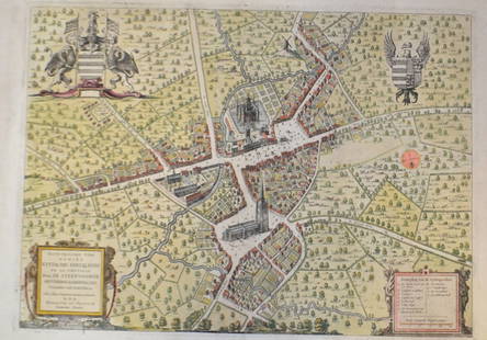
Sold201518th C French Map Of SteenvoordePLOUICH, Vedastus du -" Illvstrissimo viro domino" .The city of Steenvoorde is a small town located north of France. The city of Steenvoorde is located in the department of Nord of the french region.See Sold Price
Jun 15Riverfront Auctions'1785 Bocage Map of the City of Athens in Ancient Greece' Par M. Barbié du Bocage$5(1 bid)
5 days LeftNY Elizabeth ANTIQUE MAP-ILLUSTRATED FLORAL ILLUSTRATION 1761 NEW DICTIONARY OF TRADE AND COMMERCE R. ROTH$50
3 days LeftJasper521770 French engraving map of Bonne,Rigobert Arabie. Mer Rouge et Golfe Persique$95
5 days LeftNY Elizabeth M. HANSIZ'S 1729 GERMANIA SACRA BLINDSTAMPED PIGSKIN ANTIQUE FOLIO WITH MAP$50
5 days LeftNY Elizabeth M. HANSIZ'S 1727 GERMANIA SACRA BLINDSTAMPED PIGSKIN ANTIQUE FOLIO WITH MAP$50(1 bid)
5 days LeftNY Elizabeth ANTIQUE GEOMORPHOLOGY: 1782 POMPONII MELA DE SITU ORBIS ARMORIAL VELLUM BINDING$50
3 days LeftJasper521719 Chatelain Map of Russian Empire -- Carte Generale des Etats du Czar Empereur de Moscovie…$320
3 days LeftA.H. Wilkens Auctions & AppraisalsFRENCH GILT METAL SNUFF BOX WITH STONE INSERTCA$200(1 bid)
Jun 14DuMouchellesRigobert Bonne (French, 1727-1794) Hand Colored Engraving Ca. 18th Century, Les Etats Unis De$50
5 days LeftNY Elizabeth 1704 AN ANTIQUE DETAIL OF EVERY SEAT IN THE CURRENT WARS OF EUROPE W/MAPS$50(1 bid)