Sold2017Hawaiian Islands Map, George Cram, 1905Hawaiian Islands. George Cram. 1895. Map showing placenames, roads, elevations of mtns. points, bays, etc. Inset: Harbor of Honolulu Island of Oahu. Please note that this lot has a confidential reservSee Sold Price
Sold2021Ruth Taylor White Hawaii Pictorial Maps (4)Island of Hawaii. Maui. Oahu. Kauai. Set of 4 Cartographs. Printed by The Paradise of the Pacific for the Hawaii Tourist Bureau, Honolulu. C. 1935. Ex library..See Sold Price
Sold20191938 U.S. Geological Survey Map of Oahu Hawaii"Geologic and Topographic Map of the Island of Hawaii. Showing well, springs, tunnels, shafts, proposed Kalihi-Waiahole tunnel, specimen localities and structure sections". Inset map of Honolulu, explSee Sold Price
Sold2024Waikiki Beach PosterWaikiki Beach is a famous and iconic stretch of shoreline located in the neighborhood of Waikiki in Honolulu, on the island of Oahu, Hawaii. Here are key aspects of Waikiki Beach:1. **Location:** WaikSee Sold Price
Sold2023Honolulu, Hawaii Travel PosterHonolulu is the capital and largest city of the state of Hawaii in the United States. Located on the island of Oahu, Honolulu is known for its stunning natural beauty, vibrant culture, and world-classSee Sold Price
Sold2017Hawaiian Islands Map, George Cram, 1906Hawaiian Islands. George Cram. Cram's Unrivaled Family Atlas of the World Indexed. 1906. 14.5 x 12 inches. Inset showing Harbor of Honolulu Please note that this lot has a confidential reserve. When ySee Sold Price
Sold2024Antique Hawaiian Islands Government Survey Maps (Set of 6)Lot of 6 antique Hawaiian governmental survey maps (Hawaii, Lanai, Kaho'olawe, Maui, Moloka'I, Oahu, and the full island chain), signed by W.A.Wall. Framed w/ glass and single matted. (14"H 11.5"W 1"DSee Sold Price
Sold2022Three Antique Hawaiian Maps, US Government3 1920s Hawaiian Maps. Island Of Oahu Map Approximately 47.1875 x 36.5 in. Hawaiian Islands Approximately 45.875 x 35.125 in. Hawaii To Oahu Approximately 46.4375 x 35.5625 in.See Sold Price
Sold2022Jose Vives-Atsara "Landscape", oil on canvas.Jose Vives-Atsara, Landscape, oil on canvas. Oil on canvas. Signed lower right, "Vives Atsara". Titled on reverse: "Hawaiian Landscape - Oahu Island, Hawaii". Canvas: 24"H x 30"W; Frame: 33"H x 39"W.See Sold Price
Sold20211865 Hawaiian Islands Pacific Islands Kamehameha1865 Hawaiian Islands Pacific Islands Kamehameha Portraits EARLY HAWAII MAP Rufus Anderson’s “The Hawaiian Islands” is a 19th-century account of the Pacific islands covering the origin of the isSee Sold Price
Sold2021Vintage View-master with 6 Reel in Original Box.Vintage Sawyer's View-master with 6 Reel in Original Box. Sawyers View-Master - Portland, Oregon. Reels Inc: Island of Maui #67. Island of Kauai #72. Island of Hawaii #66. Island of Oahu #64. HawaiianSee Sold Price
Sold2023Mabel Alvarez - Still Life With Pears - LithographMabel Alvarez U.S.A. B: 1891 D: 1985. Entitled - Still Life With Pears, Lithograph.Alvarez was born to a prominent Spanish family who lived on the island of Oahu in Hawaii. Her father, Luis Alvarez waSee Sold Price
Sold2017White: Vintage Pictorial Map of Oahu, 1930Map: 1930 White Map of Oahu -- The Island of Oahu Cartographer: R White Year / Place: 1930 Map Dimensions: 11.3 x 14.6 in. Condition: Very Good. Nice colored impression. Very little toning. A very attSee Sold Price
Sold2021Boating maps, royal island harbor, egg islands, currentMaps from 1981 tropic Isle publishers, Inc By Harry Kline, Royal island harbor, egg Islands, current island Anchorage. Size 11“ x 17“See Sold Price
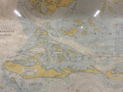
Sold2024Vintage Framed Pine Island & Lacoste Island MapVintage full color paper map, marked on top Pine island, Charlotte harbor and Lacosta island. Showing waterways and directions. Framed in a wooden frame. Approx 14 x 18 inches window measures 11.5 x 1See Sold Price
Sold2016Map of Hawaii and New Zealand by Colton, 1855Map features: Hawaiian Group or Sandwich Islands. New Zealand. Viti Group or Feejee Islands. Society Islands. Marquesas or Washington Is. Galapagos Islands. Samoan or Navigators Island. This map is frSee Sold Price
Sold2021Seikichi Takara American Hawaii Artist AbstractO/C, SLR, dated, 18 x 45", Seikichi Takara, a self-taught artist born and raised an the island of Oahu is a second generation American of Okinawan ancestry. Takara has been recognized InternationallySee Sold Price
Sold2018Oahu Hawaiian IslandsTitle/Content of Map: Oahu Hawaiian Islands Date: 1902 Cartographer: WALL, WALTER/JOHN M. DONN Size: 27 X 33 "Compiled, from all available data in the office and also from private surveys, by John M.See Sold Price
Sold20211881 Kalani of Oahu HAWAII Polynesia CANNIBALISM Island1881 Kalani of Oahu HAWAII Polynesia CANNIBALISM Island Mythology Newell Novel “Kalani of Oahu” is a fictionalized history of Hawaii at the time of contact with the West. Newell combines HawaiianSee Sold Price
Sold2018Hawaii Travel Poster.Hawaii Travel Poster. Hawaii Visitors Bureau, 1960s. Color photo-offset posters advertising travel to the four main island of Oahu. 28 ½ x 21". Minor marginal restoration. A/A-.See Sold Price
Sold2015M. Dumont D’Urville. Map of Hawaii Islands. 1834.Print of steel engraving titled „Carte des Iles Hawaii“.Author Jules Sébastien César Dumont d'Urville.Engraved by Ambroise Tardieu.From „Voyage pittoresque Autour du Monde, resume general desSee Sold Price
Sold2017Mitchell: Antique Map of Palestine, 18481861 Johnson’s China. Lovely map of China with original hand coloring. Features two insets: Harbor & Island of Amoy, and Map of Canton and Adjacent Islands. Very clean with good impression. From theSee Sold Price
Sold20191855 Colton Map of Hawaii, New Zealand, Oceania IslandsTitle/Content of Map: 1855 Colton Map of Hawaii, New Zealand, Oceania Islands -- Hawaii or Sandwitch Islands [with] Samoan.. [with] New Zealand [with] Viti Group or Feejee Islands [with] Societi IslanSee Sold Price
Sold2021Boating Maps, Long Island, Long Island north end, eastMaps from 1981 tropic Isle publishers, Inc. by Harry Klein, Long Island, Long Island Northwynn, East Coast harbors. Size, 11” x17”See Sold Price
2 days LeftJasper52Orient. Western Pacific Islands. Fiji Tonga Melanesia Micronesia. TIMES 1958 map$30
Featured19 hrs LeftJasper521740. Map of Isle de Juan Fernandes ''Robinson Crusoe Island'', Chile. George Anson$130
24 hrs LeftJasper521760 MAP CARTE PARTICULIERE DE L'ISLE DE JUAN FERNANDES antique Robinson Crusoe$55
Featured1 day LeftJasper521764 Bellin Map of Lesser Antilles Northern Portion -- Petites Antilles ou Isles du Vent 3e. Partie.$130
5 days LeftTrillium Antique Prints & Rare BooksWilkes - 4 Engravings of Trees & Mountains in Nu?uanu Pali, Hawaii / Upolu, Samoa / New South Wales,$100
2 days LeftKotler Galleries & AuctioneersPAUL BERNARD KING OIL PAINTING -MONHEGAN ISLAND HARBOR - Paul Bernard King - American, 1867-1947$14,000
24 hrs LeftJasper521822 MAP of LEEWARD ISLANDS GEOGRAPHICAL STATISTICAL HISTORICAL antique 17.5x22"$120


![1855 Colton Map of Hawaii, New Zealand, Oceania Islands: Title/Content of Map: 1855 Colton Map of Hawaii, New Zealand, Oceania Islands -- Hawaii or Sandwitch Islands [with] Samoan.. [with] New Zealand [with] Viti Group or Feejee Islands [with] Societi Islan](https://p1.liveauctioneers.com/5584/157856/79675033_1_x.jpg?height=310&quality=70&version=1577197209)


![[BOOKS] AMERICAN SOUTH. LOT OF 5 VOLUMES (1 of 3)](https://p1.liveauctioneers.com/8124/329803/177770645_1_x.jpg?height=282&quality=70&version=1715634941)