Sold20223 Framed Vermont MapsA group of 3 framed Vermont maps including a reproduction 1796 Sotzmann 24" x 32" frame, Stowe Vermont from Beers Atlas 1878 19" x 23", and reproduction of Stowe Vermont map blown up, 25" x 32"See Sold Price
Sold2023THREE ANTIQUE MAPS OF VERMONT, LOW, SCOTT AND WHITE.A George White map of VT, Overall 18.5” x 14.5”; Joesph Scott 1796 Map of VT from Atlas of US, Overall 11.5” x 10”; J. Low 1799 Map of VT, Overall 17” x 13”.See Sold Price
Sold2017Map of the States of New Hampshire & VermontCirca 1796 Antique Map Title: "Map of the States of New Hampshire and Vermont". Citation: by J. Denison. Amos Doolittle, Sculp. Approximate size: 10-3/8" x 8-3/8". Please note that this lot has a confSee Sold Price
Sold2017William Faden 1796 Map Eastern US, North AmericaFaden, William (BRITISH, 1749-1836); Map of the Eastern United States, North American with British Territories and Those of Spain according to the Treaty of 1784 (from a larger atlas), 1796; handcolorSee Sold Price
Sold2024A general chart of the West India Islands… DELAROCHETTE/FADEN Caribbean 1796 mapTitle: A general chart of the West India Islands… DELAROCHETTE/FADEN Caribbean 1796 map Description: A general chart of the West India Islands with the adjacent coasts of the Spanish continent by L.See Sold Price
Sold20211796 MAP OF NORTH & SOUTH CAROLINA, DENISON, FRAMEJ. Denison (American, 18th century). "Map of North and South Carolina" -1796, from "Morse's Universal Geography", engraving. Framed. Provenance: From the Lifetime Collection of Billy S. Arant, Jr., ChSee Sold Price
Sold2024Carey, pub. 1796 - Map of the State of MarylandThis fine map engraving is from one of the ealiest American atlases published in the states: Mathew Carey's General Atlas. The work was published in Philadelphia by Carey in 1796. It was an importantSee Sold Price
Sold2024Carey, pub. 1796 - Map of the Tennassee State formerly part of North Carolina (Tennessee)This fine map engraving is from one of the ealiest American atlases published in the states: Mathew Carey's General Atlas. The work was published in Philadelphia by Carey in 1796. It was an importantSee Sold Price
Sold20191796 MAP OF THE BRITISH ISLESItalian map. Caleographia Camerale. Engraving. Dimensions: (Frame) H 22.25"x W 16.75", (Sight) H 21.25" x W 15.75" Condition: Some creases to paper.See Sold Price
Sold2021Wilkes, John 1796 Map. North AmericaCopper Engraved Map Published 1796-1828 London for "Encyclopaedia Londinensis, or universal dictionary of arts, sciences and literature" by John Wilkes et al. Paper Size: 10.5 x 8.5 inch (27 x 22cm) ISee Sold Price
Sold20161796 Map Africa PropriaANTIQUE MAP “AFRICA PROPRIA” CARTGAHE LIBYA, TRIPOLI, MALTA, BY CELLARIUS 1796. From: Geographia Antiqua London. Very Good, measures 15 x 10”, central fold. No Reserve Free shipping for this iteSee Sold Price
Sold2021Wilkes, John 1796 Map. Modern AfricaCopper Engraved Map Published 1796-1828 London for "Encyclopaedia Londinensis, or universal dictionary of arts, sciences and literature" by John Wilkes et al. Paper Size: 10.5 x 8.5 inch (27 x 22cm) GSee Sold Price
Sold2021Wilkes, John 1796 Map. South AmericaCopper Engraved Map Published 1796-1828 London for "Encyclopaedia Londinensis, or universal dictionary of arts, sciences and literature" by John Wilkes et al. Paper Size: 10.5 x 8.5 inch (27 x 22cm) GSee Sold Price
Sold20181796 State of Rhode Island Hand Colored MapNew York,Dated 1796 Map of the State of Rhode Island as updated by the latest surveys,1796, hand colored on laid paper, engraved for the American edition of Winterbothams America, published by John ReSee Sold Price
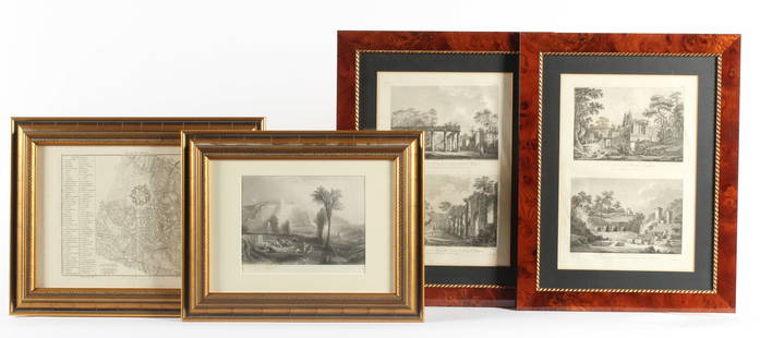
Sold2023Four Antique European EngravingsDescription: Each professionally framed, to include a 1796 map of Milan by J. J. De La Lande, a 19th century steel engraving after J.M.W. Turner of Ehrenbreitstein, and two plates depicting scenes ofSee Sold Price
Sold2020Vermont 1897Title/Content of Map: Vermont 1897 Date Printed: 1897 Material/Medium: Paper Size: approx 22x14.5 inches Additional Info: Cram's Universal Atlas Reserve: $30.00 Shipping: Domestic: Flat-rate of $15.00See Sold Price
Sold2018Colton: Antique Map of Vermont, 1859Title/Content of Map: Vermont by Colton Date Printed: 1859 Cartographer: H.J. Colton Material/Medium: Paper Size: 17 1/2" x 15" Hand colored,engraved. Published in New York in 'Colton's General Atlas.See Sold Price
Sold2017Bradford: Antique Map of Vermont, 1838Title/Content of Map: Vermont by Bradford Date Printed: 1838/1841 Cartographer: Thomas G. Bradford Material/Medium: Paper Size: 13" x 15" A General Atlas of the World with a seperate Map of each of thSee Sold Price
Sold20221796 Reid Map of Connecticut -- Connecticut from the Best AuthoritiesTitle: 1796 Reid Map of Connecticut -- Connecticut from the Best Authorities Cartographer: J Reid Year/Place: 1796 Dimensions: 13.9 X 17.1 in. Description: This is an excellent, early and uncommon mapSee Sold Price
Sold2022Fine Colton map of Vermont by ColtonScarce Colton’s Vermont map in impressive, clean condition with no faults. From the only known example of Colton’s 1890 General Atlas (Rumsey notes 1888 as the last edition). Highly detaSee Sold Price
Sold2016Map of Vermont & New Hampshire, 1868Original engraving from Johnson's Atlas of the World, 1868. Map details cities, towns and territories. Dimensions: 18" x 26". No Reserve This item ships from Ocean View, DE.See Sold Price
Sold2022Excellent antique map of Vermont from scarce Gray’s Nat’l AtlasJ. H. Colton 1855 map of Vermont, republished in the very scarce 1884 edition of Gray’s National Atlas. The ornamental border was dropped when it was republished. Shows railroads, post offices,See Sold Price
Sold2016EARLY MAP OF VERMONT BY JOHN REID"FROM THE LATEST AUTHORITIES"; PUBLISHED BY JOHN REID; NEW YORK (FOXING AT RIGHT ON CREASE); 17 1/4" X 14" SIGHTSee Sold Price
Sold20221864 Map of Vermont, New Hampshire, Massachusetts,Rhode Island and Connecticut 26" x 18" Please see photos and come to the 2 day preview for condition.See Sold Price
4 days LeftJasper521874 Holmes Plan of New York's Upper East Side -- Map of the Common Lands from 76th to 93rd Street$750
4 days LeftCedarburg Auction & Appraisals LLCSet of Four Maps Showing All of Spain and Portugal$375(2 bids)
5 days LeftCottone AuctionsEmile A. Gruppe (American, 1896-1978) "Bend in the River, Vermont"$1,000(1 bid)
Jun 02Carlsen Gallery, Inc.2 CARTE DE VISTES - 1 CIVIL WAR AMPUTEES & VERMONT CAVALRY SOLDIER WITH SABER$200(4 bids)
Jun 07Freeman's | Hindman[MAP]. TODESCHI, Pietro. [Nova et Acurata Totius Americae Tabula auct. G.I. Blaeu] America quarta$5,000
4 days LeftCedarburg Auction & Appraisals LLCRare 1877 Double sided map of Milwaukee and Wisconsin$80(6 bids)
Jun 04Freeman's | HindmanAldro Thompson Hibbard (American, 1886–1972) - Vermont Snowscape$1,500
2 days LeftArarity AuctionsThomson's 1817 Hand Colored Map Comparative Heights of the World's Great Mountains$50
Jun 02South Jersey Auction by Babington Auction IncVermont Furn slatted arts & crafts queen size bed$100
Jun 02South Jersey Auction by Babington Auction IncVermont Furn Design solid cherry low chest$100(1 bid)


![[Woman traveller - French Revolution] (1 of 1)](https://p1.liveauctioneers.com/94/330664/178342176_1_x.jpg?height=282&quality=70&version=1716466933)


![[MAP]. TODESCHI, Pietro. [Nova et Acurata Totius Americae Tabula auct. G.I. Blaeu] America quarta (1 of 1)](https://p1.liveauctioneers.com/197/329395/177650542_1_x.jpg?height=282&quality=70&version=1715364962)


