Sold2024Hendrick Hondius Map Of GothiaAmstelodami Sumptibus Henrici Hondy, map of Gothia in Southern SwedenSee Sold Price
Sold2017Hand-Colored copper engraved Maps(lot of 3) "Imperium Caroli Magni," hand colored copper engraved map depicting Charlemagne’s empire, published by Sumptibus Henrici Hondy, Amsterdam, text verso, overall (with frame): 18.75"h x 23.7See Sold Price
Sold2018Old map of Venezuela, Janssonius, Amstelodami, circaAntique map of Venezuela, Novae Andalusiae Janssonius, Amstelodami, circa 1650, map shows Venezuela with the Caribbean and Windward Islands, Aruba, Curacao, Bonaire, Los Roques, Isla la Orchila, IslaSee Sold Price
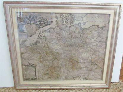
Sold20231769 ANTIQUE MAP of EUROPE framed EUROPEAN POSTAL ROADS & STATIONS1769 ANTIQUE MAP: MAPPA GEOGRAPHICA EXHIBENS POSTAS omnes tam vehiculares quam verdarias Totius Germaniae cum earum accurata distantia Diligentissime propriis sumptibus excudit. Aug. Vindelicor. : TobSee Sold Price
Sold2023Antique Map Print - Europe - Map of Poland and Silesia - Pieter van de KeereTitle: Antique Map Print - Europe - Map of Poland and Silesia - Pieter van de Keere Date: 1632 Material: Paper Dimensions: 30 cm x 24 cm Description: Gerard Mercator. Polonia et Silesia (Poland and SiSee Sold Price
Sold2017America Septentrio Nalis 1639, ReproductionMap: America Septentrio Nalis 1639, Reproduction – amstelodami excudit ioannes ianbonius 21 x 23 Rare vintage reproduction of an antique map entitled “America Septentrio Nalis” Year: 1639 reprodSee Sold Price
Sold20231632 EUROPE DESCRIPTION by MERCURII GALLOBEGICI antique VELLUM BOUND w/ MAPMERCURII GALLOBEGICI sive, rerum in Gallia et Belgio potissimum; Hispania quoqve Italia, Anglia, Germania, Ungaria, Bohemia... Frankfurt; 1632 Illustrated with one plate and the map of Western EuropeSee Sold Price
Sold2017Ortelius: Antique Map of the World, 1587Map: World Date Printed: 1587-1612 Cartographer: Abraham Ortelius Material/Medium: Paper Size: *** Approx 16" x 21" Original hand color. Copperplate engraved.One of the most famous and iconic world maSee Sold Price
Sold2017Levasseur: Antique Map of North America, 1840Title/Content of Map: 1840 Levasseur Map of North America - Amerique Septrentionale Date Printed: 1840 Paris Cartographer: V. Levasseur Size: 11 x 16.5 in. Condition: Excellent. Minor age toning; issuSee Sold Price
Sold2021Four Antique MapsFour antique maps. Including a very early hand made paper map of Florida and Virginia. Fragment of old newspaper on back dated 1630. Unframed, each approx H 21" W 24". All in excellent condition, minoSee Sold Price
Sold2023TWO ANTIQUE MAPS OF CHINA.Two antique maps of China, including Chinae by Abraham Ortelius, 1595, image 14.25” x 18.25”, with map of Eastern Asia, Le table de la region orientale, image 10” x 13.5”.See Sold Price
Sold2017Jaillot: Antique Map of North America, 1696Map: 1696 Jaillot Map of North America (California as an Island) -- Amerique Septentrionale Divisee en ses Principales Parties Date Printed: 1696 Amsterdam Cartographer: H. Jaillot Size: 19.3 x 23 in.See Sold Price
Sold2018Homann: Antique Map of New England, 1720The map names New England as "Almouchi Cosen" as well as Nova Anglia, while present-day New York State is named variously as New Jork, Nieuw Nederland and Novum Belgium (New York, New Netherlands andSee Sold Price
Sold2024Matthaus Merian 1627 Antique Map Engraving "Virginia" from Theodore de Bry's "Grand Voyages" #1Antique 1627 map of Virginia by Matthaus Merian after John Smith's 1612 map, from Theodore de Bry's "Grand Voyages". Please see "The Philidelphia Print Shop" sheet shown in final photo. Good conditionSee Sold Price
Sold2017Forlani: Antique Map, Town View of Venice, 1569Title: Venetia, Splendid 1569 Lafreri-school town view of Venice Map maker: Paolo Forlani, De’ disegni delle più illustri città et fortezze del mondo Place and Year: Venice, 1569 Dimensions: 19.2See Sold Price
Sold2024John Speed 1676 Original Antique Map of Virginia and Maryland No ColorAntique 1676 map of Virginia and Maryland engraved by Francis Lamb and republished by Thomas Basset & Richard Chriswell after John Speed's 1611 atlas. With "The Description of Mary-Land" text on reverSee Sold Price
Sold2024Antique map of Virginia - Florida by Blaeu W. 1642-43Virginia and Florida. "Virginiae partis australis, et Floridae partis orientalis, interjacentiumque regionum nova descriptio". Orig. copperplate engraving, W. J. Blaeu, published by C. and J. Blaeu inSee Sold Price
Sold2017Hondius: Antique Map of the Western Hemisphere, 1631Title: America noviter delineata. Hondius 1631 western hemisphere with polar inserts Map maker: Henricus Hondius Place and Year: Amsterdam, 1631 Dimensions: 37.7 x 49.8 cm (14¾ x 19½ in) Technique:See Sold Price
Sold2018Blaeu: Antique Map of Europe, 1650Title/Content of Map: Highly decorative Map by Blaeu Date Printed: c1650 Cartographer: W. Blaeu Material/Medium: Paper Size: 19" x 24" Hand colored engraved Map. French text on Verso. Magnificent examSee Sold Price
2017Hondius: Antique Map of the World, 1630Map: Terravm Orbis Maker: H. Hondius Date Printed: 1630 Material/Medium: Ink on paper Size: 33 x 24 in Nova Totivs Please note that this lot has a confidential reserve. When you leave a bid in advanceSee Sold Price
Sold2017Hondius: Antique Map of Virginia & the Carolinas, 1606Map: 1606 Hondius Map of Virginia and the Carolinas - Virginiae item ed Floridae Americae provinciarum, nova descripto Cartographer: J Hondius Year / Place: 1606 c., Amsterdam Map Dimensions: 13.5 X 1See Sold Price
Sold2017ANTIQUE MAP OF AFRICA, GERHARD MERCATOR JR.17TH CFramed engraved hand colored map, after 1600, by Gerhard Mercator Jr (his grandfather was Gerhard Mercator, Flemish, 1512-1594), "Africa Ex magna orbis terre descriptione Gerardi Mercatoris desumpta,See Sold Price
Sold2018Blaeu: Antique Map of Anglo Saxon Britain, 1645Title/Content of Map: Map of Anglo Saxon Britian Date Printed: 1645 Cartographer: W. Blaeu Material/Medium: Paper Size: 19" x 23" Anglo Saxon Britian. Hand colored copperplate engraved. Latin text onSee Sold Price
Sold2018Ottens: Antique Map of the Caribbean / West Indies 1730Title/Content of Map: 1730 Ottens Map of the Caribbean / West Indies -- Insula Americana nempe Cuba, Hispaniola, Jamaica, Pto Rico, Lucania,Antillae vulgo Caribe barlo et Soto vento etc. Date Printed:See Sold Price
5 days LeftJasper521719 Anakrisis Apocalypsios Joannis Apostoli VELLUM antique Apocalypse VITRINGA$260
1 day LeftAlbion AuctionsCooke, George 1801 Antique Map. Pacific Ocean - Australia etc (Fault)$5(1 bid)