Sold2019Partie Occidentale du Canada Great Lakes Midwest.Reserve Reduced! TITLE/CONTENT OF MAP: 'Partie Occidentale du Canada et Septentrionale de la Louisiane avec une Partie de la Pensilvanie par le Sr. d'Anville de l'Academie Rle. des Inscriptions et BelSee Sold Price
Sold2017Bonne: Map of the Great Lakes, 1880Map: 1880 Bonne Map of the Great Lakes -- Partie Occidentale du Canada, contenant les cinq Grands Lacs, avec les Pays Circonvoisins Cartographer: R. Bonne Year / Place: 1780 Paris Map Dimensions: 8.3See Sold Price
Sold20181780 Bonne Map of the Great Lakes -- Partie OccidentaleTitle/Content of Map: 1780 Bonne Map of the Great Lakes -- Partie Occidentale du Canada Contenant les Cinq Grands Lacs, avec les Pays Circonvoisins Date Printed: 1780, Paris Cartographer: R. Bonne SizSee Sold Price
Sold2017d'Anville / Santini: Antique Map of Great Lakes, 1775Map: Partie Occidentale du Canada et Septentrionale de la Louisiane Cartographer: d'Anville / Santini Place & Date: Venice / 1775 Size: 22 1/4" x 19" Condition: outline color; light overall age toningSee Sold Price
Sold2016Influential map of Great Lakes region 1755Heading: Author: Bellin, Jacques Nicolas Title: Partie Occidentale de la Nouvelle France ou du Canada Place Published: Nuremberg Publisher:Homann Heirs Date Published: 1755 DescriptionSee Sold Price
Sold2019Two Maps by Jacques Nicolas Bellin (1703-1772), "PartieTwo Maps by Jacques Nicolas Bellin (1703-1772), "Partie Occidental de la Nouvelle France du Canada (Great Lakes)," 1755; together with "Carte de la Louisiana et Pays Voisins," 1757, both hand colored,See Sold Price
Sold20211783 Delisle/Dezauche Map of Great Lakes and Canada --Title: 1783 Delisle/Dezauche Map of Great Lakes and Canada -- Carte du Canada qui Comprend la Partie Septentrionale des Etars Unis d'Amerique… Cartographer: Delisle/Dezauche Year/Place: 1783, PaSee Sold Price
Sold2016Map of Canada Framed Vintage 40s Print After 1720Map of Canada Framed Vintage 40-s Print After 1720 Guillaume De L'Isle Carte Du Canada Qui Comprend la Partie Septentrionale Des Etats Unis D'Amerique Canada and Great Lakes Map Approximately 21 5/8"See Sold Price
Sold2023Cartes des Lac du Canada'. The Great Lakes of North America. BELLIN 1757 mapDescriptionCAPTION PRINTED BELOW PICTURE: Cartes des Lac du Canada [Map of the Great Lakes of North America]DATE PRINTED: 1757IMAGE SIZE: Approx 20.5 x 30.0cm, 8 x 11.75 inches (Medium); Please note tSee Sold Price
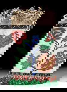
Sold2023Early Winnebago / Ojibwe Beaded Leather PouchNative American / First Nations, Northern United States / Canada, Great Lakes Region & Midwest, Winnebago / Ojibwe, ca. early 20th century CE. A hide bag with beadwork across both sides, the front panSee Sold Price
Sold20241920s Native American Chippewa Beaded Leather Bag**Originally Listed At $300** First Nations / Native American, Midwestern United States / Canada, Great Lakes Region & Midwest, Chippewa / Ojibwe, ca. 1920s to 1930s CE. A fringed hide drawstring bagSee Sold Price
Sold2017Bellin: Antique Map of the Great Lakes, 1755Map: 1755 Bellin Map of Great Lakes -- Partie Occidentale de la Nouvelle France… Cartographer: J N Bellin, Homann issue Year / Place: 1755, Nurnberg Map Dimensions: 24 x 19 in. Condition: Very goodSee Sold Price
20181719 Chatelain Map of Eastern Canada and Great LakesTitle/Content of Map: 1719 Chatelain Map of Eastern Canada and Great Lakes Region -- Carte du Canada ou de la Nouvelle France & Des Decouvertes qui y ont ete Faites, Dresse sur les observations les plSee Sold Price
Sold20191719 Chatelain Map of Eastern Canada and Great LakesTitle/Content of Map: 1719 Chatelain Map of Eastern Canada and Great Lakes Region -- Carte du Canada ou de la Nouvelle France & Des Decouvertes qui y ont ete Faites, Dresse sur les observations les plSee Sold Price
Sold2023 [MAPS - GREAT LAKES REGION]. VAUGONDY, Gilles Robert de (16...[MAPS - GREAT LAKES REGION]. VAUGONDY, Gilles Robert de (1688-1766). Les Lacs du Canada et Nouvelle Angleterre… Paris, 1749. Engraved map (229 x 318 mm) with hand-colored outlining, appearing toSee Sold Price
Sold2022(CANADA.) Guillaume de L'Isle. Carte du Canada ou de la Nouvelle France.(CANADA.) Guillaume de L'Isle. Carte du Canada ou de la Nouvelle France. Double-page engraved map of eastern Canada and the Great Lakes region with a fine figural title cartouche in the blank northwesSee Sold Price
Sold20211754 Bellin Map of the Great Lakes Region -- Carte desTitle: 1754 Bellin Map of the Great Lakes Region -- Carte des Lacs du Canada pour Servir a l'Histoire Generale des Voyages Cartographer: J Bellin Year/Place: 1754 c., Paris Map Dimensions (in.): 7.7 XSee Sold Price
Sold20191754 Bellin Map of the Great Lakes Region -- Carte desTitle: 1754 Bellin Map of the Great Lakes Region -- Carte des Lacs du Canada pour Servir a l'Histoire Generale des Voyages Date: 1754 c., Paris Medium: JBellin Size: 7.7 X 11.4 in. Additional InformatSee Sold Price
2022Jacques-Nicolas Bellin (1703-1772), After - Map of Great Lakes 1770Carte des Lacs du Canada Engraved map from the Dutch edition of Bellin's Histoire General des Voyages. Original hand-coloring; fairly foxed, most with an early ink annotation at lower margin. AmsterdaSee Sold Price
Sold2024Sanson - Map of Canada or New France with the Great LakesThis strong map engraving is from the Dutch edition of Nicolas d'Abbeville Sanson's Cartes Generales de Toutes les Parties du Monde. The work was published in Utrecht in 1683 for the author. The atlasSee Sold Price
Sold2021[GREAT LAKES REGION]. ROBERT DE VAUGONDY, Didier[GREAT LAKES REGION]. ROBERT DE VAUGONDY, Didier (1723–1786). Partie De l’Amerique Septent? qui comprend La Nouvelle France ou Le Canada. Paris, 1755. Hand–colored engraved map of eaSee Sold Price
Sold2016Carte des Etats-Unis d'Amerique, du Canada, 1832Map: Carte des Etats-Unis d'Amerique, du Canada, du Nouveau Brunswick et d'une Partie de la Nouvelle Bretagne Cartographer: Pierre M. Lapie Publishing: Paris, 1832 Size: 16 x 20 inches Matted A greatSee Sold Price
Sold2021Early map of the Great Lakes, Midwest region. By Bonne/Title: Early map of the Great Lakes, Midwest region. By Bonne/ Raynal. 1780 Date/Period: 1780 Materials: Copperplate engraved Size: 13 1/2 x 9 3/4 An important and detailed early map of the Great LakeSee Sold Price
Sold2023Thirty Great Lakes Midwest Railroad Public and Employee Timetables - 1912 to 1966 - Nickel PlateA group of thirty Great Lakes and Midwest area railroad timetables, public and employee, spanning 1912 to 1966. Twelve public timetables are from Nickel Plate Road and include dates 1922, 1924, 1925,See Sold Price
Jun 13Swann Auction Galleries(GREAT LAKES/CANADA.) Gilles and Didier Robert de Vaugondy. Partie de l'Amerique Septent qui$450
Jun 14DuMouchellesRigobert Bonne (French, 1727-1794) Hand Colored Engraving Ca. 18th Century, Les Etats Unis De$50(1 bid)
3 days LeftEarly American History Auctions1776 Map, PARTIE ORIENTALE DU CANADA, AVEC LA NOUVELLE ANGLETERRE, L'ACADIE... by P. Santini, Framed$950
19 hrs LeftJasper52NORTH AFRICA. Barbary. Morocco Tunisia Libya Egypt. 'Barbarie'. MALLET 1683 map$20
19 hrs LeftJasper52Partie Occidentale de l’Afrique. West Africa coast Canary islands BONNE 1788 map$15(1 bid)
19 hrs LeftJasper52Partie Occidentale de l'Ancien Continent… W Africa Macaronesia. BONNE 1780 map$30
BonhamsSPEED (JOHN) AND WILLEM BLAEU Pictorial title-pages to Speed's 'Theatre of the Empire of Great B...£10
Jun 13Swann Auction Galleries(AMERICAS.) John Senex. A New Map of America From the latest Observations.$450
3 days LeftTony Putty Artifacts25 1/2" Northern Great Lakes Indian Ball Club with Spike. Pictured. Ex Joe Kinker.$155(2 bids)
5 days LeftTigerlily Arts & Antiques CoReplica of the Great Lake Freighter, Edmund Fitzgerald in Plexiglass Case$550
Jun 30JM Hobby Supply and Railroad Artifact Auctions23 Souvenir Du Canada and Super Wheels Die Cast Vehicles$10


![Cartes des Lac du Canada'. The Great Lakes of North America. BELLIN 1757 map: DescriptionCAPTION PRINTED BELOW PICTURE: Cartes des Lac du Canada [Map of the Great Lakes of North America]DATE PRINTED: 1757IMAGE SIZE: Approx 20.5 x 30.0cm, 8 x 11.75 inches (Medium); Please note t](https://p1.liveauctioneers.com/5584/311630/167410814_1_x.jpg?height=310&quality=70&version=1701439692)


![[MAPS - GREAT LAKES REGION]. VAUGONDY, Gilles Robert de (16...: [MAPS - GREAT LAKES REGION]. VAUGONDY, Gilles Robert de (1688-1766). Les Lacs du Canada et Nouvelle Angleterre… Paris, 1749. Engraved map (229 x 318 mm) with hand-colored outlining, appearing to](https://p1.liveauctioneers.com/928/301544/160920958_1_x.jpg?height=310&quality=70&version=1694462960)


![[GREAT LAKES REGION]. ROBERT DE VAUGONDY, Didier: [GREAT LAKES REGION]. ROBERT DE VAUGONDY, Didier (1723–1786). Partie De l’Amerique Septent? qui comprend La Nouvelle France ou Le Canada. Paris, 1755. Hand–colored engraved map of ea](https://p1.liveauctioneers.com/928/212515/108628837_1_x.jpg?height=310&quality=70&version=1627420959)


![Early French Map of Great Lakes [179300] (1 of 1)](https://p1.liveauctioneers.com/2699/331495/178785744_1_x.jpg?height=282&quality=70&version=1717094933)


![French Map of America Southeast [179304] (1 of 1)](https://p1.liveauctioneers.com/2699/331495/178785746_1_x.jpg?height=282&quality=70&version=1717094933)


