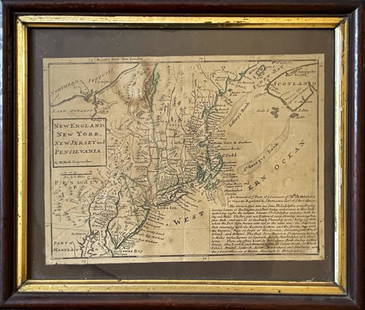
Blaeu map of New England and New Yourk 1635
Similar Sale History
Recommended Items


Item Details
Description
Author: Blaeu, Willem
Title: Nova Belgica et Anglia Nova
Place Published: Amsterdam
Publisher:
Date Published: 1635
Description:
Copper-engraved map, hand-colored in outline, with colored vignettes & cartouche. 38.7x50.3 cm. (15¼x19¾").
New England, New York, portions of Virginia, etc., with small animal vignettes (including a turkey), several Indian lodges, sailing ships, canoes, etc. Burden states that "This important map was one of the most attractive maps of the Americas at the time. It is noted for the fact that its primary source is the first manuscript map of Adrian Block, 1614. Indeed it is the first full representation of it in print. It is one of the earliest to name Nieu Amsterdam..." Schwartz & Ehrenberg describe this as "one of the earliest large-scale maps to including the part of North America settled by Dutch. First printed map that depicted canoes and North American fauna. Lake Champlain (Lacus Irocoisiensis) shown incorrectly, as in other maps of the period..." German text on verso. Burden 241; Schwartz & Ehrenberg Plate 58.
Condition
Buyer's Premium
- 23%
Blaeu map of New England and New Yourk 1635
Shipping & Pickup Options
Item located in San Francisco, CA, usPayment


![[MAP OF BERMUDA] BLAEU, WILLEM (c. 1630): Mappa Aestivarum Insularum, alias Barmudas..., engraved bi-fold map with hand-coloring, showing the coasts of Florida, Viginia, Cape Cod, and New England, based on Speed's map, with latin text on vers](https://p1.liveauctioneers.com/522/152734/77123885_1_x.jpg?height=310&quality=70&version=1571345617)


![1853 Boynton Map of Boston [verso] Map of New England: Title: 1853 Boynton Map of Boston [verso] Map of New England -- New Map of Boston, Comprising the Whole City, with the New Boundaries of the Wards… [verso] Map of New England Exhibiting the Rail Roa](https://p1.liveauctioneers.com/5584/190355/95871630_1_x.jpg?height=310&quality=70&version=1609884614)


![A highly detailed map of New England after the Jansson-Visscher series: [MAP-NORTH AMERICA] [MONTANUS, ARNOLDUS]. Novi Belgii Quod nune Novi Jorck vocatur, Novae Angliae & Partis](https://p1.liveauctioneers.com/292/326828/175962858_1_x.jpg?height=310&quality=70&version=1713473479)
![Jansson's important early map of New England: [MAP-NORTH AMERICA] JANSSON, JAN. Nova Belgica et Anglia Nova. Amsterdam: circa 1646. Latin text on verso. Neat lines 15 1/4 x 19 3/4 inches (38.7 x 50.5 cm). Marginal tears r](https://p1.liveauctioneers.com/292/326828/175962856_1_x.jpg?height=310&quality=70&version=1713473479)


![Three maps of the United States: [MAPS - AMERICA] A Group of three maps of the United States, including [SHAFFNER TALIAFERRO PRESTON, ] United States. [London,1862]. Hand-colored lithographed folding map from The War in Am](https://p1.liveauctioneers.com/292/326828/175962868_1_x.jpg?height=310&quality=70&version=1713473479)


![1900 US Census Cherry and Grape Producing Regions -- 1. Cherries Principal Regions of Production: Title: 1900 US Census Cherry and Grape Producing Regions -- 1. Cherries Principal Regions of Production 1900 [on sheet with] 2. Grapes Principal Regions of Production 1900 Cartographer: US Census Bure](https://p1.liveauctioneers.com/5584/325789/175390131_1_x.jpg?height=310&quality=70&version=1713301948)