


[BOUNDARY LINE]. Rpt. of the Boundary Comm. 1898
Similar Sale History

![[BOUNDARY LINE]. Contestanciones habidas.... 1847: [BOUNDARY LINE]. Contestanciones habidas entre el supremo gobierno mexicano, el general en gefe del ejército Americano, y el comisionado de los Estados-Unidos. Mexico City: Imprenta de Vicente](https://p1.liveauctioneers.com/514/95447/48676016_1_x.jpg?height=310&quality=70&version=1477936208)


Recommended Items


![[BOUNDARY LINE]. Rpt. of the Boundary Comm. 1898](https://p1.liveauctioneers.com/514/95447/48676019_1_x.jpg?quality=1&version=1477936208&width=486)
![[BOUNDARY LINE]. Rpt. of the Boundary Comm. 1898](https://p1.liveauctioneers.com/514/95447/48676019_1_x.jpg?quality=80&version=1477936208)
Item Details
Description
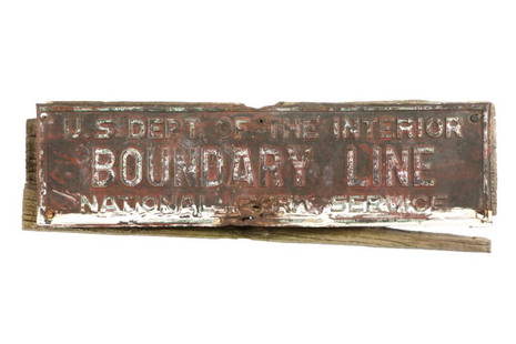
[BOUNDARY LINE]. INTERNATIONAL BOUNDARY COMMISSION. Report of the Boundary Commission upon the Survey and Re-Marking of the Boundary between the United States and Mexico West of the Rio Grande, 1891-1896. Parts I and II. Part I. Report of the International Commission. Part II. Report of the United States Section. Washington: Government Printing Office, 1898. 3 vols. Vol. I: [2], 1-56, [1-2], 3-240 pp., frontispiece, 45 plates (mostly photographic), 4 folded charts. 4to (29.5 x 23 cm), contemporary tan sheep, raised bands, boards rolled in blind, gilt-lettered spine labels. Moderate overall rubbing, backstrip partly loose, upper joint starting, upper hinge split, corners bumped. Interior very fine. Vol. II: Report of the Boundary Commission upon the Survey and Re-Marking of the Boundary between the United States and Mexico West of the Rio Grande, 1891-1896. Album. [2] pp., 258 photos of the new monuments with bilingual captions. Oblong 4to (28 x 36 cm), contemporary tan sheep, raised bands, boards rolled in blind, gilt-lettered spine labels. Backstrip loose, front board mostly loose, moderately rubbed and faded, corners bumped and rubbed. Interior fine. Vol. III: Boundary between the United States and Mexico, as Surveyed and Marked by the International Boundary Commission, under the Convention of July 29, 1882. Revived February 18, 1889. List of Maps and Profiles: A and B - - - - Index Map of the Boundary. 1, 2, 3, and 4 - - - California Line. 5 - - - - - - Colorado River Section of the Boundary (in Colors). 6, 7, 8, 9, 10 and 11 – Arizona – Sonora Oblique Line. 12, 13, 14, 15, and 16 – Parallel 31° 20’ North Latitude. 16 and 17 - - - - Meridian Section. 17, 18, and 19 - - - Parallel 31° 47’ North Latitude. 20, 21, 22, 23, and 24 – Profile of the Boundary. A and B Show the Prominent Peaks, Roads and Springs in the Vicinity of the Boundary Line Whose Positions and Heights Were Determined by the U.S. Section of the Commission. The Railroads, Roads and Trails and the Location of Settlements, Rivers, &c., at a Distance from the Boundary Were Compiled from County Maps, General Land Office Maps, U.S. Engineer Maps, &c. Pacific Coast Line and San Diego Bay from U.S. Coast and Geodetic Survey Charts. Coast of Lower California and Gulf of California from U.S. Hydrographic Office Charts. [4] pp., 26 lithograph maps and profiles with bilingual captions. Folio (73.3 x 55 cm), contemporary three-quarter tan sheep over marbled boards, gilt-lettered spine label and gilt-lettered label on upper cover. Spine worn and chipped, moderately rubbed, cover label scuffed, upper hinge split. Interior very fine.
First edition (55th Congress, 2nd Session, Senate Executive Document 247).
During his survey, Emory had left about fifty markers composed generally of metal or stone cairns. Time and people had not been kind to these markers, some having been destroyed and others moved out of place. Others suffered other indignities, such as the one that was incorporated in a saloon, a situation depicted in one of the plates. To correct that situation, a new survey was ordered that was to erect more substantial markers in greater numbers. Commissioners John Whitney Barlow for the U.S. and Jacobo Blanco for Mexico met in early 1892 at El Paso to begin the work. When they were done, they had established 258 markers of substantial construction that stand to this day, each of which is shown in the Album, from El Paso to the Pacific Ocean. Many, of course, are in isolated places in the Sonora Desert, with some in seemingly impossible places like hilltops. The commission also quietly corrected minor errors in the original survey.
The maps represent the best and most detailed depiction of the boundary line published up until that time. Although the publication lacks the romance of the Emory report with its descriptions of flora and fauna with plates, it is a very solid piece of scientific work.
The American survey chief, Barlow (1838-1914) was a career military topographical engineer. He probably served the shortest tenure as U.S. Army Chief of Engineers, retiring the day after he was appointed to the post.
Condition
Buyer's Premium
- 27.5%
[BOUNDARY LINE]. Rpt. of the Boundary Comm. 1898
Shipping & Pickup Options
Item located in Llano, TX, usPayment
